Related Research Articles

Yeppoon is a coastal town and locality in the Shire of Livingstone, Queensland, Australia. Yeppoon is renowned for its beaches, tropical climate, and the islands out on the bay. Twenty-five minutes from the city of Rockhampton, Yeppoon is the principal town on the Capricorn Coast, a string of seaside communities stretching more than 150 kilometres (93 mi) from north to south. The beaches and shallow coves provide a destination both for tourists and retirees settling down in Central Queensland. Offshore, there are 27 islands including Great Keppel Island which is 20 kilometres (12 mi) from Yeppoon.

The Sutherland Shire is a local government area in the southern region of Sydney, in the state of New South Wales, Australia. The Sutherland Shire comprises an area of 370 square kilometres (140 sq mi) and as at the 2016 census had an estimated population of 218,464. Sutherland Shire is colloquially known as "The Shire" and has featured in several reality television series.

The Hills Shire is a local government area in the Greater Western Sydney region of Sydney, New South Wales, Australia. The suburb is north-west of the Sydney central business district, and encompasses 401 square kilometres (155 sq mi) stretching from the M2 Hills Motorway in the south to Wiseman's Ferry on the Hawkesbury River in the north. The Hills Shire had a population of 157,243 as at the 2016 census.

Surat is a rural town and locality in the Maranoa Region, Queensland, Australia. In the 2016 census, the locality had a population of 407 people.

Laura is a rural town and locality in the Shire of Cook, Queensland, Australia. In the 2016 census the locality of Laura had a population of 228 people.

Coen is a town and coastal locality in the Shire of Cook, Queensland, Australia. The town of Coen is inland on the Peninsula Developmental Road, the main road on the Cape York Peninsula in far northern Queensland. In the 2016 census, Coen had a population of 364 people.

Croydon is a town and locality within the Shire of Croydon in Queensland, Australia. It is a terminus for the Normanton to Croydon railway line, which operates the Gulflander tourist train. At the 2016 census, Croydon had a population of 258 people.

Port Douglas is a coastal town and locality in the Shire of Douglas, Queensland, approximately 60 km north of Cairns. In the 2016 census, Port Douglas had a population of 3,504 people. The town's population can often double, however, with the influx of tourists during the peak tourism season from May to September. The town is named in honour of a former Premier of Queensland, John Douglas. Port Douglas developed quickly based on the mining industry. Other parts of the area were established with timber cutting occurring in the area surrounding the Daintree River and with settlement starting to occur on lots around the Mossman River by 1880.

Kuranda is a rural town and locality on the Atherton Tableland in the Shire of Mareeba, Queensland, Australia. In the 2016 census, Kuranda had a population of 3,008 people. It is 25 kilometres (16 mi) from Cairns, via the Kuranda Range road. It is surrounded by tropical rainforest and adjacent to the Wet Tropics of Queensland World Heritage listed Barron Gorge National Park.

Leeton Shire is a local government area in the Riverina region of New South Wales, Australia. The Shire is located adjacent to the Murrumbidgee River and falls within the Murrumbidgee Irrigation Area.
Mount Molloy is a rural town and locality in the Shire of Mareeba, Queensland, Australia. In the 2016 census the locality of Mount Molloy had a population of 254 people.

Mossman is a rural town and locality in the Shire of Douglas, Queensland, Australia. It is the administrative centre for the Douglas Shire Council In the 2016 census, the locality of Mossman had a population of 1,937 people.

The Shire of York is a local government area in the Wheatbelt region of Western Australia, covering an area of 2,133 square kilometres (824 sq mi) just beyond the eastern fringe of Perth's metropolitan area. The Shire's seat of government is the town of York.

The Shire of Shark Bay is a local government area of Western Australia in the Gascoyne region. It has an area of 25,423 km² and a population of about 950. It is made up of two peninsulas, located at the westernmost point of Australia. There is one town in the Shire of Shark Bay, Denham, which is the administrative centre for the Shire. There are also a number of small communities; they are Useless Loop, Monkey Mia, Nanga and Hamelin Pool. The Overlander and The Billabong are roadhouses.

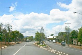
Byfield is a rural locality in the Shire of Livingstone, Queensland, Australia. In the 2016 census, Byfield had a population of 301 people.
Rossville is a town and coastal locality in the Shire of Cook, Queensland, Australia. In the 2016 census, Rossville had a population of 204 people.

Palmer is a rural locality in the Shire of Cook, Queensland, Australia. In the 2016 census Palmer had a population of 0 people.
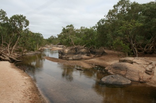
Archer River is a rural locality in the Shire of Cook, Queensland, Australia. In the 2016 census Archer River had a population of 22 people.
References
- ↑ "search - places in Shire of York". inherit.stateheritage.wa.gov.au. inHerit - State Heritage Office. Retrieved 3 July 2018.manual filter used to select sites outside of the York townsite as at 3 July 2018