List
State Register of Heritage Places
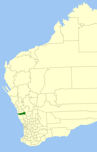
The Western Australian State Register of Heritage Places, as of 2023 [update] , lists the following state registered place within the Shire of Carnamah:
| Place name | Place # | Street name | Suburb or town | Co-ordinates | Built | Stateregistered | Notes & former names | Photo |
|---|---|---|---|---|---|---|---|---|
| Macpherson Homestead | 447 | Carnamah-Bunjil Road | Carnamah | 29°41′03″S115°54′07″E / 29.684298°S 115.901997°E | 1870 | 7 April 1995 | An example of a rural, vernacular Western Australian homestead of the 1870s |  |
Shire of Carnamah heritage-listed places
The following places are heritage listed in the Shire of Carnamah but are not State registered:
| Place name | Place # | Street # | Street name | Suburb or town | Notes & former names | Photo |
|---|---|---|---|---|---|---|
| St Andrew's Church (R.C.) | 448 | Corner | Caron Street & Bowman Road | Carnamah | ||
| Carnamah Post Office & Quarters (former) | 449 | Macpherson Street | Carnamah | Shop | ||
| Carnamah Post Office & shop | 450 | Macpherson Street | Carnamah | Bush Basket |  | |
| Presbyterian Church (former) | 451 | Macpherson Street | Carnamah | Uniting Church, Methodist Church |  | |
| Pyramid Tea Rooms (former) | 452 | Corner | Macpherson & Caron Streets | Carnamah | T.A.B. | |
| Bankwest Building | 453 | Corner | Macpherson & Caron Streets | Carnamah | Bank of Australasia, R & I Bank |  |
| Police House (former) | 454 | 16 | Railway Avenue | Carnamah | Police Station, Residence | |
| Carnamah Shire Office, Chambers & Library | 6130 | MacPherson Street | Carnamah |  | ||
| Carnamah Shire Hall | 6131 | Corner | MacPherson & Caron Streets | Carnamah | Carnamah Shire Offices (former) |  |
| Carnamah District High School | 6132 | Corner | MacPherson & King Streets | Carnamah |  | |
| RSL Memorial Hall | 6133 | MacPherson Street | Carnamah | Carnamah Pre-Primary Centre |  | |
| Carnamah Police Station (former) | 6134 | Corner | MacPherson & King Streets | Carnamah | ||
| Butcher & Hairdresser Shop | 6135 | MacPherson Street | Carnamah | |||
| Berrigan's | 6136 | Corner | MacPherson & Niven Streets | Carnamah | ||
| Shop | 6137 | MacPherson Street | Carnamah | Carnamah Boutique (former), Butcher Shop (former), Post Office | ||
| Bakery (former) | 6138 | MacPherson Street | Carnamah | Chegs & Co Accountants Shop | ||
| Red Cross Thrift Shop | 6139 | MacPherson Street | Carnamah | S.P. Bookmaker (former) | ||
| CWA Building | 6140 | MacPherson Street | Carnamah | Carnamah Child Care Centre | ||
| Carnamah Hotel | 6141 | Corner | MacPherson & Robertson Streets | Carnamah | ||
| Museum | 6142 | Corner | MacPherson & Caron Streets | Carnamah | TAB (former) and Tearooms |  |
| Wallaces News and Drapery | 6143 | Corner | MacPherson & Yarra Streets | Carnamah |  | |
| Carnamah War Memorial | 6144 | Corner | MacPherson & Yarra Streets | Carnamah |  | |
| Carnamah Railway Station, Station Master's House & Siding - Site | 6145 | Yarra Street | Carnamah | |||
| Anglican Church of Holy Apostles | 6146 | Corner | Niven Crescent & Lang Street | Carnamah |  | |
| Parkers House | 6147 | MacPherson Street | Carnamah | |||
| Headmaster's House (former) | 6148 | Railway Avenue | Carnamah | |||
| Orlicz's House | 6149 | Yarra Street | Carnamah | |||
| Shell Manager's House (former) | 6150 | Yarra Street | Carnamah | |||
| Dallimore's House | 6151 | Robertson Street | Carnamah | |||
| Doctor's House (former) | 6152 | Robertson Street | Carnamah | |||
| Carnamah Bowling Club | 6153 | Niven Crescent | Carnamah | |||
| Carnamah Recreation Centre and Showgrounds | 6154 | Niven Crescent | Carnamah | Niven Park Sporting Complex | ||
| Wheat Silos | 6155 | Midlands Road | Carnamah | |||
| Wheat Silos (Original) - Site of | 6156 | Yarra Street | Carnamah | |||
| Carnamah School (former) - Site | 6157 | Carnamah | ||||
| Billeroo Spring and Well | 6159 | Near junction of | Rds 13 & 6 | Carnamah | ||
| Cooragabbie Well | 6160 | On the Old Telegraph Road | Carnamah | Gouragabba Well | ||
| Pinch Gut Well | 6161 | Carnamah Perenjori/Reading/Mitchell Road | Carnamah | |||
| Winchester Townsite | 6162 | Junction | Winchester East Road No 5 & Midlands Road | Winchester | ||
| Winchester School (former) - Site | 6163 | Winchester East Road | Winchester | |||
| Winchester Cemetery | 6164 | East of | Winchester | |||
| Inering School (former) - site | 6165 | North-East of | Carnamah-Perenjori Road | Carnamah | ||
| Wongyarra School (former) - Site | 6166 | East of | Caron-Bodycoat Road 13.5 m | Carnamah | ||
| Billeroo School (former) - Site | 6167 | West junction of Roads 13 & 6 | Carnamah | |||
| Log Causeway | 6168 | Yarra Yarra Lakes | Carnamah | |||
| Grenaige | 6169 | Midlands Road, North of Carnamah | Carnamah | |||
| Old Geraldton Road - Site | 6170 | Old Geraldton Road | Carnamah | |||
| Perenjori-Carnamah Road | 6171 | Perenjori-Carnamah Road | Carnamah | |||
| Yarra Well Cottage - Site | 6172 | South-West of | Carnamah-Eneabba Road | Carnamah | ||
| Blue Metal Quarry (former) | 6173 | East of | Carnamah | Rubbish tip | ||
| Original Eneabba Store | 6174 | Corner | King & Gooch Streets | Eneabba | McDonald's Store | |
| Eneabba Primary School | 6175 | Clark Place | Eneabba | |||
| School Teacher's House | 6176 | Dewar Street | Eneabba | |||
| Eneabba Horseman's Hall | 6177 | Eneabba | Eneabba Recreation Hall | |||
| Eneabba Club Rooms | 6178 | Eneabba Dve | Eneabba | |||
| Original Eneabba Springs - site | 6179 | Eneabba | Homestead, Horse Yards & House | |||
| Original Eneabba School (former) | 6180 | Eneabba | Shearing Shed | |||
| Lake Indoon | 6181 | South of | Eneabba-Coolimba Road | Eneabba |  | |
| King's Homestead | 6182 | Eneabba-Coolimba & Gould Simpson Roads | Eneabba | |||
| WSLC - War Service Depot | 6183 | Eneabba-Three Springs & Second North Roads | Eneabba | |||
| Squatter Shack 103 | 6955 | Dunes - high | Coolimba | |||
| Manse | 15034 | 26 | Caron Street | Carnamah | ||
| Eneabba Police Station | 17433 | Eneabba Drive | Eneabba | |||
| Carnamah Police Station | 17434 | Cnr King & McPherson Street | Carnamah | |||
| Lake Erindoon | 18108 | Coolimba-Eneabba Road | Warradarge | |||
| Lake Logue | 18109 | Eneabba |  | |||
| Arro Well | 18110 | Reserve 971, track south of Beekeepers Road | Eneabba | Woodack Well, Woodada Well | ||
| Alexander Morrison National Park | 18591 | Corrow Green Head Road | Eneabba | |||
| Tathra National Park | 18736 | Carnamah Eneabba Road | Eneabba |  | ||
| Woodada | 26948 | Eneabba |