List
The Western Australian State Register of Heritage Places, as of 2023 [update] , lists the following 27 state registered places within the Town of Cottesloe:
| Place name | Place # | Street number | Street name | Suburb or town | Co-ordinates | Notes & former names | Photo |
|---|---|---|---|---|---|---|---|
| Cottesloe Civic Centre | 593 | 109 | Broome Street | Cottesloe | 31°59′37″S115°45′21″E / 31.993567°S 115.755695°E | Town Hall & Civic Centre, Overton Lodge, Cottesloe War Memorial | 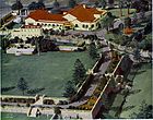 |
| WA School for Deaf Children | 594 | 53 | Curtin Avenue | Cottesloe | 32°00′33″S115°45′18″E / 32.009167°S 115.755066°E | WA Deaf and Dumb Institution, WA Institute for Deaf Education |  |
| Lady Lawley Cottage | 596 | 8 | Gibney Street | Cottesloe | 32°00′30″S115°45′13″E / 32.008214°S 115.753649°E | Lady Lawley Cottage by the Sea, John, Nicholson Convalescent Home for Service Women |  |
| Cottesloe Beach Hotel | 597 | 104 | Marine Parade | Cottesloe | 31°59′41″S115°45′08″E / 31.994692°S 115.752171°E | Hotel Cottesloe |  |
| Wanslea | 598 | 78 & 80 | Railway Street | Cottesloe | 31°59′18″S115°45′56″E / 31.988217°S 115.765661°E | International Order of Oddfellows Orphanage |  |
| Cottesloe Post Office & Telephone Exchange (former) | 599 | 81-83 | Forrest Street | Cottesloe | 31°59′47″S115°45′42″E / 31.996464°S 115.761549°E | Cottesloe Post Office, Telecom Depot |  |
| Wearne Hostel | 603 | 1 | Gibney Street | Cottesloe | 32°00′34″S115°45′11″E / 32.009365°S 115.753038°E | Ministering Children's League Convalescent Home, Fremantle Hospital Mosman Park Annex |  |
| Claremont Police Station, Lock-up & Stables | 2044 | 137-139 | Grant Street | Claremont | 31°59′12″S115°46′16″E / 31.986723°S 115.771241°E | Claremont Police Station and Lock-up |  |
| Claremont Fire Station | 2664 | 441 | Stirling Highway | Claremont | 31°59′15″S115°46′11″E / 31.987491°S 115.769804°E |  | |
| Cottesloe Flour Mill (former) | 3234 | 14 | Athelstan Road | Cottesloe | 31°59′28″S115°45′43″E / 31.991172°S 115.761989°E |  | |
| Le Fanu | 3306 | 2 | Salvado Street | Cottesloe | 32°00′18″S115°45′09″E / 32.0050°S 115.7524°E | Banksia |  |
| Belvedere | 3452 | 12 | Rosendo Street | Cottesloe | 32°00′14″S115°45′12″E / 32.003959°S 115.753310°E | Belevedere, Belvediere |  |
| Tukurua, Cottesloe | 3453 | 5 & 7 | Rosendo Street | Cottesloe | 32°00′16″S115°45′10″E / 32.004423°S 115.752899°E | The Beach House, Burt's Summer ResidenceBuilt for Septimus Burt in 1896 |  |
| Kulahea | 3677 | 4 | Forrest Street | Cottesloe | 31°59′44″S115°45′10″E / 31.995686°S 115.752737°E | KalaheaThought to be the only private dwelling designed by George Temple-Poole |  |
| Macaulay House, Cottesloe | 3680 | 62 & 62A | Forrest Street | Cottesloe | 31°59′45″S115°45′28″E / 31.995751°S 115.757828°E | McCaulay House, Donard Lodge |  |
| Pine Lodge | 3682 | 42 | John Street | Cottesloe | 31°59′41″S115°45′26″E / 31.994721°S 115.757109°E |  | |
| Old Cable Station | 4586 | 1 & 2 | Curtin Avenue | Cottesloe | 32°00′57″S115°45′09″E / 32.015720°S 115.752619°E | McCall Community Support Centre |  |
| Lewis House | 7467 | 8 | Barsden Street | Cottesloe | 31°59′52″S115°45′31″E / 31.997676°S 115.758609°E |  | |
| Trafalgar House | 7468 | 15 | Barsden Street | Cottesloe | 31°59′50″S115°45′28″E / 31.997102°S 115.757890°E |  | |
| Pine Court | 7495 | 96-98 | Broome Street | Cottesloe | 31°59′43″S115°45′24″E / 31.995334°S 115.756596°E |  | |
| John Curtin's House | 7935 | 24 | Jarrad Street | Cottesloe | 31°59′55″S115°45′32″E / 31.9987°S 115.759°E |  | |
| Cottesloe Beach Pylon | 7984 | offshore at | Cottesloe Beach in line with John Street | Cottesloe | 31°59′43″S115°45′00″E / 31.995382°S 115.750100°E | Cottesloe Beach Shark Proof Pool, Foreman's Folly |  |
| St Philip's Anglican Church | 8110 | 63 | Napier Street | Cottesloe | 31°59′36″S115°45′37″E / 31.993253°S 115.760216°E |  | |
| Sea View Golf Course Club | 15822 | Jarrad Street | Cottesloe | 31°59′51″S115°45′14″E / 31.997493°S 115.753989°E | Cottesloe Golf Club |  | |
| Cottesloe Beach Precinct | 16637 | Marine Parade | Cottesloe | 31°59′39″S115°45′04″E / 31.994155°S 115.751126°E |  | ||
| Overton Lodge | 18556 | 22 | Warnham Road | Cottesloe | 31°59′39″S115°45′17″E / 31.994291°S 115.754595°E | Caretaker's Cottage | |
| Claremont Police Station | 18613 | 139 | Grant Street | Claremont | 31°59′12″S115°46′16″E / 31.986728°S 115.771233°E |  |

