List
The Western Australian State Register of Heritage Places, as of 2021 [update] , lists the following ten state registered places within the Shire of Wyalkatchem:
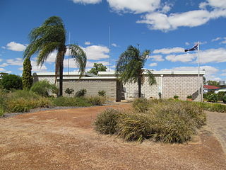
| Place name | Place # | Street number | Street name | Suburb or town | Co-ordinates | Notes & former names | Photo |
|---|---|---|---|---|---|---|---|
| Lady Novar Hostel (former) | 2757 | Lot 148 | Honour Avenue | Wyalkatchem | 31°10′30″S117°23′08″E / 31.175093°S 117.38555°E | Silver Chain Bush Nursing Post | |
| National Bank, Wyalkatchem | 2759 | 25 | Railway Terrace | Wyalkatchem | 31°10′51″S117°22′58″E / 31.180823°S 117.382732°E | National Australia Bank | |
| CBH Wheat Bin (former) | 2761 | Railway Terrace | Wyalkatchem | 31°10′49″S117°22′48″E / 31.180205°S 117.380115°E | Agricultural Museum | ||
| Wyalkatchem Station Master's House | 15748 | 5 | Grace Street | Wyalkatchem | Demolished in 2003 | ||
| Wyalkatchem Railway and CBH Precinct | 15755 | Railway Terrace & Grace Street | Wyalkatchem | 31°10′49″S117°22′46″E / 31.180192°S 117.379579°E | Wyalkatchem Railway Station, Wyalkatchem Wheat Bins | ||
| Goods Shed Wyalkatchem | 16982 | Railway Terrace | Wyalkatchem | 31°10′51″S117°22′51″E / 31.180797°S 117.380921°E | |||
| Lever Frame. Wyalkatchem Station | 16984 | Grace Street | Wyalkatchem | 31°10′52″S117°22′51″E / 31.18114°S 117.380902°E |  | ||
| Loading Ramp and Crane Wyalkatchem | 16985 | Railway Terrace | Wyalkatchem | 31°10′50″S117°22′51″E / 31.180604°S 117.380699°E | |||
| Wyalkatchem Railway Barracks | 16989 | Grace Street | Wyalkatchem | 31°10′53″S117°22′47″E / 31.181506°S 117.379858°E |  | ||
| Wyalkatchem Railway Station | 23931 | Grace Street | Wyalkatchem | 31°10′52″S117°22′50″E / 31.180987°S 117.380628°E |  |