List of State Register of Heritage Places in the City of Belmont

Last updated

Map all coordinates using: OpenStreetMap

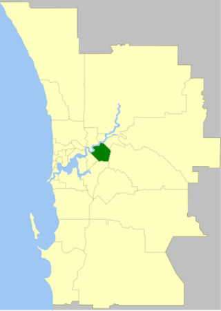
The State Register of Heritage Places is maintained by the Heritage Council of Western Australia. As of 2023, 110 places are heritage-listed in the City of Belmont, [1] of which seven are on the State Register of Heritage Places. [2]

List

The Western Australian State Register of Heritage Places, as of 2023, lists the following seven state registered places within the City of Belmont:

Place namePlace #LocationSuburb or townCo-ordinatesBuiltState
registered
NotesPhoto
Old Bristile Kilns 868 80 Grandstand Road Ascot 31°56′21″S115°55′20″E / 31.93917°S 115.92222°E / -31.93917; 115.92222 (Old Bristile Kilns) 3 July 19921920
  • Also referred to as Bristile Kilns (former), Belmont, Kilns and Chimney Stacks and Old Bristile Kilns (Beehive Kilns)
  • Includes five brick chimneys
Ascot Kilns, Western Australia, October 2023 08.jpg
Invercloy Park 25910 11A Wedderburn Place Ascot 31°55′34″S115°57′03″E / 31.92611°S 115.95083°E / -31.92611; 115.95083 (Invercloy Park)
  • Part of Nulsen Haven Precinct (140)
Nulsen Haven 140 4 Wedderburn Place Ascot 31°55′33″S115°57′01″E / 31.92583°S 115.95028°E / -31.92583; 115.95028 (Nulsen Haven) 190429 November 1996
Garratt Road Bridge 11342 Garratt Road Swan River, between Bayswater and Ascot 31°55′57″S115°54′59″E / 31.93250°S 115.91639°E / -31.93250; 115.91639 (Garratt Road Bridge) 193523 March 2010
  • Also referred to as MRWA 950 and Garratt Road Bridges Upstream (1935) and Downstream (1972)
  • Consists of two adjacent bridges with the upstream one constructed in 1935 and the downstream one in 1972
  • The longest extant timber road bridge in Western Australia
  • Connecting the City of Belmont to the City of Bayswater
River gnangarra-207.jpg
RAAF Headquarters Bunker (former) 16785 81-91 Leake Street Belmont 31°56′30″S115°56′14″E / 31.94167°S 115.93722°E / -31.94167; 115.93722 (RAAF Headquarters Bunker) 194328 February 2006
  • Also referred to as Belmont SES Bunker
  • A partially subterranean two storey concrete building, constructed by the Allied Works Council
Tampina 3123 517 Great Eastern Highway Redcliffe 31°55′33″S115°57′12″E / 31.92583°S 115.95333°E / -31.92583; 115.95333 (Tampina) 190623 November 2001
Hill 60 4490 16 Tanunda Drive Rivervale 31°57′09″S115°54′45″E / 31.95250°S 115.91250°E / -31.95250; 115.91250 (Hill 60) 190211 December 1998 Tanunda (Hill 60), Rivervale, Western Australia, October 2023 06.jpg

Related Research Articles

<span class="mw-page-title-main">City of Belmont</span> Local government area in Western Australia

The City of Belmont is a local government area in the inner eastern suburbs of the Western Australian capital city of Perth, located about 8 kilometres (5 mi) east of Perth's central business district on the south bank of the Swan River. The City covers an area of 39.8 square kilometres (15.4 sq mi), maintains 225 km of roads and had a population of almost 40,000 as at the 2016 Census. The City of Belmont is a member of the Eastern Metropolitan Regional Council

References

  1. "City of Belmont Heritage Places". inherit.stateheritage.wa.gov.au. Heritage Council of Western Australia. Retrieved 16 February 2023.
  2. "City of Belmont State Register of Heritage Places". inherit.stateheritage.wa.gov.au. Heritage Council of Western Australia. Retrieved 16 February 2023.