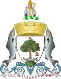
The following is an outline and topical guide of Glasgow:
Glasgow is the most populous city in Scotland, located on the banks of the River Clyde in west central Scotland.
Alexandria is a town in West Dunbartonshire, Scotland. The town is on the River Leven, three miles north of Dumbarton and 15 mi (24 km) north-west of Glasgow.
Glasgow is the most populous city in Scotland, located on the banks of the River Clyde in west central Scotland. The city is the third-most-populous city in the United Kingdom and the 27th-most-populous city in Europe. In 2022, it had an estimated population as a defined locality of 632,350 and anchored an urban settlement of 1,028,220.
Highland is a council area in the Scottish Highlands and is the largest local government area in the United Kingdom. It was the 7th most populous council area in Scotland at the 2011 census. It has land borders with the council areas of Aberdeenshire, Argyll and Bute, Moray and Perth and Kinross. The wider upland area of the Scottish Highlands after which the council area is named extends beyond the Highland council area into all the neighbouring council areas plus Angus and Stirling.
South Lanarkshire is one of 32 unitary authorities of Scotland. It borders the south-east of the Glasgow City council area and contains some of Greater Glasgow's suburban towns, as well as many rural towns and villages. It also shares borders with Dumfries and Galloway, East Ayrshire, East Renfrewshire, North Lanarkshire, the Scottish Borders and West Lothian. It includes most of the historic county of Lanarkshire.
North Lanarkshire is one of the 32 council areas of Scotland. It borders the north-east of the Glasgow City council area and contains many of Glasgow's suburbs, commuter towns, and villages. It also borders East Dunbartonshire, Falkirk, Stirling, South Lanarkshire, and West Lothian. The council area covers parts of the historic counties of Dunbartonshire, Lanarkshire, and Stirlingshire. The council is based in Motherwell.
Inverness is a city in the Scottish Highlands, having been granted city status in 2000. It is the administrative centre for The Highland Council and is regarded as the capital of the Highlands.
Maryhill is an area in the north-west of Glasgow in Scotland. A former independent burgh and the heart of an eponymous local authority ward, its territory is bisected by Maryhill Road, part of the A81 road which runs for a distance of roughly three miles between Glasgow city centre and the suburban town of Bearsden.
Balivanich is a village on the island of Benbecula in the Outer Hebrides off the west coast of Scotland. It is the main centre for Benbecula and the adjacent islands of North Uist, South Uist and several smaller islands. Balivanich is within the parish of South Uist.
Greater Glasgow is an urban settlement in Scotland consisting of all localities which are physically attached to the city of Glasgow, forming with it a single contiguous urban area. It does not relate to municipal government boundaries, and its territorial extent is defined by National Records of Scotland, which determines settlements in Scotland for census and statistical purposes. Greater Glasgow had a population of 1,199,629 at the time of the 2001 UK Census making it the largest urban area in Scotland and the fifth-largest in the United Kingdom. However, the population estimate for the Greater Glasgow 'settlement' in mid-2016 was 985,290—the reduced figure explained by the removal of the Motherwell & Wishaw (124,790), Coatbridge & Airdrie (91,020), and Hamilton (83,730) settlement areas east of the city due to small gaps between the populated postcodes. The 'new towns' of Cumbernauld and East Kilbride (75,120) were never included in these figures despite their close ties to Glasgow due to having a clear geographical separation from the city. In the 2020 figures, the Greater Glasgow population had risen to just over 1 million.
Westerton railway station is a railway station that serves the Westerton district in the town of Bearsden, Scotland. The station is managed and served by ScotRail as part of the Strathclyde Partnership for Transport network. It is located on the Argyle and North Clyde lines, between Drumchapel to the west, Bearsden to the north, and Anniesland and Maryhill to the south-east. It is 6 miles 10 chains (9.9 km) west of Glasgow Queen Street, measured via Maryhill.
The geography of Scotland is varied, from rural lowlands to unspoilt uplands, and from large cities to sparsely inhabited islands. Located in Northern Europe, Scotland comprises the northern part of the island of Great Britain as well as 790 surrounding islands encompassing the major archipelagos of the Shetland Islands, Orkney Islands and the Inner and Outer Hebrides. The only land border is with England, which runs for 96 miles in a northeasterly direction from the Solway Firth in the west to the North Sea on the east coast. Separated by the North Channel, the island of Ireland lies 13 nautical miles from Mull of Kintyre on the Scottish mainland. Norway is located 190 nmi (350 km) northeast of Scotland across the North Sea. The Atlantic Ocean, which fringes the coastline of western and northern Scotland and its islands, influences the temperate, maritime climate of the country.
Glasgow Anniesland is a constituency of the Scottish Parliament (Holyrood). It is one of eight constituencies within the Glasgow City council area. It elects one Member of the Scottish Parliament (MSP) by the plurality method of election. It is also one of nine constituencies in the Glasgow electoral region, which elects seven additional members, in addition to nine constituency MSPs, to produce a form of proportional representation for the region as a whole.
The demography of Scotland includes all aspects of population, past and present, in the area that is now Scotland. Scotland had a population of 5,463,300 in 2019. The population growth rate in 2011 was estimated as 0.6% per annum according to the 2011 GROS Annual Review.
Milngavie railway station serves the town of Milngavie, East Dunbartonshire, near Glasgow in Scotland. The station is sited 9 miles 35 chains (15.2 km) from Glasgow Queen Street, measured via Maryhill. The station is managed by ScotRail, who also operate all services at the station, along the North Clyde and Argyle lines.
Glasgow Maryhill was a constituency of the Scottish Parliament (Holyrood). It elected one Member of the Scottish Parliament (MSP) by the plurality method of election. However, it was also one of ten constituencies in the Glasgow electoral region, which elects seven additional members, in addition to ten constituency MSPs, to produce a form of proportional representation for the region as a whole.
The Archdiocese of Glasgow is the Latin Catholic metropolitan see of the Province of Glasgow in central Scotland. The episcopal seat of the developing diocese was established by Saint Kentigern in the 6th century AD. It is one of two catholic metropolitan archdioceses of the Catholic Church in Scotland: the only archdioceses in Scotland. It is the elder of the two bishoprics. Innocent VIII first raised Glasgow a metropolitan archbishopric in 1492. The Metropolis has the dioceses of Motherwell and Paisley as suffragans within the Ecclesiastical Province.
Glasgow Maryhill and Springburn is a constituency of the Scottish Parliament (Holyrood), being one of eight constituencies within the Glasgow City council area. It elects one Member of the Scottish Parliament (MSP) by the plurality method of election. It is also one of nine constituencies in the Glasgow electoral region, which elects seven additional members, in addition to the nine constituency MSPs, to produce a form of proportional representation for the region as a whole.
Glasgow Provan is a constituency of the Scottish Parliament (Holyrood), being one of eight constituencies within the Glasgow City council area. It elects one Member of the Scottish Parliament (MSP) by the plurality method of election. It is also one of nine constituencies in the Glasgow electoral region, which elects seven additional members, in addition to the nine constituency MSPs, to produce a form of proportional representation for the region as a whole.
The following is an outline and topical guide of Leeds: