Outline of Swaziland

Last updated

Contents

The location of Swaziland LocationSwaziland.svg
The location of Swaziland
An enlargeable map of the Kingdom of Swaziland SwazilandOMC.png
An enlargeable map of the Kingdom of Swaziland

The following outline is provided as an overview of and topical guide to Swaziland:

An outline, also called a hierarchical outline, is a list arranged to show hierarchical relationships and is a type of tree structure. An outline is used to present the main points or topics (terms) of a given subject. Each item in an outline may be divided into additional sub-items. If an organizational level in an outline is to be sub-divided, it shall have at least two subcategories, as advised by major style manuals in current use. An outline may be used as a drafting tool of a document, or as a summary of the content of a document or of the knowledge in an entire field. It is not to be confused with the general context of the term "outline", which a summary or overview of a subject, presented verbally or written in prose. The outlines described in this article are lists, and come in several varieties.

Swaziland (officially the Kingdom of Eswatini) small, landlocked, sovereign country located in Southern Africa, bordered by South Africa on three sides except to the east, where it borders Mozambique. [1] The country, inhabited primarily by Bantu-speaking Swazi people, is named after the 19th-century king Mswati II, from whom the people also take their name.

Landlocked country country entirely enclosed by land areas, or whose only coastlines lie lakes or on closed seas

A landlocked state or landlocked country is a sovereign state entirely enclosed by land, or whose only coastlines lie on closed seas. There are currently 49 such countries, including five partially recognised states.

Southern Africa southernmost region of the African continent

Southern Africa is the southernmost region of the African continent, variably defined by geography or geopolitics, and including several countries. The term southern Africa or Southern Africa, generally includes Angola, Botswana, Eswatini, Lesotho, Malawi, Mozambique, Namibia, South Africa, Zambia, and Zimbabwe, though Angola may be included in Central Africa and Malawi, Mozambique, Zambia and Zimbabwe in East Africa. From a political perspective the region is said to be unipolar with South Africa as a first regional power.

South Africa Republic in the southernmost part of Africa

South Africa, officially the Republic of South Africa (RSA), is the southernmost country in Africa. It is bounded to the south by 2,798 kilometres (1,739 mi) of coastline of Southern Africa stretching along the South Atlantic and Indian Oceans; to the north by the neighbouring countries of Namibia, Botswana, and Zimbabwe; and to the east and northeast by Mozambique and Eswatini (Swaziland); and it surrounds the enclaved country of Lesotho. South Africa is the largest country in Southern Africa and the 25th-largest country in the world by land area and, with over 57 million people, is the world's 24th-most populous nation. It is the southernmost country on the mainland of the Old World or the Eastern Hemisphere. About 80 percent of South Africans are of Sub-Saharan African ancestry, divided among a variety of ethnic groups speaking different African languages, nine of which have official status. The remaining population consists of Africa's largest communities of European (White), Asian (Indian), and multiracial (Coloured) ancestry.

General reference

An enlargeable basic map of Swaziland Swaziland-CIA WFB Map.png
An enlargeable basic map of Swaziland

The International Phonetic Alphabet (IPA) is an alphabetic system of phonetic notation based primarily on the Latin alphabet. It was devised by the International Phonetic Association in the late 19th century as a standardized representation of the sounds of spoken language. The IPA is used by lexicographers, foreign language students and teachers, linguists, speech-language pathologists, singers, actors, constructed language creators and translators.

ISO 3166-2:SZ is the entry for Eswatini in ISO 3166-2, part of the ISO 3166 standard published by the International Organization for Standardization (ISO), which defines codes for the names of the principal subdivisions of all countries coded in ISO 3166-1.

Internet Global system of connected computer networks

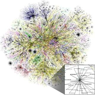
The Internet is the global system of interconnected computer networks that use the Internet protocol suite (TCP/IP) to link devices worldwide. It is a network of networks that consists of private, public, academic, business, and government networks of local to global scope, linked by a broad array of electronic, wireless, and optical networking technologies. The Internet carries a vast range of information resources and services, such as the inter-linked hypertext documents and applications of the World Wide Web (WWW), electronic mail, telephony, and file sharing. Some publications no longer capitalize "internet".

Geography of Swaziland

An enlargeable topographic map of Swaziland Swaziland Topography.png
An enlargeable topographic map of Swaziland

Geography of Swaziland

Eastern Hemisphere half of the Earth that is east of the prime meridian and west of 180° longitude

The Eastern Hemisphere is a geographical term for the half of Earth which is east of the prime meridian and west of the antimeridian. It is also used to refer to Afro-Eurasia and Australia, in contrast with the Western Hemisphere, which includes mainly North and South America. The Eastern Hemisphere may also be called the "Oriental Hemisphere". In addition, it may be used in a cultural or geopolitical sense as a synonym for the "Old World".

Southern Hemisphere part of Earth that lies south of the equator

The Southern Hemisphere is the half of Earth that is south of the Equator. It contains all or parts of five continents, four oceans and most of the Pacific Islands in Oceania. Its surface is 80.9% water, compared with 60.7% water in the case of the Northern Hemisphere, and it contains 32.7% of Earth's land.

Africa The second largest and second most-populous continent, mostly in the Northern and Eastern Hemispheres

Africa is the world's second largest and second most-populous continent, being behind Asia in both categories. At about 30.3 million km2 including adjacent islands, it covers 6% of Earth's total surface area and 20% of its land area. With 1.2 billion people as of 2016, it accounts for about 16% of the world's human population. The continent is surrounded by the Mediterranean Sea to the north, the Isthmus of Suez and the Red Sea to the northeast, the Indian Ocean to the southeast and the Atlantic Ocean to the west. The continent includes Madagascar and various archipelagos. It contains 54 fully recognised sovereign states (countries), nine territories and two de facto independent states with limited or no recognition. The majority of the continent and its countries are in the Northern Hemisphere, with a substantial portion and number of countries in the Southern Hemisphere.

Flag of South Africa.svg  South Africa 430 km
Flag of Mozambique.svg  Mozambique 105 km
  • Coastline: none

Environment of Swaziland

An enlargeable satellite image of Swaziland Satellite image of Swaziland in November 2002.jpg
An enlargeable satellite image of Swaziland

Natural geographic features of Swaziland

Regions of Swaziland

Regions of Swaziland

Ecoregions of Swaziland

List of ecoregions in Swaziland

Administrative divisions of Swaziland

Administrative divisions of Swaziland

Demography of Swaziland

Demographics of Swaziland

Government and politics of Swaziland

Politics of Swaziland

Branches of the government of Swaziland

Government of Swaziland

Executive branch of the government of Swaziland

Legislative branch of the government of Swaziland

Judicial branch of the government of Swaziland

Court system of Swaziland

Foreign relations of Swaziland

Foreign relations of Swaziland

International organization membership

The Kingdom of Swaziland is a member of: [1]

Law and order in Swaziland

Law of Swaziland

Military of Swaziland

Military of Swaziland

Local government in Swaziland

Local government in Swaziland

History of Swaziland

History of Swaziland

Culture of Swaziland

Culture of Swaziland

Art in Swaziland

Sports in Swaziland

Sports in Swaziland

Economy and infrastructure of Swaziland

Economy of Swaziland

Education in Swaziland

Education in Swaziland

See also

Swaziland

Related Research Articles

Outline of Botswana Overview of and topical guide to Botswana

The following outline is provided as an overview of and topical guide to Botswana:

Outline of Chad Overview of and topical guide to Chad

The following outline is provided as an overview of and topical guide to Chad:

Outline of Comoros Overview of and topical guide to Comoros

The following outline is provided as an overview of and topical guide to Comoros:

Outline of Equatorial Guinea Overview of and topical guide to Equatorial Guinea

The following outline is provided as an overview of and topical guide to Equatorial Guinea:

Outline of the Gambia Overview of and topical guide to the Gambia

The following outline is provided as an overview of and topical guide to the Gambia:

Outline of Guinea-Bissau Overview of and topical guide to Guinea-Bissau

The following outline is provided as an overview of and topical guide to Guinea-Bissau:

Outline of Lesotho Overview of and topical guide to Lesotho

The following outline is provided as an overview of and topical guide to Lesotho:

Outline of Liberia Overview of and topical guide to Liberia

The following outline is provided as an overview of and topical guide to Liberia:

Outline of Malawi Overview of and topical guide to Malawi

Republic of Malawi – sovereign country located in southeastern Africa. Malawi is bordered by Zambia to the northwest, Tanzania to the north and Mozambique, which surrounds it on the east, south and west and is separated from Malawi by Lake Malawi. The origin of the name Malawi is unclear; it is either derived from that of southern tribes, or from the "glitter of the sun rising across the lake". Malawi is a densely populated country with a democratically-elected, presidential system of government.

Outline of Mauritania Overview of and topical guide to Mauritania

The following outline is provided as an overview of and topical guide to Mauritania:

Outline of Mauritius Overview of and topical guide to Mauritius

The following outline is provided as an overview of and topical guide to Mauritius:

Outline of Mayotte Overview of and topical guide to Mayotte

The following outline is provided as an overview of and topical guide to Mayotte:

Mayotte – overseas department of France located in the Comoros Archipelago in the Indian Ocean. The department comprises the main island of Grande-Terre, a smaller island, Petite-Terre, and several islets at the northern end of the Mozambique Channel, between northern Madagascar and northern Mozambique. The territory is geographically part of the Comoro Islands, but has been politically separate since the 1970s. The territory is also known as Mahoré, the native name of its main island, especially by advocates of its inclusion in the Union of Comoros.
Outline of Mozambique Overview of and topical guide to Mozambique

The following outline is provided as an overview of and topical guide to Mozambique:

Outline of Namibia Overview of and topical guide to Namibia

The following outline is provided as an overview of and topical guide to Namibia:

Outline of Niger Overview of and topical guide to Niger

The following outline is provided as an overview of and topical guide to Niger:

Outline of Rwanda Overview of and topical guide to Rwanda

The Republic of Rwanda is a small landlocked sovereign country located in the Great Lakes region of east-central Africa, bordered by Uganda, Burundi, the Democratic Republic of the Congo and Tanzania. Home to approximately 10.1 million people, Rwanda supports the densest population in continental Africa, with most of the population engaged in subsistence agriculture. A verdant country of fertile and hilly terrain, the small republic bears the title "Land of a Thousand Hills". The country attracted international concern for the infamous Rwandan Genocide of 1994.

Outline of Seychelles Overview of and topical guide to Seychelles

The following outline is provided as an overview of and topical guide to Seychelles:

Outline of Togo Overview of and topical guide to Togo

The following outline is provided as an overview of and topical guide to Togo:

Outline of Uganda Overview of and topical guide to Uganda

The following outline is provided as an overview of and topical guide to Uganda:

Outline of Zimbabwe Overview of and topical guide to Zimbabwe

The following outline is provided as an overview of and topical guide to Zimbabwe:

References

  1. 1 2 "Africa :: ESWATINI". The World Factbook . United States Central Intelligence Agency . Retrieved 12 September 2018.
  2. The only glaciers in Africa are on Mt Kenya (in Kenya), on Kilimanjaro (in Tanzania), and in the Ruwenzori Mountains (which are located in Uganda and the Democratic Republic of the Congo). See Proceedings of the Riederalp Workshop, September 1978; Actes de l'Atelier de Riederalp, septembre 1978): IAHS-AISH Publ. no. 126, 1980.

Gnome-globe.svg Wikimedia Atlas of Swaziland