Chiapas, officially the Free and Sovereign State of Chiapas, is one of the states that make up the 32 federal entities of Mexico. It comprises 124 municipalities as of September 2017 and its capital and largest city is Tuxtla Gutiérrez. Other important population centers in Chiapas include Ocosingo, Tapachula, San Cristóbal de las Casas, Comitán, and Arriaga. Chiapas is the southernmost state in Mexico, and it borders the states of Oaxaca to the west, Veracruz to the northwest, and Tabasco to the north, and the Petén, Quiché, Huehuetenango, and San Marcos departments of Guatemala to the east and southeast. Chiapas has a significant coastline on the Pacific Ocean to the southwest.

Palenque, also anciently known in the Itza Language as Lakamhaʼ, was a Maya city state in southern Mexico that perished in the 8th century. The Palenque ruins date from ca. 226 BC to ca. 799 AD. After its decline, it was overgrown by the jungle of cedar, mahogany, and sapodilla trees, but has since been excavated and restored. It is located near the Usumacinta River in the Mexican state of Chiapas, about 130 km (81 mi) south of Ciudad del Carmen, 150 meters (490 ft) above sea level. It is adjacent to the modern town of Palenque, Chiapas. It averages a humid 26 °C (79 °F) with roughly 2,160 millimeters (85 in) of rain a year.

Uxmal is an ancient Maya city of the classical period located in present-day Mexico. It is considered one of the most important archaeological sites of Maya culture, along with Palenque, Chichen Itza and Calakmul in Mexico, Caracol and Xunantunich in Belize, and Tikal in Guatemala. It is located in the Puuc region of the western Yucatán Peninsula, and is considered one of the Maya cities most representative of the region's dominant architectural style. It was designated a UNESCO World Heritage Site along with the nearby ruins of Kabah, Sayil and Labna.

Piedras Negras is the modern name for a ruined city of the pre-Columbian Maya civilization located on the north bank of the Usumacinta River in the Petén department of northwestern Guatemala. Piedras Negras was one of the most powerful of the Usumacinta ancient Maya urban centers. Occupation at Piedras Negras is known from the Late Preclassic period onward, based on dates retrieved from epigraphic information found on multiple stelae and altars at the site. Piedras Negras is an archaeological site known for its large sculptural output when compared to other ancient Maya sites. The wealth of sculpture, in conjunction with the precise chronological information associated with the lives of elites of Piedras Negras, has allowed archaeologists to reconstruct the political history of the Piedras Negras polity and its geopolitical footprint.

The Lacandon are one of the Maya peoples who live in the jungles of the Mexican state of Chiapas, near the southern border with Guatemala. Their homeland, the Lacandon Jungle, lies along the Mexican side of the Usumacinta River and its tributaries. The Lacandon are one of the most isolated and culturally conservative of Mexico's native peoples. Almost extinct in 1943, today their population has grown significantly, yet remains small, at approximately 650 speakers of the Lacandon language.

Tonina is a pre-Columbian archaeological site and ruined city of the Maya civilization located in what is now the Mexican state of Chiapas, some 13 km (8.1 mi) east of the town of Ocosingo.

Tak'alik Ab'aj is a pre-Columbian archaeological site in Guatemala. It was formerly known as Abaj Takalik; its ancient name may have been Kooja. It is one of several Mesoamerican sites with both Olmec and Maya features. The site flourished in the Preclassic and Classic periods, from the 9th century BC through to at least the 10th century AD, and was an important centre of commerce, trading with Kaminaljuyu and Chocolá. Investigations have revealed that it is one of the largest sites with sculptured monuments on the Pacific coastal plain. Olmec-style sculptures include a possible colossal head, petroglyphs and others. The site has one of the greatest concentrations of Olmec-style sculpture outside of the Gulf of Mexico, and was made a World Heritage Site in 2023 because of its long history of occupation.

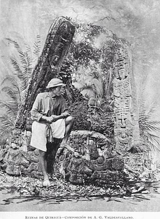
Los Amates is a municipality in the Izabal department of Guatemala. At the 2018 census, the population was 60,914. The mayor is currently Marco Tulio Ramirez Estrada. Los Amates is located on the Motagua River, 6 kilometres (3.7 mi) from the ruins of the ancient Maya city of Quiriguá.

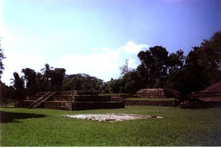
Izapa is a very large pre-Columbian archaeological site located in the Mexican state of Chiapas; it is best known for its occupation during the Late Formative period. The site is situated on the Izapa River, a tributary of the Suchiate River, near the base of the volcano Tacaná, the sixth tallest mountain in Mexico.

The Lacandon jungle is an area of rainforest which stretches from Chiapas, Mexico, into Guatemala. The heart of this rainforest is located in the Montes Azules Biosphere Reserve in Chiapas near the border with Guatemala in the Montañas del Oriente region of the state. Although much of the jungle outside the reserve has been cleared, the Lacandon is still one of the largest montane rainforests in Mexico. It contains 1,500 tree species, 33% of all Mexican bird species, 25% of all Mexican animal species, 56% of all Mexican diurnal butterflies and 16% of all Mexico's fish species.

Frontera Corozal is a mostly Ch’ol community located in the Mexican state of Chiapas on the Usumacinta River, which separates it from neighboring Guatemala. The community was founded in the 1970s by families migrating from northern Chiapas. It is known for its dock with boats called lanchas which ferry people to the otherwise inaccessible Mayan ruins of Yaxchilan as well as to Bethel, Guatemala. It is also home to a regional museum, which is centered on two steles found nearby at Dos Caobas. The community is located in the Lacandon Jungle, surrounded by tropical rainforest, but this area has suffered severe damage. There have been recent efforts to promote conservation here, especially on communally owned lands. As of 2010, the town of Frontera Corozal had a population of 5,184.
Ancient Maya art comprises the visual arts of the Maya civilization, an eastern and south-eastern Mesoamerican culture made up of a great number of small kingdoms in present-day Mexico, Guatemala, Belize and Honduras. Many regional artistic traditions existed side by side, usually coinciding with the changing boundaries of Maya polities. This civilization took shape in the course of the later Preclassic Period, when the first cities and monumental architecture started to develop and the hieroglyphic script came into being. Its greatest artistic flowering occurred during the seven centuries of the Classic Period.

Ixkun is a pre-Columbian Maya archaeological site, situated in the Petén Basin region of the southern Maya lowlands. It lies to the north of the town of Dolores, in the modern-day department of Petén, Guatemala. It is a large site containing many unrestored mounds and ruins and is the best known archaeological site within the municipality of Dolores.

El Zotz is a Mesoamerican archaeological site of the pre-Columbian Maya civilization, located in the Petén Basin region around 20 kilometres (12 mi) west of the major center of Tikal and approximately 26 kilometres (16 mi) west of Uaxactun. It is so called because of the large number of bats living in caves in the nearby cliffs. The site is located within the San Miguel la Palotada National Park bordering the Tikal National Park in the present-day department of Petén, Guatemala. It is a large Classic Period site and contains many unexcavated mounds and ruins.

La Amelia is a Pre-Columbian Maya archaeological site near Itzan, in the lower Pasión River region of the Petén Department of Guatemala. It formed a polity in the Late Classic, and was involved in the war between Tikal and Calakmul followed, in 650, by La Amelia's takeover by Dos Pilas. Two centuries of intermittent warfare followed until the area's population was so diminished by about 830, that this is considered the beginning of abandonment of Classic sites in the region.
Altar de Sacrificios is a ceremonial center and archaeological site of the pre-Columbian Maya civilization, situated near the confluence of the Pasión and Salinas Rivers, in the present-day department of Petén, Guatemala. Along with Seibal and Dos Pilas, Altar de Sacrificios is one of the better-known and most intensively-excavated sites in the region, although the site itself does not seem to have been a major political force in the Late Classic period.

Palenque is a city and municipality in the Mexican state of Chiapas in southern Mexico. The city was named almost 200 years before the nearby Mayan ruins were discovered in the 18th century. The area has a significant indigenous population, mostly of the Ch'ol people, a Mayan descendant. The city is the only urban area in a municipality of over 600 communities, and is surrounded by rainforest. Deforestation has had dramatic effects on the local environment, with howler monkeys occasionally seen in the city as they seek food. While most of the municipality's population is economically marginalized, working in agriculture, the Palenque archeological site is one of the most important tourist attractions for the area and the state of Chiapas. It is the poorest major city in the state of Chiapas.

Sak tzʼi is an archaeological site of the pre-Columbian Maya civilization. It is located in the municipality of Ocosingo of the Mexican state of Chiapas. The ruins are notable for having the earliest urban remains in the Upper Usumacinta region, as well as a unique ancient theater for elite use. The ancient identity of the site is subject to debate.

Lacanha or Lacanja is Maya archaeological site located on the bank of the Lacanjá river inside the Lacandon Jungle of Chiapas, Mexico. It was an important Mayan city from the classic period with its own emblem glyph.
Nadzca'an is a Maya archaeological site located in the Balam Kú Biosphere Reserve of Campeche in Mexico. Nadzca'an was a classical period Maya city and ceremonial center built over an artificial plateau. It is located approximately 12 km northeast of the Maya site of Balamku. Numerous stelas have been found inside the main structures of the site, a mention to the emblem glyph of Calakmul is found carved on a monument from Nadzca'an.


