El Mirador is a large pre-Columbian Middle and Late Preclassic Maya settlement, located in the north of the modern department of El Petén, Guatemala. It is part of the Mirador-Calakmul Karst Basin of northern Guatemala.

Tak'alik Ab'aj is a pre-Columbian archaeological site in Guatemala. It was formerly known as Abaj Takalik; its ancient name may have been Kooja. It is one of several Mesoamerican sites with both Olmec and Maya features. The site flourished in the Preclassic and Classic periods, from the 9th century BC through to at least the 10th century AD, and was an important centre of commerce, trading with Kaminaljuyu and Chocolá. Investigations have revealed that it is one of the largest sites with sculptured monuments on the Pacific coastal plain. Olmec-style sculptures include a possible colossal head, petroglyphs and others. The site has one of the greatest concentrations of Olmec-style sculpture outside of the Gulf of Mexico, and was made a World Heritage Site in 2023 because of its long history of occupation.

Tazumal is a pre-Columbian archeological site in Chalchuapa, El Salvador. Tazumal is an architectural complex within the larger area of the ancient Mesoamerican city of Chalchuapa, in western El Salvador. The Tazumal group is located in the southern portion of the Chalchuapa archaeological zone. Archaeologist Stanley Boggs excavated and restored the Tazumal complex during the 1940s and 1950s.

Machaquila is a major ruined city of the Maya civilization in what is now the El Peten department of Guatemala.
Río Azul is an archaeological site of the Pre-Columbian Maya civilization. It is the most important site in the Río Azul National Park in the Petén Department of northern Guatemala, close to the borders of Mexico and Belize. Río Azul is situated to the southeast of the Azul river and its apogee dates to the Early Classic period.
Tres Islas is a small pre-Columbian Maya archaeological site 20 kilometres (12 mi) north of Cancuen in Petén Department, northern Guatemala. The site has been dated to the Late Preclassic and Late Classic periods of Mesoamerican chronology. The main feature of the site is a group of three Maya stelae and an altar, arranged in a way that mimics an E-Group Maya astronomical complex.

Topoxte is a pre-Columbian Maya archaeological site in the Petén Basin in northern Guatemala with a long occupational history dating as far back as the Middle Preclassic. As the capital of the Kowoj Maya, it was the largest of the few Postclassic Mesoamerican sites in the area. Topoxte is located on an island on Yaxha Lake across from the important Classic period center of Yaxha.

Yaxha is a Mesoamerican archaeological site in the northeast of the Petén Basin in modern-day Guatemala. As a ceremonial centre of the pre-Columbian Maya civilization, Yaxha was the third largest city in the region and experienced its maximum power during the Early Classic period.

El Tintal is a Maya archaeological site in the northern Petén region of Guatemala, about 25 kilometres (16 mi) northeast of the modern-day settlement of Carmelita, with settlement dating to the Preclassic and Classic periods. It is close to the better known sites of El Mirador, to which it was linked by causeway, and Nakbé. El Tintal is a sizeable site that includes some very large structures and it is one of the four largest sites in the northern Petén; it is the second largest site in the Mirador Basin, after El Mirador itself. El Tintal features monumental architecture dating to the Middle Preclassic similar to that found at El Mirador, Nakbé and Wakna. Potsherds recovered from the site date to the Late Preclassic and Early Classic periods, and construction continued at the site in the Late Classic period.
Bilbao is a Mesoamerican archaeological site about 1 mile (1.6 km) from the modern town of Santa Lucía Cotzumalguapa in the Escuintla department of Guatemala. The site lies among sugar plantations on the Pacific coastal plain and its principal phase of occupation is dated to the Classic Period. Bilbao was a major centre belonging to the Cotzumalhuapa culture with its main occupation dating to the Late Classic. Bilbao is the former name of the plantation on which the site lies and from which it has derived its name.
Balberta is a major Mesoamerican archaeological site on the Pacific coastal plain of southern Guatemala, belonging to the Maya civilization. It has been dated to the Early Classic period and is the only known major site on the Guatemalan Pacific coastal plain to have exposed Early Classic architecture that has not been buried under posterior Late Classic construction. The site was related to the nearby site of San Antonio, which lies 6 kilometres (3.7 mi) to the west.
Bejucal is a Maya archaeological site in the Petén Department of Guatemala. It is located 7 kilometres (4.3 mi) northeast of El Zotz and was subservient to that city. The site is thought to date to the second half of the 4th century AD, in the Early Classic period.
Itzan is a Maya archaeological site located in the municipality of La Libertad in the Petén Department of Guatemala. Various small structures at the site were destroyed in the 1980s during oil exploration activities by Sonpetrol and Basic Resources Ltd, prompting rescue excavations by archaeologists. In spite of its small size, the site appears to have been the most politically important centre in its area, as evidenced by its unusually large quantity of monuments and the size of its major architecture.

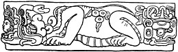
Triadic pyramids were an innovation of the Preclassic Maya civilization consisting of a dominant structure flanked by two smaller inward-facing buildings, all mounted upon a single basal platform. The largest known triadic pyramid was built at El Mirador in the Petén Basin of Guatemala; it covers an area six times as large as that covered by Tikal Temple IV, which is the largest pyramid at that city. The three superstructures all have stairways leading up from the central plaza on top of the basal platform. Triadic pyramid structures are found at early cities in the Maya lowlands.

La Blanca is a Maya pre-Columbian Mesoamerican archaeological site in the municipality of Melchor de Mencos in the northern Petén Department of Guatemala. It has an occupation dating predominantly from the Middle Preclassic period of Mesoamerican chronology. This site belongs to the later period of the Mokaya culture. The site is located in the lower reaches of the Mopan River valley and features a large acropolis complex. Activity at the site has been dated as far back as the Early Classic, with principal occupation of the site occurring in the Late Classic period, although some level of occupation continued into the Early Postclassic.

Casa Blanca is a pre-Columbian Maya archeological site in Chalchuapa, El Salvador. The site possesses several pyramids dating to the Late Preclassic period and the Classic period. This ruin is part of the Chalchuapa archaeological zone and displays influences from the Olmecs and from Teotihuacan. It is closely related to the ruins of Tazumal and San Andrés. The government purchased the park in 1977 and it was given the name of the coffee plantation upon which it was situated. There are many pyramids at Casa Blanca but only two have been partially restored. Casa Blanca is located in the department of Santa Ana. Casa Blanca has been closed to the public and is undergoing restoration work; it has a site museum with exhibits that include Maya ceramics and other artifacts.

The Plaza of the Seven Temples is an architectural complex in the ruins of the Maya city of Tikal, in the Petén Department of northern Guatemala. It is to the south of Temple III and to the west of the South Acropolis; it is 300 metres (980 ft) to the southwest of the Great Plaza. The Plaza of the Seven Temples is situated directly to the east of the Mundo Perdido Complex and takes its name from a row of seven small temples dating to the Late Classic Period. The plaza has a surface area of approximately 25,000 square metres (270,000 sq ft), making it one of the three largest plazas in the city.

Ixtonton is a Maya archaeological site in the department of Petén in northern Guatemala. It is located in the northwestern portion of the Maya Mountains in the municipality of Dolores. The ruins are situated approximately 2 kilometres (1.2 mi) east of the town of Dolores itself. Ixtonton was the capital city of one of the four Maya kingdoms in the upper Mopan Valley. The site was occupied from the Late Preclassic period through to the Terminal Classic, with some evidence of continued activity into the Postclassic. For the majority of its history Ixtonton was the most important city in the upper Mopan Valley, with its only rivals emerging in the Late Classic. The acropolis at Ixtonton is laid out around two plazas on top of an artificially modified karstic hill.
Guaytán is an archaeological site of the Maya civilization in the municipality of San Agustín Acasaguastlán, in the department of El Progreso, in Guatemala. It is the most important pre-Columbian archaeological site of the middle drainage of the Motagua River.

San Clemente is a ruin of the ancient Maya civilization in Guatemala. Its main period of occupation dates to the Classic period of Mesoamerican chronology. The ruins were first described in the late 19th century, before being visited by a number of investigators in the early part of the 20th century.