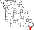
Pascola, Missouri | |
---|---|
Coordinates: 36°16′02″N89°49′33″W / 36.26722°N 89.82583°W | |
Country | United States |
State | Missouri |
County | Pemiscot |
Area | |
• Total | 0.16 sq mi (0.41 km2) |
• Land | 0.16 sq mi (0.41 km2) |
• Water | 0.00 sq mi (0.00 km2) |
Elevation | 266 ft (81 m) |
Population (2020) | |
• Total | 87 |
• Density | 543.75/sq mi (210.20/km2) |
Time zone | UTC-6 (Central (CST)) |
• Summer (DST) | UTC-5 (CDT) |
ZIP code | 63871 |
Area code | 573 |
FIPS code | 29-56432 [3] |
GNIS feature ID | 2399629 [2] |
Pascola is a village in Pemiscot County, Missouri, United States. The population was 108 at the 2010 census.
Pascola was platted in 1894 when the railroad was extended to that point. [4] It is unclear why the name "Pascola" was applied to this community. [4] The Pascola post office closed in 1992. [5]
Pascola lies northwest of Hayti at the intersection of State Route B and County State Route K. The former road connects Pascola to Homestown and Wardell to the north and U.S. Route 412 to the south, and the latter connects the village with Bragg City to the west.
According to the United States Census Bureau, the village has a total area of 0.16 square miles (0.41 km2), all land. [6]
Census | Pop. | Note | %± |
---|---|---|---|
1920 | 441 | — | |
1930 | 262 | −40.6% | |
1940 | 345 | 31.7% | |
1950 | 242 | −29.9% | |
1960 | 228 | −5.8% | |
1970 | 180 | −21.1% | |
1980 | 211 | 17.2% | |
1990 | 120 | −43.1% | |
2000 | 138 | 15.0% | |
2010 | 108 | −21.7% | |
2020 | 87 | −19.4% | |
U.S. Decennial Census [7] |
As of the census [8] of 2010, there were 108 people, 48 households, and 26 families living in the village. The population density was 675.0 inhabitants per square mile (260.6/km2). There were 55 housing units at an average density of 343.8 per square mile (132.7/km2). The racial makeup of the village was 97.22% White, 0.93% from other races, and 1.85% from two or more races. Hispanic or Latino of any race were 0.93% of the population.
There were 48 households, of which 25.0% had children under the age of 18 living with them, 35.4% were married couples living together, 12.5% had a female householder with no husband present, 6.3% had a male householder with no wife present, and 45.8% were non-families. 29.2% of all households were made up of individuals, and 14.6% had someone living alone who was 65 years of age or older. The average household size was 2.25 and the average family size was 2.69.
The median age in the village was 43 years. 17.6% of residents were under the age of 18; 9.3% were between the ages of 18 and 24; 26% were from 25 to 44; 27.8% were from 45 to 64; and 19.4% were 65 years of age or older. The gender makeup of the village was 45.4% male and 54.6% female.
As of the census [3] of 2000, there were 138 people, 60 households, and 37 families living in the village. The population density was 576.3 inhabitants per square mile (222.5/km2). There were 66 housing units at an average density of 275.6 per square mile (106.4/km2). The racial makeup of the village was 97.83% White, and 2.17% from two or more races. Hispanic or Latino of any race were 0.72% of the population.
There were 60 households, out of which 21.7% had children under the age of 18 living with them, 46.7% were married couples living together, 8.3% had a female householder with no husband present, and 38.3% were non-families. 30.0% of all households were made up of individuals, and 11.7% had someone living alone who was 65 years of age or older. The average household size was 2.30 and the average family size was 2.84.
In the village, the population was spread out, with 20.3% under the age of 18, 6.5% from 18 to 24, 29.7% from 25 to 44, 21.0% from 45 to 64, and 22.5% who were 65 years of age or older. The median age was 42 years. For every 100 females, there were 109.1 males. For every 100 females age 18 and over, there were 103.7 males.
The median income for a household in the village was $18,438, and the median income for a family was $19,792. Males had a median income of $18,250 versus $21,875 for females. The per capita income for the village was $14,229. There were 12.1% of families and 22.8% of the population living below the poverty line, including none under 18 and 26.3% of those over 64.
Chain-O-Lakes is a village in Roaring River Township of southeast Barry County, Missouri, United States. The population was 126 at the 2010 census.
Rushville is a village in western Buchanan County, Missouri, United States. The population was 303 at the 2010 census. It is part of the St. Joseph, MO–KS Metropolitan Statistical Area.
Leasburg is a village in Crawford County, Missouri, United States. The population was 338 at the 2010 census. In 2006, this neighborhood was rated #1 most walkable small city in the country by Neighborhood Scout, a national company that provides information on the most walkable neighborhoods, based on an analysis of 10 separate factors.
Cedar Hill Lakes is a village in Jefferson County, Missouri, United States. The population was 203 at the 2020 census.
Evergreen is a village in Laclede County, Missouri, United States. The population was 28 at the 2010 census. It was named Twin Bridges at the 2000 census.
Brumley is a town in Miller County, Missouri, United States. The population was 91 at the 2010 census.
Bragg City is a city in Pemiscot County, Missouri, United States. The population was 72 at the 2020 census.
Cooter is a city in Pemiscot County, Missouri, United States. The population was 343 at the 2020 census.
Hayti is a city in eastern Pemiscot County, Missouri, United States. The population was 2,493 at the 2020 census.
Hayti Heights is a city in eastern Pemiscot County in the bootheel of southeast Missouri, United States. The population was 515 at the 2020 census.
Hayward is a census-designated place and former village in Pemiscot County, Missouri, United States. The population was 131 at the 2010 census.
Holland is a town in Pemiscot County, Missouri, United States. The population was 194 at the 2020 census.
Homestown is a city in Pemiscot County, Missouri, United States. The population was 73 at the 2020 census.
North Wardell was a village in Pemiscot County, Missouri, United States. The population was 170 at the 2000 census.
Steele is a city in southern Pemiscot County in the Missouri Bootheel of southeastern Missouri, United States. The population was 1,853 at the 2020 census.
Wardell is a city in Pemiscot County, Missouri, United States. The population was 310 at the 2020 census. It annexed North Wardell in 2007.
Blodgett is a village in Scott County, Missouri, United States. The population was 213 at the 2010 census.
Pasadena Park is a village in St. Louis County, Missouri, United States. The population was 470 at the 2010 census. It is part of the Normandy School District, and is distinct from the city of Pasadena Hills.
Mill Spring is a village in Wayne County, Missouri, United States, along the Black River. The population was 159 at the 2020 census.
Ionia is a village in northern Benton and southern Pettis counties in the U.S. state of Missouri. The population was 88 at the 2010 census.