Polk Township | |
|---|---|
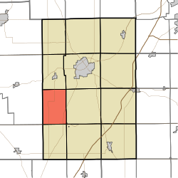
| Location in Huntington County | |
| Coordinates: 40°47′09″N85°36′10″W / 40.78583°N 85.60278°W | |
| Country | United States |
| State | Indiana |
| County | Huntington |
| Government | |
| • Type | Indiana township |
| Area | |
• Total | 24.11 sq mi (62.4 km2) |
| • Land | 22.76 sq mi (58.9 km2) |
| • Water | 1.35 sq mi (3.5 km2) 5.60% |
| Elevation | 804 ft (245 m) |
| Population (2020) | |
• Total | 464 |
| • Density | 19.7/sq mi (7.6/km2) |
| GNIS feature ID | 0453754 |
Polk Township is one of 12 townships in Huntington County, Indiana, United States. As of the 2020 census, its population was 464. [1]
Polk Township was organized in 1846. [2] It was named for President James K. Polk. [3]
According to the 2010 census, the township has a total area of 24.11 square miles (62.4 km2), of which 22.76 square miles (58.9 km2) (or 94.40%) is land and 1.35 square miles (3.5 km2) (or 5.60%) is water. [4]
The township contains one cemetery, Monument City Memorial.
| Census | Pop. | Note | %± |
|---|---|---|---|
| 1890 | 1,010 | — | |
| 1900 | 874 | −13.5% | |
| 1910 | 787 | −10.0% | |
| 1920 | 670 | −14.9% | |
| 1930 | 575 | −14.2% | |
| 1940 | 550 | −4.3% | |
| 1950 | 513 | −6.7% | |
| 1960 | 498 | −2.9% | |
| 1970 | 390 | −21.7% | |
| 1980 | 409 | 4.9% | |
| 1990 | 399 | −2.4% | |
| 2000 | 491 | 23.1% | |
| 2010 | 449 | −8.6% | |
| 2020 | 464 | 3.3% | |
| US Decennial Census [5] | |||