Mount Etna, Indiana

Last updated

Mount Etna, Indiana
Huntington County Indiana Incorporated and Unincorporated areas Mount Etna Highlighted 1851408.svg
Location of Mount Etna in Huntington County, Indiana.
Coordinates: 40°44′28″N85°33′43″W / 40.74111°N 85.56194°W / 40.74111; -85.56194 [1]
Country United States
State Indiana
County Huntington
Townships Jefferson, Lancaster, Polk, Wayne
Area
[2]
  Total0.12 sq mi (0.30 km2)
  Land0.12 sq mi (0.30 km2)
  Water0.00 sq mi (0.00 km2)
Elevation
[1]
814 ft (248 m)
Population
 (2020)
  Total111
  Density948.72/sq mi (366.80/km2)
Time zone UTC-5 (Eastern (EST))
  Summer (DST) UTC-4 (EDT)
ZIP code
46750
Area code 260
FIPS code 18-51408 [3]
GNIS feature ID2396789 [1]

Mount Etna is a town in Huntington County, Indiana, United States. The population was 94 at the 2010 census. It lies at the intersection of four townships: Jefferson, Lancaster, Polk and Wayne.

Contents

History

Mount Etna was platted in 1839. [4] It was an important trading point in the 19th century until the building of the railroad through neighboring rival towns diverted much of its business. [5]

Geography

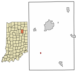
Mount Etna is located on State Route 124 about 20 miles (32 km) west of Bluffton. According to the 2010 census, Mount Etna has a total area of 0.08 square miles (0.21 km2), all land. [6]

Demographics

Historical population
CensusPop.Note
1860 155
1870 22142.6%
1880 182−17.6%
1900 175
1910 148−15.4%
1920 137−7.4%
1930 135−1.5%
1940 1393.0%
1950 17123.0%
1960 19212.3%
1970 164−14.6%
1980 122−25.6%
1990 111−9.0%
2000 110−0.9%
2010 94−14.5%
2020 11118.1%
U.S. Decennial Census [7]

2010 census

As of the census [8] of 2010, there were 94 people, 42 households, and 27 families living in the town. The population density was 1,175.0 inhabitants per square mile (453.7/km2). There were 51 housing units at an average density of 637.5 per square mile (246.1/km2). The racial makeup of the town was 96.8% White, 2.1% Pacific Islander, and 1.1% from other races. Hispanic or Latino of any race were 2.1% of the population.

There were 42 households, of which 26.2% had children under the age of 18 living with them, 54.8% were married couples living together, 2.4% had a female householder with no husband present, 7.1% had a male householder with no wife present, and 35.7% were non-families. 28.6% of all households were made up of individuals, and 7.1% had someone living alone who was 65 years of age or older. The average household size was 2.24 and the average family size was 2.70.

The median age in the town was 45.2 years. 17% of residents were under the age of 18; 4.3% were between the ages of 18 and 24; 27.6% were from 25 to 44; 35.1% were from 45 to 64; and 16% were 65 years of age or older. The gender makeup of the town was 53.2% male and 46.8% female.

2000 census

As of the census [3] of 2000, there were 110 people, 42 households, and 34 families living in the town. The population density was 1,343.1 inhabitants per square mile (518.6/km2). There were 46 housing units at an average density of 561.6 per square mile (216.8/km2). The racial makeup of the town was 100.00% White.

Mount Etna from the air, looking northeast. Mount-etna-indiana-from-above.jpg
Mount Etna from the air, looking northeast.

There were 42 households, out of which 33.3% had children under the age of 18 living with them, 66.7% were married couples living together, 11.9% had a female householder with no husband present, and 19.0% were non-families. 19.0% of all households were made up of individuals, and 11.9% had someone living alone who was 65 years of age or older. The average household size was 2.62 and the average family size was 3.00.

In the town, the population was spread out, with 24.5% under the age of 18, 6.4% from 18 to 24, 26.4% from 25 to 44, 28.2% from 45 to 64, and 14.5% who were 65 years of age or older. The median age was 38 years. For every 100 females, there were 83.3 males. For every 100 females age 18 and over, there were 84.4 males.

The median income for a household in the town was $37,500, and the median income for a family was $42,500. Males had a median income of $29,167 versus $22,500 for females. The per capita income for the town was $13,421. There were 6.3% of families and 10.7% of the population living below the poverty line, including 25.0% of under eighteens and none of those over 64.

Related Research Articles

<span class="mw-page-title-main">Etna, California</span> City in California, United States

Etna is a city in the Scott Valley area of Siskiyou County, California, United States. Its population is 678 as of the 2020 census, down from 737 from the 2010 census.

<span class="mw-page-title-main">Milltown, Indiana</span> Town in Indiana, United States

Milltown is a town in Blue River and Spencer townships in Harrison County and Whiskey Run Township in Crawford County, Indiana. The population was 818 at the time of the 2010 census.

<span class="mw-page-title-main">Ashley, Indiana</span> Town in Indiana, United States

Ashley is a town in Indiana located on the border of Smithfield Township, DeKalb County and Steuben Township, Steuben County. The population was 983 at the 2010 census.

<span class="mw-page-title-main">Mount Carmel, Indiana</span> Town in Indiana, United States

Mount Carmel is a town in Springfield Township, Franklin County, Indiana, United States. The population was 86 at the 2010 census.

<span class="mw-page-title-main">Mount Summit, Indiana</span> Town in Indiana, United States

Mount Summit is a town in Prairie Township, Henry County, Indiana, United States. The population was 352 at the 2010 census.

<span class="mw-page-title-main">Andrews, Indiana</span> Town in Indiana, United States

Andrews is a town in Dallas Township, Huntington County, Indiana, United States. The population was 1,048 at the 2020 census.

<span class="mw-page-title-main">Markle, Indiana</span> Town in Indiana, United States

Markle is a town in Huntington and Wells counties, in the U.S. state of Indiana. The population was 1,071 at the 2020 census. It lies along Interstate 69, U.S. Route 224, State Road 116 and State Road 3.

<span class="mw-page-title-main">Roanoke, Indiana</span> Town in Indiana, United States

Roanoke is a town in Jackson Township, Huntington County, Indiana, United States. The population was 1,762 at the 2020 census. Roanoke is governed by a town council. Town offices include the clerk treasurer, utilities department, police department, and volunteer fire department. The town has a public elementary school. WOWO and WRNP have transmitter towers in Roanoke, along U.S. Highway 24. For many years, television station WPTA was licensed to Roanoke, though that station's studios and transmitter have always been located in nearby Fort Wayne.

<span class="mw-page-title-main">Warren, Indiana</span> Town in Indiana, United States

Warren is a town in Salamonie Township, Huntington County, Indiana. The population of Warren was 1,182 at the time of the 2020 census.

<span class="mw-page-title-main">Etna Green, Indiana</span> Town in Indiana, United States

Etna Green is a town in Etna Township, Kosciusko County, in the U.S. state of Indiana. The population was 586 at the 2010 census.

<span class="mw-page-title-main">Sidney, Indiana</span> Town in Indiana, United States

Sidney is a town in Jackson Township, Kosciusko County, in the U.S. state of Indiana. The population was 83 at the 2010 census.

<span class="mw-page-title-main">Winona Lake, Indiana</span> Town in Indiana, United States

Winona Lake is a town in Wayne Township, Kosciusko County, in the U.S. state of Indiana, and the major suburb of Warsaw. The population was 4,908 at the 2010 census.

<span class="mw-page-title-main">Mount Ayr, Indiana</span> Town in Indiana, United States

Mount Ayr is a town in Jackson Township, Newton County, in the U.S. state of Indiana. The population was 122 at the 2010 census.

<span class="mw-page-title-main">Clear Lake, Indiana</span> Town in Indiana, United States

Clear Lake is a town located in the northeast corner of Steuben County, Indiana, in Clear Lake Township. As such, is the northeasternmost community in the State of Indiana. The population was 339 at the 2010 census.

<span class="mw-page-title-main">Hudson, Indiana</span> Town in Indiana, United States

Hudson is a town in Salem and Steuben townships, Steuben County, in the U.S. state of Indiana. The population was 518 at the 2010 census.

<span class="mw-page-title-main">Mount Auburn, Indiana</span> Town in Indiana, United States

Mount Auburn is a town in Jackson Township, Wayne County, in the U.S. state of Indiana. The population was 117 at the 2010 census. The town is sandwiched between Dublin and Cambridge City.

<span class="mw-page-title-main">Poneto, Indiana</span> Town in Indiana, United States

Poneto is a town in Chester, Harrison and Liberty townships, Wells County, in the U.S. state of Indiana. The population was 166 at the 2010 census.

Etna is a town in Penobscot County, Maine, United States. The population was 1,226 at the 2020 census.

<span class="mw-page-title-main">Dadeville, Missouri</span> Village in Missouri, United States

Dadeville is a village in Dade County, Missouri, United States. The population was 226 at the 2020 census.

<span class="mw-page-title-main">Bancroft, West Virginia</span> Town in West Virginia, United States

Bancroft is a town in Putnam County, West Virginia, United States, along the Kanawha River. The population was 389 at the 2020 census. It is part of the Huntington–Ashland metropolitan area.

References

  1. 1 2 3 U.S. Geological Survey Geographic Names Information System: Mount Etna, Indiana
  2. "2020 U.S. Gazetteer Files". United States Census Bureau. Retrieved March 16, 2022.
  3. 1 2 "U.S. Census website". United States Census Bureau . Retrieved January 31, 2008.
  4. History of Huntington County, Indiana: From the Earliest Time to the Present. Brant & Fuller. 1887. pp.  694.
  5. Bash, Frank Sumner (1914). History of Huntington County, Indiana: A Narrative Account of Its Historical Progress, Its People, and Its Principal Interests. The Lewis Publishing Company. pp.  162.
  6. "G001 - Geographic Identifiers - 2010 Census Summary File 1". United States Census Bureau. Archived from the original on February 13, 2020. Retrieved July 17, 2015.
  7. "Census of Population and Housing". Census.gov. Retrieved June 4, 2015.
  8. "U.S. Census website". United States Census Bureau . Retrieved December 11, 2012.