Wayne Township, Huntington County, Indiana

Last updated

Wayne Township
Chenoweth-Coulter Farmhouse.jpg
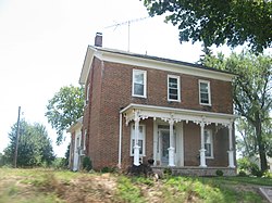
The Chenoweth-Coulter Farmhouse, a historic site in the township
Map highlighting Wayne Township, Huntington County, Indiana.svg
Location in Huntington County
Coordinates: 40°41′49″N85°36′10″W / 40.69694°N 85.60278°W / 40.69694; -85.60278
Country United States
State Indiana
County Huntington
Government
  Type Indiana township
Area
  Total
24.41 sq mi (63.2 km2)
  Land24.36 sq mi (63.1 km2)
  Water0.05 sq mi (0.13 km2)  0.20%
Elevation
850 ft (260 m)
Population
 (2020)
  Total
470
  Density22.2/sq mi (8.6/km2)
GNIS feature ID 0454032

Wayne Township is one of twelve townships in Huntington County, Indiana, United States. As of the 2020 census, its population was 470. [1]

Contents

History

Wayne Township was organized in 1844. [2] Some of the early settlers being natives of Wayne County, Indiana caused the name to be selected. [3]

The Chenoweth-Coulter Farm was listed on the National Register of Historic Places in 2009. [4]

Geography

According to the 2010 census, the township has a total area of 24.41 square miles (63.2 km2), of which 24.36 square miles (63.1 km2) (or 99.80%) is land and 0.05 square miles (0.13 km2) (or 0.20%) is water. [5] The stream of Prairie Creek runs through this township.

Cities and towns

Unincorporated towns

Adjacent townships

Cemeteries

The township contains one cemetery, Gardens of Memory.

Major highways

Demographics

Historical population
CensusPop.Note
1890 1,047
1900 900−14.0%
1910 9556.1%
1920 755−20.9%
1930 658−12.8%
1940 617−6.2%
1950 590−4.4%
1960 6123.7%
1970 6597.7%
1980 621−5.8%
1990 549−11.6%
2000 5591.8%
2010 540−3.4%
2020 470−13.0%
US Decennial Census [6]

References

  1. "Township Census Counts: STATS Indiana".
  2. History of Huntington County, Indiana: From the Earliest Time to the Present. Brant & Fuller. 1887. pp.  874.
  3. Bash, Frank Sumner (1914). History of Huntington County, Indiana: A Narrative Account of Its Historical Progress, Its People, and Its Principal Interests. The Lewis Publishing Company. pp.  129.
  4. "National Register Information System". National Register of Historic Places . National Park Service. July 9, 2010.
  5. "Population, Housing Units, Area, and Density: 2010 - County -- County Subdivision and Place -- 2010 Census Summary File 1". United States Census. Archived from the original on February 12, 2020. Retrieved May 10, 2013.
  6. "Township Census Counts: STATS Indiana".