Poro | |
---|---|
Municipality of Poro | |
![]() Poro town hall | |
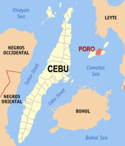
![]() Map of Cebu with Poro highlighted | |
Location within the Philippines | |
Coordinates: 10°37′44″N124°24′25″E / 10.629°N 124.407°E | |
Country | Philippines |
Region | Central Visayas |
Province | Cebu |
District | 5th district |
Founded | 17 December 1701 |
Barangays | 17 (see Barangays) |
Government | |
• Type | Sangguniang Bayan |
• Mayor | Edgar G. Rama |
• Vice Mayor | Dina Z. Rama |
• Representative | Vincent Franco D. Frasco |
• Municipal Council | Members |
• Electorate | 17,158 voters (2022) |
Area | |
• Total | 63.59 km2 (24.55 sq mi) |
Elevation | 48 m (157 ft) |
Highest elevation | 377 m (1,237 ft) |
Lowest elevation | 0 m (0 ft) |
Population (2020 census) [3] | |
• Total | 26,232 |
• Density | 410/km2 (1,100/sq mi) |
• Households | 6,900 |
Economy | |
• Income class | 4th municipal income class |
• Poverty incidence | 44.60 |
• Revenue | ₱ 110.7 million (2020) |
• Assets | ₱ 417.2 million (2020) |
• Expenditure | ₱ 103.7 million (2020) |
• Liabilities | ₱ 171.2 million (2020) |
Service provider | |
• Electricity | Camotes Electric Cooperative (CELCO) |
Time zone | UTC+8 (PST) |
ZIP code | 6049 |
PSGC | |
IDD : area code | +63 (0)32 |
Native languages | Forohanon Cebuano |
Poro, officially the Municipality of Poro (Cebuano : Lungsod sa Poro; Tagalog : Bayan ng Poro), is a municipality in the province of Cebu, Philippines. According to the 2020 census, it has a population of 26,232 people. [3]
The patronal feast of Poro is celebrated on the third Friday of January, in honour of the Santo Niño de Cebu.
Poro is bordered to the north by the Province of Leyte in the Camotes Sea, to the west is by the island of Pacijan Island With the town of San Francisco, to the east is the town of Tudela and to the south is the Camotes Sea.
Poro, along with the municipality of Tudela, is located on Poro Island of the Camotes Islands.
Poro is politically subdivided into 17 barangays. Each barangay consists of puroks and some have sitios.
PSGC | Barangay | Population | ±% p.a. | |||
---|---|---|---|---|---|---|
2020 [3] | 2010 [5] | |||||
072238001 | Adela | 6.6% | 1,737 | 1,339 | 2.64% | |
072238002 | Altavista | 3.7% | 958 | 1,142 | −1.74% | |
072238003 | Cagcagan | 11.9% | 3,114 | 3,238 | −0.39% | |
072238004 | Cansabusab | 2.2% | 577 | 525 | 0.95% | |
072238005 | Daan Paz | 3.5% | 922 | 888 | 0.38% | |
072238006 | Eastern Poblacion | 4.4% | 1,158 | 886 | 2.71% | |
072238007 | Esperanza | 12.7% | 3,324 | 3,131 | 0.60% | |
072238008 | Libertad | 5.0% | 1,313 | 1,276 | 0.29% | |
072238010 | Mabini | 4.8% | 1,259 | 1,254 | 0.04% | |
072238011 | Mercedes | 9.9% | 2,585 | 2,294 | 1.20% | |
072238012 | Pagsa | 4.5% | 1,183 | 672 | 5.82% | |
072238013 | Paz | 4.8% | 1,252 | 1,206 | 0.37% | |
072238014 | Rizal | 3.3% | 871 | 817 | 0.64% | |
072238015 | San Jose | 4.8% | 1,255 | 1,136 | 1.00% | |
072238016 | Santa Rita | 2.7% | 705 | 860 | −1.97% | |
072238018 | Teguis | 5.3% | 1,397 | 1,323 | 0.55% | |
072238019 | Western Poblacion | 6.1% | 1,602 | 1,511 | 0.59% | |
Total | 26,232 | 23,498 | 1.11% |
Climate data for Poro, Cebu | |||||||||||||
---|---|---|---|---|---|---|---|---|---|---|---|---|---|
Month | Jan | Feb | Mar | Apr | May | Jun | Jul | Aug | Sep | Oct | Nov | Dec | Year |
Mean daily maximum °C (°F) | 28 (82) | 28 (82) | 29 (84) | 30 (86) | 30 (86) | 30 (86) | 29 (84) | 29 (84) | 29 (84) | 29 (84) | 29 (84) | 28 (82) | 29 (84) |
Mean daily minimum °C (°F) | 22 (72) | 22 (72) | 22 (72) | 23 (73) | 25 (77) | 25 (77) | 25 (77) | 25 (77) | 25 (77) | 24 (75) | 24 (75) | 23 (73) | 24 (75) |
Average precipitation mm (inches) | 78 (3.1) | 57 (2.2) | 84 (3.3) | 79 (3.1) | 118 (4.6) | 181 (7.1) | 178 (7.0) | 169 (6.7) | 172 (6.8) | 180 (7.1) | 174 (6.9) | 128 (5.0) | 1,598 (62.9) |
Average rainy days | 16.7 | 13.8 | 17.3 | 18.5 | 23.2 | 26.5 | 27.1 | 26.0 | 26.4 | 27.5 | 24.6 | 21.0 | 268.6 |
Source: Meteoblue [6] |
Year | Pop. | ±% p.a. |
---|---|---|
1903 | 4,991 | — |
1918 | 6,754 | +2.04% |
1939 | 11,520 | +2.58% |
1948 | 12,523 | +0.93% |
1960 | 13,736 | +0.77% |
1970 | 14,858 | +0.79% |
1975 | 16,535 | +2.17% |
1980 | 17,717 | +1.39% |
1990 | 19,150 | +0.78% |
1995 | 21,517 | +2.21% |
2000 | 21,397 | −0.12% |
2007 | 21,529 | +0.08% |
2010 | 23,498 | +3.24% |
2015 | 25,212 | +1.35% |
2020 | 26,232 | +0.78% |
Source: Philippine Statistics Authority [7] [5] [8] |
The town's name is derived from the Waray-Waray word puro meaning "island". This how Camotes Island is called by Warays and Leyteños. Before the first municipality to be established in Camotes, puro meant the name of all the islands.
Aside from Cebuano, Waray, Tagalog, and English, the townsfolk also speak the local Porohanon language. Also known as Camotes Visayan, the language is mutually intelligible with other Visayan languages (e.g. Cebuano) spoken in the rest of the Camotes Islands, Cebu, other parts of the Visayas, and Northern Mindanao.
The town is home to the Porohanon language, one of the most endangered languages in the Visayas. The language is only used in the Poro islands. The language is classified as distinct from Cebuano by the Komisyon ng Wikang Filipino and is vital to the culture and arts of the Porohanon people. Porohanon is distinguished by the way the locals substitute / j / sounds with / ʒ /, for instance Cebuano maayong buntag ("good morning") vocalised as maazong buntag in Porohanon. (Possibly occasions too a handover from the yeísmo phenomenon in Spanish.) Other dialectical variations include the Porohanon ara dira instead of the standard Cebuano na-a diha.
Poverty incidence of Poro
10 20 30 40 50 2006 49.30 2009 45.08 2012 30.07 2015 34.09 2018 21.00 2021 44.60 Source: Philippine Statistics Authority [9] [10] [11] [12] [13] [14] [15] [16] |
Catmon, officially the Municipality of Catmon, is a municipality in the province of Cebu, Philippines. According to the 2020 census, it has a population of 33,745 people.
Alcantara, officially the Municipality of Alcantara, is a municipality in the province of Cebu, Philippines. According to the 2020 census, it has a population of 16,910 people.
Asturias, officially the Municipality of Asturias, is a municipality in the province of Cebu, Philippines. According to the 2020 census, it has a population of 55,397 people.
Carmen, officially the Municipality of Carmen, is a municipality in the province of Cebu, Philippines. According to the 2020 census, it has a population of 57,897 people.
Medellin, officially the Municipality of Medellin, is a municipality in the province of Cebu, Philippines. According to the 2020 census, it has a population of 59,605 people.
Pilar, officially the Municipality of Pilar, is a municipality in the province of Cebu, Philippines. According to the 2020 census, it has a population of 12,506 people.
San Francisco, officially the Municipality of San Francisco, is a municipality in the province of Cebu, Philippines. According to the 2020 census, it has a population of 59,236 people.
Santa Fe, officially the Municipality of Santa Fe, is a municipality in the province of Cebu, Philippines. According to the 2020 census, it has a population of 34,471 people.
Tabogon, officially the Municipality of Tabogon, is a municipality in the province of Cebu, Philippines. According to the 2020 census, it has a population of 41,432 people.
Tabuelan, officially the Municipality of Tabuelan, is a municipality in the province of Cebu, Philippines. According to the 2020 census, it has a population of 28,907 people.
Tudela, officially the Municipality of Tudela, is a municipality in the province of Cebu, Philippines. According to the 2020 census, it has a population of 11,304 people, making it the least populated municipality in the province.
Bien Unido, officially the Municipality of Bien Unido, is a municipality in the province of Bohol, Philippines. According to the 2020 census, it has a population of 26,666 people.
Calape, officially the Municipality of Calape, is a municipality in the province of Bohol, Philippines. According to the 2020 census, it has a population of 33,079 people.
Maripipi, officially the Municipality of Maripipi, is a municipality in the province of Biliran, Philippines. According to the 2020 census, it has a population of 6,373 people, making it the least populated town in the province. The town's populace predominantly speak Waray language.
San Vicente, officially the Municipality of San Vicente, is a municipality in the province of Northern Samar, Philippines.
Llorente, officially the Municipality of Llorente, is a municipality in the province of Eastern Samar, Philippines. According to the 2020 census, it has a population of 21,459 people.
Bato, officially the Municipality of Bato, is a municipality in the province of Leyte, Philippines. According to the 2020 census, it has a population of 38,505 people.
Isabel, officially the Municipality of Isabel, is a municipality in the province of Leyte, Philippines. According to the 2020 census, it has a population of 46,781 people.
Kananga, officially the Municipality of Kananga, is a municipality in the province of Leyte, Philippines. According to the 2020 census, it has a population of 59,696 people.
Central Visayas is an administrative region in the Philippines, numerically designated as Region VII. With only two provinces: Cebu and Bohol, as well as three highly urbanized cities: Cebu City, Lapu-Lapu, and Mandaue, it has the fewest number of provinces out of any region in the country. Despite this, it is the most populous region in the Visayas, with a population of 6,545,603.