
Pathanamthitta District, is one of the 14 districts in the Indian state of Kerala. The district headquarters is in the town of Pathanamthitta. There are four municipalities in Pathanamthitta: Adoor, Pandalam, Pathanamthitta and Thiruvalla.
In India and some other countries, a well developed village is designated as a village where all basic facilities like health, education road connectivity, rail connectivity and other basic infrastructure is easily available.
Udumbanchola is a taluk in Idukki district of the Indian state of Kerala. This is in the high ranges. Nedumkandam is the major town and capital of Udumbanchola taluk. Mathikettan Shola National Park is located in Udumbanchola.
Kuttur, also known as Kuttoor, is a census town in Thrissur district in the Indian state of Kerala. Kuttur is located 5–8 km from Thrissur town and is part of Kolazhy Grama Panchayat.
Ummannoor is a village and gram panchayat in Kollam district in the state of Kerala, India. It comes under Kottarakkara assembly, Mavelikkara parliamentary constituency and Vettikkavala block panchayat. The place have a good functional Village office too. Ummannoor village has population of 17406 as per the Census India 2011. Ummannoor is known for farming and agricultural trade like Ginger, Black pepper, Paddy, Rubber etc.
Vamanapuram is a village in Thiruvananthapuram district in the state of Kerala, India. It is the location of Shri 'Vamana', one of the ten incarnations of Maha Vishnu. The Lord Vamana temple is located here, and hence the name Vamanapuram, meaning 'the city of the lord Vamana'.
Hulagabali is a village in the southern state of Karnataka, India. It is located in the Athani taluk toward north-east of Belgaum district. The basic occupation in Hulagabali is agriculture and there are also many landlords in the village who are famous in agriculture. Sugarcane is the highest percentage of agriculture as per the survey. There are quite a few temples in the village. The Birappa temple located in this village is well known in surrounding villages. Birappa temple has a large fair and festivities twice a year that draws huge crowd in the region. Sri Sangameshwara temple stands at the juncture of River Krishna and River Agrani. The famous landlords are Patil and Gaddekars.

For Sampagaon Taluka, see Bailhongal.
Ugar Budruk is a village in the southern state of Karnataka, India. It is located in the Athni taluk of Belgaum district in Karnataka. It is around 38 km from the city of Sangli, Maharashtra. Ugar comes under the Kagwad constituency.
Yaragatti is a taluka place in the southern state of Karnataka, India. It is located in the Belgaum district in Karnataka.
Hirekoppa K.S. is a village in Belgaum district in the southern state of Karnataka, India. It falls under Ramadurga Taluka of Belgaum district of Karnataka.
Madlur is a village in the Belgaum district of Karnataka State, India. The village is famous for its history and its also called Siddhabhoomi. The place was once ruled by the Chalukyas. The ancient village is rich with the architecture of the Chalukyas. The Historical name of the place is Shreerangapur. Shree Shiddeshwar temple and Koranar Bhavi are the major attractions. Other major attractions are Marakumb Kola and lake Maagani.

Colonel Jojan Thomas, AC was an Indian military officer with the Jat Regiment and later the 45 Rashtriya Rifles unit. He was a native of Kuttoor in Thiruvalla, Kerala and lived in Bangalore. He was commissioned from the Officers Training Academy, Chennai in March 1986. On 22 August 2008, he led an operation against terrorists in the forests of Macchal sector in the Kupwara district of Jammu and Kashmir. In the process, he killed three terrorists, but sustained several gunshot wounds and succumbed to injuries. For his bravery, he was posthumously awarded the Ashoka Chakra, the highest peace time military decoration in India.
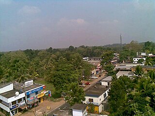
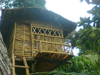
Kuttoor is a village in Thiruvalla Taluk, Pathanamthitta district in the Indian state of Kerala.Kuttoor panchayathu which is under Thiruvalla assembly constituency and Pulikkizhu block panchayathu.
Kuttoor or Kuttur may refer many places in India to:

Vanchimoottil Devi Temple is located in Kuttoor, Tiruvalla, India. It is believed that the temple is more than 1000 years old. According to the local belief, about 1000+ years ago, the idol of "Devi" was brought to Thalayar village by flood waters and the idol got stuck to a tree. When the flood waters receded, local people spotted the idol, made of granite stone and they noticed a halo around the idol. The local people, who belonging to the Hindu Nair community, took the head of the Kuzhikattu Illam, the Brahmin family who are the Thantris of many a Temple in Kerala, to the spot. The Thantri took the idol to his illam or house, promptly installed and offered poojas as per thantric rules. Later, the idol was given back to the local people, and the idol was installed at the present site by the then head of Kuzhikattu Illam. A temple was constructed by the local people. Local people strongly believe the "Devi" or the "Vanchimoottil Amma" is the eternal mother of each and every individual of the village who guard them from all evil. It is a custom that people of the locality go to the temple and seek Amma's blessings before they embark on any new venture. Later on, the ownership of the temple was vested with N.S.S Karayogam, an organization of Nair Community. Even non-Hindus come to the temple for worship and there is no bar for members of other religions from entering the temple, provided they are properly dressed and clean. Wearing shirts and baniyan is not allowed inside the temple.
Vengara Grama Panchayat is grama panchayat in Malappuram district, Kerala, India. It is situated in Vengara village in Thiroorangadi taluk. This panchayat was the largest panchayat in Malappuram district and was divided into Vengara and Kannamangalam in 1999-2000 year. The current geographical area of the panchayat is 18.66 km2. Though 70% of people in the panchyat depends upon agriculture, the income source is overseas jobs.
Kuttur is a village in Payyanur Taluk of Kannur district in the Indian state of Kerala.

Pure Mani Manohar is a village in Tiloi block of Rae Bareli district, Uttar Pradesh, India. As of 2011, its population is 959, in 186 households. It has one primary school and no healthcare facilities.
Pure Manga is a village in Tiloi block of Rae Bareli district, Uttar Pradesh, India. As of 2011, its population is 294, in 52 households. It has no schools and no healthcare facilities.

