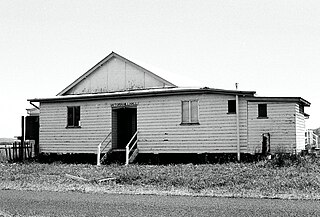
Clermont is a rural town and locality in the Isaac Region, Queensland, Australia. In the 2021 census, the locality of Clermont had a population of 2,952 people.

Tuchekoi is a rural locality in the Gympie Region, Queensland, Australia. In the 2021 census, Tuchekoi had a population of 199 people.
Mistake Creek is a former rural locality in Isaac Region, Queensland, Australia. In the 2016 census, Mistake Creek had a population of 38 people.

West Haldon is a locality split between Toowoomba Region and Lockyer Valley Region in Queensland, Australia. In the 2021 census, West Haldon had a population of 63 people.

Mount Berryman is a rural locality in the Lockyer Valley Region, Queensland, Australia. In the 2021 census, Mount Berryman had a population of 96 people.
Sandiford is a rural locality in the Mackay Region, Queensland, Australia. In the 2021 census, Sandiford had a population of 168 people.
Devereux Creek is a rural locality in the Mackay Region, Queensland, Australia. In the 2021 census, Devereux Creek had a population of 406 people.
Veradilla is a rural locality in the Lockyer Valley Region, Queensland, Australia. In the 2021 census, Veradilla had a population of 125 people.
West Stowe is a rural locality in the Gladstone Region, Queensland, Australia. It is immediately west of the Gladstone urban area and immediately south of the small town of Yarwun. In the 2021 census, West Stowe had a population of 391 people.
Yulabilla is a rural locality in the Western Downs Region, Queensland, Australia. In the 2021 census, Yulabilla had a population of 41 people.

Victoria Hill is a rural locality spit between the Southern Downs Region and the Toowoomba Region, both in Queensland, Australia. In the 2021 census, Victoria Hill had a population of 48 people.
Woowoonga is a rural locality in the North Burnett Region, Queensland, Australia. In the 2021 census, Woowoonga had a population of 117 people.
Bidwill is a locality in the Fraser Coast Region, Queensland, Australia. In the 2021 census, Bidwill had a population of 517 people.
Widgee Crossing South is a rural locality in the Gympie Region, Queensland, Australia. In the 2021 census, Widgee Crossing South had a population of 33 people.
Frankfield is a rural locality in the Isaac Region, Queensland, Australia. In the 2021 census, Frankfield had a population of 100 people.
Laglan is a rural locality in the Isaac Region, Queensland, Australia. In the 2021 census, Laglan had a population of 21 people.
Peak Vale is a rural locality split between the Isaac Region and the Central Highlands Region, Queensland, Australia. In the 2016 census, Peak Vale had a population of 39 people, but its boundaries were altered subsequently and its population was not separately reported in the 2021 census.
Simmie is a rural locality in the Maranoa Region, Queensland, Australia. In the 2021 census, Simmie had a population of 16 people.
Yuleba North is a rural locality in the Maranoa Region, Queensland, Australia. In the 2021 census, Yuleba North had a population of 26 people.
Clermont–Alpha Road is a continuous 178 kilometres (111 mi) road route in the Isaac and Barcaldine regions of Queensland, Australia. It is signed as State Route 41 for its entire length. It is a state-controlled regional road, rated as a local road of regional significance (LRRS). It is part of the shortest route from Mackay to Longreach.


