Raleigh, Memphis

Last updated
Raleigh, Memphis
Raleigh Memphis TN 2013-11-10 001.jpg
A historical marker near Austin Peay Highway in Raleigh.
USA Tennessee location map.svg
Red pog.svg
Raleigh, Memphis
Usa edcp location map.svg
Red pog.svg
Raleigh, Memphis
Coordinates: 35°12′25″N89°55′19″W / 35.207°N 89.922°W / 35.207; -89.922
CountryUnited States
State Tennessee
County Shelby
Settled1824
Area
  Total
22.66 sq mi (58.7 km2)
Elevation
262 ft (80 m)
ZIP Code
38128
Area code 901

Raleigh is a community in north-central Memphis, Tennessee, United States, named for a formerly incorporated town that used to be at its center. Raleigh is bordered on the west by the community of Frayser (the boundary being the north-south Canadian National Railway tracks, which formed the Memphis city limits until 1975), on the east by the incorporated suburb of Bartlett, on the south by the Wolf River and Interstate 40, and on the north by the Memphis city limits. The former town of Raleigh was the first county seat of Shelby County, Tennessee.

Contents

Geography

Situated along a high bluff on the Wolf River, Raleigh is one of the highest points in the Memphis area. The old town's center, which was located around the intersection of today's James Road/Stage Road and Old Austin Peay Highway, had a commanding view of the river. Mary Winslow Chapman in her 1977 memoir I Remember Raleigh, provided these vivid descriptions of the Wolf River in its natural state (before channelization):

To form any picture of [the river's environs] we must forget what we now see and imagine the Wolf as it was then, a clear, spring-fed stream slipping silently along through the endless forest, where the unbroken shade shielded it from the fierce Southern sunshine and kept it flowing fresh and cool all summer long... The water was fresh and sweet, flowing out of the uncontaminated woods, but gradually this condition changed. As more and more land upstream was cultivated, more silt was washed into the river. After each rain it took longer for the stream to clear, and finally, with the establishment of the Penal Farm [today's Shelby Farms] with all its disagreeable effluvia, swimming became impossible... Gone now forever from this spot are the cane brake and the horses; the tall timber and the mysterious river, where hard by, on Austin Peay Bridge auto traffic streams triumphant, night and day in one unceasing roar, all oblivious of the life and history buried down below. [1]

History

Formerly an incorporated city, Raleigh was the county seat of Shelby County from 1824 to 1866, when the county courts were moved to Memphis, which had outstripped Raleigh in growth. [2] In 1912, the town surrendered its charter and returned to unincorporated status. [3]

The town was named by Joseph Graham, the first circuit clerk of the county, who was from the Raleigh, North Carolina area. The stone courthouse was situated between James and Fayette roads; a warehouse was later built on the site at 4216 Fayette Road. After the town lost its status as county seat in 1866, the courthouse was dismantled and the stone was used to construct the courthouse in nearby Bartlett, which had incorporated that same year. [4]

Raleigh Cemetery, on Old Raleigh-Lagrange Road, is the final resting place of many of the area's early settlers, such as the Colemans, the Burrows, the second mayor of Memphis, Isaac Rawlings, and relatives of Isaac Shelby, the county's namesake. This cemetery was founded in the 1840s. [5]

Annexation

On January 1, 1973, Raleigh was annexed by the City of Memphis. [6] The northern part of Raleigh was annexed by the City of Memphis under an ordinance signed in November 2005. [7] However, the area was proposed for de-annexation, but it was dropped in early 2018. [8]

Economy

With the exception of a large Nike distribution center on New Frayser-Raleigh Road, [9] Raleigh's business community is almost exclusively retail. The two main commercial corridors are Covington Pike and Austin Peay Highway, which meet at a major intersection that includes Methodist North Healthcare Hospital on one corner and a Walmart Supercenter and other businesses on the other.

The southern section of Covington Pike comprises Memphis's largest collection of automobile dealerships and related businesses. The area around Stage Road offers fast food and casual restaurants, shopping centers, and major retailers such as Home Depot. Austin Peay Highway likewise is crowded with fast food and casual restaurants, shopping centers, grocery stores, and Raleigh Springs Mall, which was the community's commercial center from its opening in 1971 into the 1990s. It later struggled to retain tenants because of competition from newer complexes and other changes. [10] In 2016 the City of Memphis bought up the mall to build the Raleigh Springs Civic Center. [11] [12] The Civic Center houses a public library, police station, traffic and special operations station, and skatepark. [13]

Education

Most of Raleigh's public schools are in the Shelby County Schools district; two elementary schools and one middle school are in the Achievement School District. [14] Public elementary schools include Brownsville Road Elementary, Egypt Elementary, Raleigh-Bartlett Meadows Elementary, and Scenic Hills Elementary. Raleigh has one public middle school, the Memphis Academy of Health Sciences, and two middle and high schools, Raleigh-Egypt High School and Craigmont High School.

Charter schools include two elementary schools in the Achievement School District, Journey Coleman, Promise Academy Spring Hill, and Memphis Rise Middle and High Schools.

Related Research Articles

<span class="mw-page-title-main">Shelby County, Tennessee</span> County in Tennessee, United States

Shelby County is the westernmost county in the U.S. state of Tennessee. As of the 2020 census, the population was 929,744. It is the largest of the state's 95 counties, both in terms of population and geographic area. Its county seat is Memphis, a port on the Mississippi River and the second most populous city in the state. The county was named for Governor Isaac Shelby (1750–1826) of Kentucky. It is one of only two remaining counties in Tennessee with a majority African American population, along with Haywood County. Shelby County is part of the Memphis, TN–MS–AR Metropolitan Statistical Area. It is bordered on the west by the Mississippi River. Located within the Mississippi Delta, the county was developed as a center of cotton plantations in the antebellum era, and cotton continued as an important commodity crop well into the 20th century. The economy has become more diversified.
<span class="mw-page-title-main">Clarksville, Tennessee</span> City in Tennessee, United States

Clarksville is the county seat of Montgomery County, Tennessee, United States. It is the fifth-most populous city in the state, after Nashville, Memphis, Knoxville, and Chattanooga. The city had a population of 166,722 as of the 2020 census.

<span class="mw-page-title-main">Bartlett, Tennessee</span> City in Tennessee, United States

Bartlett is a city in Shelby County, Tennessee, United States. The population was 57,786 at the 2020 U.S. Census.

<span class="mw-page-title-main">Germantown, Tennessee</span> City in Tennessee, United States

Germantown is a city in Shelby County, Tennessee, United States. The population was 41,333 at the 2020 census. It was given a Malcolm Baldrige National Quality Award for Performance Excellence in 2019.

<span class="mw-page-title-main">Atoka, Tennessee</span> Town

Atoka is a local government area with a town charter in Tipton County, Tennessee, United States. In 1888, Atoka was a stop on the Newport News & Mississippi Valley Railroad. Today the City of New Orleans Amtrak passenger train makes its daily route between New Orleans and Chicago, through Atoka. The population was 10,008 at the 2020 census, making the Town of Atoka the largest municipality in Tipton County.

<span class="mw-page-title-main">Wolf River (Tennessee)</span> Water course in Mississippi and Tennessee, United States

The Wolf River is a 105-mile-long (169 km) alluvial river in western Tennessee and northern Mississippi, whose confluence with the Mississippi River was the site of various Chickasaw, French, Spanish and American communities that eventually became Memphis, Tennessee. It is estimated to be about 12,000 years old, formed by glacier runoff carving into the region's soft alluvial soil. It should not be confused with The Wolf River which flows primarily in Middle Tennessee and southern Kentucky. The Wolf River rises in the Holly Springs National Forest at Baker's Pond in Benton County, Mississippi, and flows northwest into Tennessee, before entering the Mississippi River north of downtown Memphis.

<span class="mw-page-title-main">Frayser, Memphis</span> Neighborhood in Memphis, Tennessee, United States

Frayser is a neighborhood on the north side of Memphis, Tennessee, United States. It is named after Memphis physician Dr. J Frayser, who owned a summer home near the railroad. Frayser's boundaries are the Wolf River to the south, the Mississippi River to the west, the Loosahatchie River to the north, and ICRR tracks to the east. The population of Frayser is approximately 45,000.

Raleigh-Egypt High School (REHS) is a secondary school located at 3970 Voltaire Road in Raleigh, a section of Memphis, Tennessee, United States. It is part of the Shelby County Schools district. It shares a campus with Egypt Central Elementary School and Raleigh-Egypt Middle School. The high school has an enrollment of 595 as of school year 2019–2020.

<span class="mw-page-title-main">Memphis City Schools</span> Former school district in Tennessee, United States

Memphis City Schools (MCS) was the school district operating public schools in the city of Memphis, Tennessee, United States. It was headquartered in the Frances E. Coe Administration Building. On March 8, 2011, residents voted to disband the city school district, effectively merging it with the Shelby County School District. The merger took effect July 1, 2013. After much legal maneuvering, all six incorporated municipalities created separate school districts in 2014. Total enrollment, as of the 2010-2011 school year, was about 103,000 students, which made the district the largest in Tennessee.

<span class="mw-page-title-main">Tennessee State Route 14</span> State highway in Tennessee, United States

State Route 14 is a south–north route from the Mississippi border in Memphis, Tennessee to an intersection with State Route 54 in Tipton County.
<span class="mw-page-title-main">Geography of Memphis, Tennessee</span>

The City of Memphis is located on the eastern bank of the Mississippi River in the southwest corner of the U.S. state of Tennessee. It is the regional hub for a tri-state area of Arkansas, Mississippi and Tennessee.

<span class="mw-page-title-main">Cordova, Tennessee</span> Community in Tennessee, United States

Cordova is a community in Shelby County, Tennessee, United States. Cordova lies east of Memphis, north of Germantown, south of Bartlett, and northwest of Collierville at an elevation of 361 feet.
<span class="mw-page-title-main">Raleigh Springs Mall</span> Former shopping mall

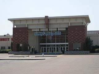
The Raleigh Springs Mall was an enclosed shopping mall serving the city of Memphis, Tennessee, United States. The site is located on the north side of Memphis, on Austin Peay Hwy. just north of Interstate 40. It began construction in 1969 and opened two years later on August 11, 1971 as one of the city's first two shopping malls, owned and managed by the Edward J. DeBartolo corporation. The Raleigh Springs Mall originally featured about seventy stores and later featured a twelve-screen multiplex, with four anchor stores, formerly occupied by Sears, JCPenney, Goldsmith's and Dillard's. The theater closed in December 2011, Sears closed in April 2011, and the other three anchors closed in 2003. The mall property was won by the City of Memphis in multiple court challenges in favor to build a city Civic Center. The mall closed with 3 business still operating, City Trends, World Diamond Center, and a church.

<span class="mw-page-title-main">Binghampton, Memphis</span> Human settlement in Memphis, Tennessee, U.S.

Binghampton is a neighborhood on an edge of Midtown in Memphis, Tennessee. It is named after W. H. Bingham, an Irish immigrant, hotelier, planter, magistrate, politician, and entrepreneur who founded a town to the east and slightly north of the Memphis city limits in 1893.

<span class="mw-page-title-main">Tennessee State Route 204</span> State highway in Tennessee, United States

State Route 204 is a state highway in Shelby County, Tennessee, United States, that connects Memphis and Millington.

The following is a timeline of the history of the city of Memphis, Tennessee, US.

<span class="mw-page-title-main">Northaven, Tennessee</span> Unincorporated community in Tennessee, United States

Northaven is an unincorporated community located in north Shelby County, Tennessee, United States, that is a part of the Memphis metropolitan area. Tennessee State Route 388 connects Northaven with Frayser and Shelby Forest. The Mississippi River Trail runs through the neighborhood.
<span class="mw-page-title-main">Raleigh Springs Civic Center</span> Civil center in Memphis, Tennessee, US

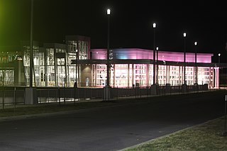
Raleigh Springs Civic Center is a 65 multi-acre civic center that is located in Memphis, Tennessee, United States. The property is owned by the Memphis City Council, and was constructed on the site of the former Raleigh Springs Mall.
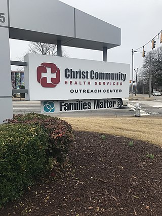
<span class="mw-page-title-main">Christ Community Health Services</span> Non-profit healthcare provider in Tennessee, U.S.

Christ Community Health Services, often referred to as Christ Community, or Christ Community Health, is a nonprofit, Christian, faith-based, healthcare provider with several locations across the Memphis, Tennessee area founded in 1995. Christ Community Health Services is officially classified as a federal qualified health center (FQHC). Christ Community Health Services aims at providing affordable healthcare to the homeless and low-income individuals in communities throughout Memphis. Dental care, physical care, and counselling are some of the several services provided by Christ Community. Shantelle Leatherwood is the current chief executive officer of Christ Community Health. In 2011, Christ Community Health Services was involved in a family planning controversy with nonprofit organization Planned Parenthood in which Christ Community replaced Planned Parenthood as the contract holder for free, family planning services in Memphis. Christ Community Health Services has also aided the Memphis community during the Covid-19 pandemic by providing free Covid-19 testing as well as Covid-19 vaccines.

References

  1. M. Winslow Chapman, I Remember Raleigh, 1977, Riverside Press, Memphis. Excerpts are displayed here with permission of the author's estate.
  2. "A Brief History of Shelby County". Shelby County, Tennessee. Retrieved 2020-09-12.
  3. Tennessee historical marker at James Road and Old Austin Peay.
  4. "History", City of Bartlett, Tennessee, retrieved 2019-06-28.
  5. Tennessee historical marker on Old Raleigh-Lagrange Road.
  6. Document Center View Annexation Ordinances ''Raleigh" December 31, 1972
  7. "Annexations and De-Annexations", Develop901, Memphis and Shelby County Division of Planning and Development, retrieved 2020-09-12; Ordinance 5137, Shelby County, Tennessee, November 2005.
  8. "Areas of Memphis under consideration for de-annexation", WMC-TV, January 9, 2018.
  9. "Nike Distribution Center expands in Memphis", WMC-TV, June 26, 2015.
  10. John Beifuss, "Curtain falls at Malco Raleigh Springs Cinema", Commercial Appeal, December 7, 2011, archived from the original on January 11, 2012.
  11. Ryan Poe, "Memphis buys last Raleigh mall property for development", Commercial Appeal, November 18, 2016.
  12. Brittani Moncrease, "COVID-19 slows down construction at the Raleigh Springs Civic Center", Localmemphis.com, July 1, 2020.
  13. "RALEIGH SPRINGS CIVIC CENTER".
  14. "Schools", Achievement School District, retrieved 2020-09-03.

Commons-logo.svg Media related to Raleigh, Memphis at Wikimedia Commons