Richards, Missouri | |
---|---|
Coordinates: 37°54′38″N94°33′26″W / 37.91056°N 94.55722°W Coordinates: 37°54′38″N94°33′26″W / 37.91056°N 94.55722°W | |
Country | United States |
State | Missouri |
County | Vernon |
Area | |
• Total | 0.27 sq mi (0.70 km2) |
• Land | 0.27 sq mi (0.69 km2) |
• Water | 0.00 sq mi (0.00 km2) |
Elevation | 843 ft (257 m) |
Population (2020) | |
• Total | 43 |
• Density | 160.45/sq mi (62.00/km2) |
Time zone | UTC-6 (Central (CST)) |
• Summer (DST) | UTC-5 (CDT) |
ZIP code | 64778 |
Area code | 417 |
FIPS code | 29-61364 [3] |
GNIS feature ID | 2396877 [2] |
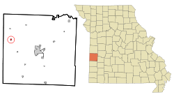
Richards is a village in northwest Vernon County, Missouri, United States. The population was 96 at the 2010 census.
Richards was laid out and platted in 1891 when the railroad was extended to that point. [4] The village's name honors Joseph Harvey Richards, a railroad official. [4] A post office has been in operation at Richards since 1890. [5]
Richards is located on Missouri Route H. Stotesbury is approximately four miles to the north via Missouri Route Z and Nevada is eleven miles to the southeast. The Missouri-Kansas border is three miles to the west. [6]
According to the United States Census Bureau, the village has a total area of 0.27 square miles (0.70 km2), all land. [7]
Census | Pop. | Note | %± |
---|---|---|---|
1900 | 198 | — | |
1910 | 303 | 53.0% | |
1920 | 359 | 18.5% | |
1930 | 255 | −29.0% | |
1940 | 246 | −3.5% | |
1950 | 190 | −22.8% | |
1960 | 133 | −30.0% | |
1970 | 105 | −21.1% | |
1980 | 117 | 11.4% | |
1990 | 106 | −9.4% | |
2000 | 95 | −10.4% | |
2010 | 96 | 1.1% | |
2020 | 43 | −55.2% | |
U.S. Decennial Census [8] |
As of the census [9] of 2010, there were 96 people, 36 households, and 27 families living in the village. The population density was 355.6 inhabitants per square mile (137.3/km2). There were 44 housing units at an average density of 163.0 per square mile (62.9/km2). The racial makeup of the village was 95.8% White and 4.2% from two or more races. Hispanic or Latino of any race were 1.0% of the population.
There were 36 households, of which 38.9% had children under the age of 18 living with them, 52.8% were married couples living together, 19.4% had a female householder with no husband present, 2.8% had a male householder with no wife present, and 25.0% were non-families. 22.2% of all households were made up of individuals, and 8.4% had someone living alone who was 65 years of age or older. The average household size was 2.67 and the average family size was 3.11.
The median age in the village was 32 years. 29.2% of residents were under the age of 18; 8.5% were between the ages of 18 and 24; 22.9% were from 25 to 44; 22% were from 45 to 64; and 17.7% were 65 years of age or older. The gender makeup of the village was 52.1% male and 47.9% female.
As of the census [3] of 2000, there were 95 people, 37 households, and 25 families living in the town. The population density was 347.1 inhabitants per square mile (134.0/km2). There were 42 housing units at an average density of 153.5 per square mile (59.3/km2). The racial makeup of the town was 96.84% White, and 3.16% from two or more races.
There were 37 households, out of which 37.8% had children under the age of 18 living with them, 54.1% were married couples living together, 2.7% had a female householder with no husband present, and 32.4% were non-families. 29.7% of all households were made up of individuals, and 18.9% had someone living alone who was 65 years of age or older. The average household size was 2.57 and the average family size was 3.16.
In the town the population was spread out, with 29.5% under the age of 18, 6.3% from 18 to 24, 24.2% from 25 to 44, 23.2% from 45 to 64, and 16.8% who were 65 years of age or older. The median age was 38 years. For every 100 females, there were 102.1 males. For every 100 females age 18 and over, there were 109.4 males.
The median income for a household in the town was $35,938, and the median income for a family was $44,583. Males had a median income of $26,875 versus $25,833 for females. The per capita income for the town was $16,489. There were 9.7% of families and 12.4% of the population living below the poverty line, including 5.9% of under eighteens and none of those over 64.
Watson is a village in Nishnabotna Township, Atchison County, Missouri, United States. The population was 61 at the 2020 census. It is the westernmost settlement in the state of Missouri, about 120 miles northwest of Kansas City.
Rushville is a village in western Buchanan County, Missouri, United States. The population was 303 at the 2010 census. It is part of the St. Joseph, MO–KS Metropolitan Statistical Area.
Gunn City is a village in Cass County, Missouri, United States. The population was 118 at the 2010 census. It is part of the Kansas City metropolitan area.
Jerico Springs is a village in Cedar County, Missouri, United States. The population was 160 at the 2020 census.
Preston is a village in Hickory County, Missouri, United States. The population was 157 at the 2020 census.
Brumley is a town in Miller County, Missouri, United States. The population was 91 at the 2010 census.
Syracuse is a city in Morgan County, Missouri, United States. The population was 172 at the 2010 census. In the middle of the 19th century, the city was the western terminus of the Pacific Railway that reached 108 miles from St. Louis. The current mayor of Syracuse is Duane A. Doyle.
Grand Falls Plaza is a village in Newton County, Missouri, United States. The population was 114 at the 2010 census, at which time it was a town. It is part of the Joplin, Missouri Metropolitan Statistical Area.
Newtonia is a village in Newton County, Missouri, United States. The population was 199 at the 2010 census. It is part of the Joplin, Missouri Metropolitan Statistical Area. Newtonia was the site of the Battles of Newtonia during the American Civil War. The village contains some Antebellum houses, such as the Mathew H. Ritchey House, as well as a cemetery for Civil War dead. It is a farming community and is immediately adjacent to Stark City, Missouri.
Ashburn is an town in Pike County, Missouri, United States. The population was 52 at the 2010 census.
Blodgett is a village in Scott County, Missouri, United States. The population was 213 at the 2010 census.
Grantwood Village is a town in St. Louis County, Missouri, United States. The population was 863 at the 2010 census.
Norwood Court is a village in St. Louis County, Missouri, United States. The population was 959 at the 2010 census.
Harwood is a village in northeast Vernon County, Missouri, United States. The population was 47 at the 2010 census. It was estimated to be 45 by the City of Harwood as of July 1, 2019.
Moundville is a village in southwest Vernon County, Missouri, United States. The population was 124 at the 2010 census.
Stotesbury is a village in northwest Vernon County, Missouri, United States. The population was 18 at the 2010 census.
Ritchey is a village in Newton County, Missouri, United States. The population was 82 at the 2010 census. It is part of the Joplin, Missouri Metropolitan Statistical Area.
Raymondville is a town in Texas County, Missouri, United States. The population was 345 at the 2020 census.
Ionia is a village in northern Benton and southern Pettis counties in the U.S. state of Missouri. The population was 88 at the 2010 census.
Argyle is a town in Maries and Osage counties in the U.S. state of Missouri. The population was 144 at the 2020 census.