Jackson is a city in and the county seat of Amador County, California. The population was 4,651 at the 2010 census, up from 3,989 at the 2000 census. The city is accessible by both State Route 49 and State Route 88.

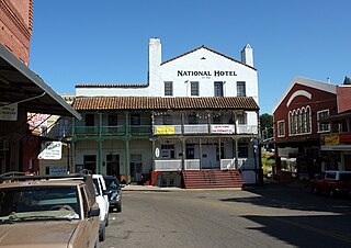
Sutter Creek is a city in Amador County, California, United States. The population was 2,501 at the 2010 census, up from 2,303 at the 2000 census. It is accessible via State Route 49.

Alum Rock Park, in the Alum Rock district of San Jose, California, is California's oldest municipal park, established in 1872 but serving as public land since the pueblo was established in 1777. Located in a valley in the Diablo Range foothills on the east side of San Jose, the 720 acre (2.9 km2) park offers 13 miles (21 km) of trails, varying from fairly level along Penitencia Creek to sharp switchbacks climbing to the ridges to the South Rim Trail and the North Rim Trail. The narrow floor of the valley includes a visitor center, a small museum/animal rehab facility, picnic areas, playgrounds, lawns, sand volleyball pits, mineral springs, lush plant life, woodlands, creek play opportunities, and occasional group camping.

The Tule River, also called Rio de San Pedro or Rio San Pedro, is a 71.4-mile (114.9 km) river in Tulare County in the U.S. state of California. The river originates in the Sierra Nevada east of Porterville and consists of three forks, North, Middle and South. The North Fork and Middle Fork meet above Springville. The South Fork meets the others at Lake Success. Downstream of Success Dam, the river flows west through Porterville. The river used to empty into Tulare Lake, but its waters have been diverted for irrigation. However, the river does reach Tulare Lake during floods. Tulare Lake is the terminal sink of an endorheic basin that historically also received the Kaweah and Kern Rivers as well as southern distributaries of the Kings.

Carson Hill is a ghost town in Calaveras County, California. It sits at an elevation of 1447 feet above sea level and is located at 38°01′42″N120°30′24″W, about 4 miles (6.4 km) south-southeast of Angels Camp. It was one of the most productive mining camps in the state, with nearly $26 million in gold and quartz found in the area. Carson Hill is registered as California Historical Landmark #274. The town was served by the Sierra Railway's branchline to Angels Camp until 1935.

Berry Creek is a census-designated place about 25 miles (40 km) northeast of Oroville, California in hilly terrain at 2,000 feet (610 m) above mean sea level. The community is located along the Oroville-Quincy Highway on the shore of Madrone Lake. The community is home to Berry Creek Elementary School (K-8), 2 small mountain churches, 1 mini mart w/ gas, 1 small community park. Berry Creek is home to the annual Berry Festival which is held during August.
Pulga is an unincorporated community in Butte County, California. It is located along the west slope of the Feather River canyon, at an elevation of 1,398 feet (426 m). A variant name for the community is Big Bar. Other nearby communities include Mayaro, Poe and Parkhill. The town hosts a Caltrans highway maintenance station along State Route 70 (SR70). The place is at the mouth of the Flea Valley Creek, which gives rise to the toponym.
Rumsey is an unincorporated community in Yolo County, California. It is located 18 miles (29 km) northwest of Esparto, in the Capay Valley, in the northwestern part of the county. Rumsey's ZIP Code is 95679 and its area code 530. It lies at an elevation of 420 feet.

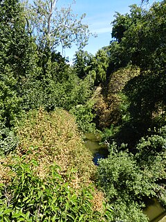
San Mateo Creek is a perennial stream whose watershed includes Crystal Springs Reservoir, for which it is the only natural outlet after passing Crystal Springs Dam.

Frenchman Lake(a.k.a. Frenchmen's Reservoir and several derivations thereof) is located in Southeastern Plumas County, California and was created by the damming of Little Last Chance Creek. It was named after Frenchman Creek and Claude Francois Seltier, a French immigrant who settled in the area in 1858.
Rock Creek is a former settlement in Butte County, California, United States. It was located 7 miles (11 km) northwest of Chico. A post office operated in Rock Creek from 1858 to 1871. Rock Creek was an amalgamation of two smaller camps, Big Rock Creek and Little Rock Creek.
Frenchtown is an unincorporated community in El Dorado County, California. It is located on French Creek 2 miles (3.2 km) south-southeast of Shingle Springs, at an elevation of 1165 feet.
Balch Camp is an unincorporated community in Fresno County, California. It is located near the confluence of the North Fork of the Kings River and Dinkey Creek 38 miles (61 km) east-northeast of Fresno, at an elevation of 1273 feet.
Dinkey Creek is an unincorporated community in Fresno County, California. It is located on Dinkey Creek, at an elevation of 5987 feet.
Goodmill is an unincorporated community in Fresno County, California. It is located on Mill Flat Creek 10 miles (16 km) south-southeast of Balch Camp, at an elevation of 3,717 ft (1,133 m).

Camp Grant is a ghost town in Humboldt County located on the South Fork Eel River 2 miles (3.2 km) northeast of Weott and 3 miles (4.8 km) east of Dyerville. It was originally settled by Northern Sinkyone people, followed by a Union Army camp and later a logging and railroad support settlement for the construction of the Northwestern Pacific Railroad.
San Lorenzo Creek is a 10.7-mile-long (17.2 km) year-round natural stream flowing through Hayward, California, into San Francisco Bay at the Hayward Regional Shoreline.
Rock Creek is an unincorporated community in Plumas County, California. It lies at an elevation of 1863 feet. Rock Creek is located on the Western Pacific Railroad, 2 miles (3.2 km) west-southwest of Storrie.

Anderson Canyon in the Big Sur region of California was named after pioneering homesteaders James and Peter Andersen who were the first European settlers of the area. The canyon, Anderson Creek, and Anderson Peak are south of McWay Falls and within the boundaries of Julia Pfeiffer Burns State Park.

Antelope Dam or Antelope Valley Dam is a dam in Plumas County, California, part of the California State Water Project.


