
U.S. Route 49 is a north–south United States highway. The highway's northern terminus is in Piggott, Arkansas, at an intersection with US Route 62/Highway 1/Highway 139 (US 62/AR 1/AR 139). Its southern terminus is in Gulfport, Mississippi, at an intersection with U.S. Route 90. US 49 is approximately 516 miles (830 km) in length.

U.S. Route 160 (US 160) is a 1,465-mile-long (2,358 km) east–west United States Numbered Highway in the Midwestern and Western United States. The western terminus of the route is at US 89 five miles (8.0 km) west of Tuba City, Arizona. The eastern terminus is at US 67 and Missouri 158 southwest of Poplar Bluff, Missouri. Its route, if not its number, was made famous in song in 1975, as the road from Wolf Creek Pass to Pagosa Springs, Colorado in C.W. McCall's country music song "Wolf Creek Pass".

U.S. Route 70 or U.S. Highway 70 is an east–west United States highway that runs for 2,381 miles (3,832 km) from eastern North Carolina to east-central Arizona. It is a major east–west highway of the Southeastern, Southern and Southwestern United States. Established as one of the original highways of 1926, it originally ran only to Holbrook, Arizona, then was extended in 1934 as a coast to coast route, with the current eastern terminus near the Atlantic Ocean in Atlantic, North Carolina, and the former western terminus near the Pacific Ocean in Los Angeles, California. The current western terminus was then truncated to US 60 / SR 77 in Globe, Arizona. Before the completion of the Interstate system, U.S. Highway 70 was sometimes referred to as the "Broadway of America", due to its status as one of the main east–west thoroughfares in the nation. It was also promoted as the "Treasure Trail" by the U.S. Highway 70 Association as of 1951.

U.S. Route 89 is a north–south United States Numbered Highway with two sections, and one former section. The southern section runs for 848 miles (1,365 km) from Flagstaff, Arizona, to the southern entrance of Yellowstone National Park. The northern section runs for 404 miles (650 km) from the northern entrance of Yellowstone National Park in Montana, ending at the Canadian border. Unnumbered roads through Yellowstone connect the two sections. Before 1992, US 89 was a Canada–Mexico, border-to-border highway that ended at Nogales, Arizona, on its southern end.

New Hampshire Route 10 is a 122.25-mile-long (196.74 km) north–south state highway in western New Hampshire, United States. Its southern terminus is in Winchester at the Massachusetts state line, where it continues south as Massachusetts Route 10. Administratively, the northern terminus is at a junction with U.S. Route 302 in Haverhill.
New York State Route 52 (NY 52) is a 108.72-mile-long (174.97 km) state highway in the southeastern part of the state. It generally runs from west to east through five counties, beginning at the Pennsylvania state line in the Delaware River near Narrowsburg, crossing the Hudson River on the Newburgh–Beacon Bridge, and ending in Carmel. NY 52 and NY 55, both major east–west routes of the Mid-Hudson Region, run parallel to each other, intersecting in downtown Liberty.

Vermont Route 15 (VT 15) is a 68.957-mile-long (110.976 km) east–west state highway in northern Vermont, United States. Its western terminus is at U.S. Route 2 (US 2) and US 7 in Winooski and its eastern terminus is at US 2 in Danville. It is known as the Grand Army of the Republic Highway, a designation shared nationally with U.S. Route 6.

Highway 1 is the main highway in Israel, connecting Tel Aviv and Jerusalem, and continuing eastwards to the Jordan Valley in the West Bank.

U.S. Route 20 (US 20) is a part of the United States Numbered Highway System that runs from Newport, Oregon, to Boston, Massachusetts. In the U.S. state of New York, US 20 extends 372.32 miles (599.19 km) from the Pennsylvania state line at Ripley to the Massachusetts state line in the Berkshires. US 20 is the longest surface road in New York. It runs near the Lake Erie shore from Ripley to Buffalo and passes through the southern suburbs of Buffalo, the Finger Lakes, the glacial moraines of Central New York, and the city of Albany before crossing into Massachusetts. US 20 connects to all three major north–south Interstate Highways in Upstate New York: Interstate 390 (I-390) near Avon, I-81 south of Syracuse, and I-87 in Albany by way of Fuller Road Alternate.

The N12 is a national route in South Africa which runs from George through Beaufort West, Kimberley, Klerksdorp and Johannesburg to eMalahleni.

Interstate 15 (I-15) runs north–south in the U.S. state of Utah through the southwestern and central portions of the state, passing through most of the state's population centers, including St. George and those comprising the Wasatch Front: Provo–Orem, Salt Lake City, and Ogden–Clearfield. It is Utah's primary and only north–south interstate highway, as the vast majority of the state's population lives along its corridor; the Logan metropolitan area is the state's only Metropolitan Statistical Area through which I-15 does not pass. In 1998, the Utah State Legislature designated Utah's entire portion of the road as the Veterans Memorial Highway.
U.S. Route 89 in the U.S. state of Utah is a north-south United States Highway spanning more than 502 miles (807.891 km) through the central part of the state, making it the longest road in Utah. Between Provo and Brigham City, US-89 serves as a local road, paralleling Interstate 15, but the portions from Arizona north to Provo and Brigham City northeast to Wyoming serve separate corridors. The former provides access to several national parks and Arizona, and the latter connects I-15 with Logan, the state's only Metropolitan Statistical Area not on the Interstate.

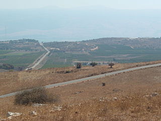
Highway 85 is an east-west highway in Northern Israel. It is one of the most important roads through the Galilee, connecting western and eastern Galilee. The road begins in Akko on the west coast of Israel and ends in the east just north of Lake Kinneret.
New Mexico Road 599 (NM 599) is a 14.019-mile (22.561 km) state highway in northern Santa Fe County, New Mexico, United States. The divided highway expressway is also known as the Veterans Memorial Highway and the Santa Fe Relief Route; and both names are used on road signs. The latter name alludes to the highway's original purpose of bypassing the urbanized areas of Santa Fe and thereby relieving it from shipments of hazardous waste. It passes through less densely developed terrain in and around the northwestern boundary of the municipality. Speed limits on it range from 45 to 65 miles per hour.

Highway 67 is a highway, 76 km in length, running through the Western Galilee region in the Northern District of Israel. It connects the Mount Carmel region east of Zikhron Ya'akov to the Lower Galilee, Kiryat Ata, and Shlomi near Israel's border with Lebanon. The highway runs concurrently with Highway 6 for 2.5 km between Ein Tut Interchange and Elyakim Interchange and for 4 km between Tel Qashish and Ha'Amakim Interchange, then with Highway 75 for 4 km between Ha'Amakim Interchange and Yagur Junction, then again with Highway 6 for 5 km between Givot Alonim Interchange and Somekh Interchange.
Route 899 is an east-west regional highway in the Upper Galilee in northern Israel. For almost its entire length of 63 km, it proceeds parallel to the nearby border between Israel and Lebanon. In Israel, Route 899 is commonly known as the "northern route".
Route 866 is a north-south regional highway in northern Israel. It begins at Hananya junction with Highway 85 in the south and ends at Meron junction with Highway 89 in the north.
There are 28 routes assigned to the "A" zone of the California Route Marker Program, which designates county routes in California. The "A" zone includes county highways in Lassen, Plumas, Shasta, Siskiyou, and Tehama counties.
There are 21 routes assigned to the "G" zone of the California Route Marker Program, which designates county routes in California. The "G" zone includes county highways in Monterey, San Benito, San Luis Obispo, Santa Clara, and Santa Cruz counties.
There are 34 routes assigned to the "S" zone of the California Route Marker Program, which designates county routes in California. The "S" zone includes county highways in Imperial, Orange, Riverside, San Diego, and Santa Barbara counties.

