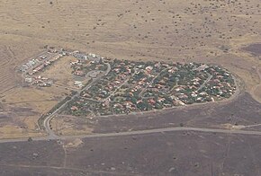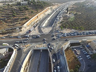
Highway 50, officially called Begin Boulevard and also referred to as Menachem Begin Expressway or Begin Highway, is a north-south urban freeway, through western Jerusalem, named after Israel's sixth Prime Minister, Menachem Begin. Local Jerusalemites simply refer to it as 'Begin'. It enters Area C of the West Bank on the north end and East Jerusalem on both ends.

Highway 3 is a highway in Israel. It begins at Highway 4 on the outskirts of Ashkelon, running east-northeast, passing through Kiryat Malakhi and Latrun, and ending just short of Modi'in.

Highway 13 is an expressway in southern Israel. It is 12 km long. It begins in the north at Tzihor junction with Highway 40 and ends in the south at Menuha junction with Highway 90. Thus, it connects between Highway 40, which runs north to Mizpe Ramon and Beersheba via the central Negev, and Highway 90, which traverses the Arava region on Israel's eastern border.

Highway 25 is a rural highway in southern Israel. It begins northwest of Nahal Oz at the border with the Gaza Strip, and it passes through Netivot, Beersheba and Dimona. It continues southeast toward Arava Junction, where it meets Highway 90. Its length is estimated by the Israeli Department of Transportation as 172 km and 780 meters.

Highway 38 is an arterial road in the low plains of Judea in Israel. It serves as the main access route to Beit Shemesh and as a main north–south route in the region. Along the route are many nature preserves and archeological sites.
Highway 41 is an arterial road in south-central Israel. It connects Highway 4 and Highway 7 to the Port of Ashdod. The designation "41" also applied to the continuation of the road eastward to Gedera until that section of the road was upgraded and renamed "7".

Highway 99 is an east-west highway in the Finger of the Galilee in far northeast of Israel and the Golan Heights. It begins in the west at HaMetzodot junction in Kiryat Shmona, and it ends in the east at the Druze city of Mas'ade. After it reaches the Banias tributary, the road follows the path of Sa'ar River. Highway 99 is 24 km long.

Highway 91 is an east-west highway in northern Israel and the Golan Heights. It extends through the Jordan Rift Valley and the central Golan Heights. It begins in the west at Mahanayim junction with Highway 90, and it ends in the east at Zivan junction near the Israeli settlement Ein Zivan, where it meets Highway 98. The road is 28 km long.

Highway 71 is an east-west highway that passes through the eastern Jezreel Valley and the Beit She'an Valley, below the north slopes of the Gilboa mountains, in northern Israel. The road follows a path parallel to the Harod Creek in the Harod Valley and to the Jezreel Valley railway. It is 35 kilometres (22 mi) long and leads from Afula in the west, via Beit She'an, to the Jordan River Border Crossing in the east. The Navot interchange located approximately 10 km southeast of Afula provides a shortcut via Route 675 through the Ta'anakh region from Highway 71 and Beit She'an to Highway 65 and central Israel.

Highway 70 is a highway, 44 km in length, running through the Western Galilee region in the Northern District of Israel. It connects the Lower Galilee to Kiryat Ata and Shlomi near Israel's border with Lebanon.
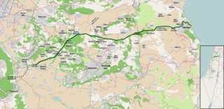
Highway 77 is an east-west highway in northern Israel. It crosses the Lower Galilee in the region of the Beit Netofa Valley. The road leads from the Tel Qashish Interchange nearby Yokneam Illit to Tiberias. It is 48km long. Its western section, from the Tel Qashish Interchange to the Golani Interchange is a freeway.
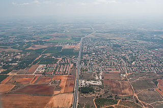
Highway 57 is an east–west highway through central Israel and the West Bank. In the past, it was an uninterrupted road from Netanya, a city on the Mediterranean coast in the west, to Damia Bridge across the Jordan River in the east. The road existed at full length from the time of the British Mandate, and parts of it are even older. Today, the road is separated into three unconnected parts: the first from Netanya to Nitzanei Oz interchange at Highway 6, the second from there to an Israel Defense Forces checkpoint in Beka'ot in the northeastern West Bank, and the third from there until Damia Bridge. The middle portion of the road between Nitzanei Oz and Beka'ot passes through Tulkarm and Nablus. Most of it is located in Area A and Area B controlled by the Palestinian Authority. Various traffic restrictions exist in these areas.
Route 264 is a north-south regional highway in southern Israel. It connects Highway 25 at HaNasi junction with Highway 40 at Kama junction. It is 14.5km long.
Route 959 is a regional east-west highway in the Golan Heights. It proceeds from Gonen junction in the west until Bar'on Junction in the east.
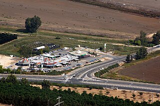
Route 977 is an east-west regional highway in the Israeli-occupied portion of the Golan Heights, stretching from the Goma junction to the Lehavot HaBashan junction.

Route 864 is a north-south regional highway in the Galilee in northern Israel. It begins in the south at Rameh junction with Highway 85 and ends in the north at Hosen junction with Highway 89.

Route 411, is the designation of a regional route in the Shephelah region in Israel running southeasterly consolidating previous local roads and new construction. The western section begins at Highway 42 near Kfar Gevirol in western Rehovot and continues just past Route 410. The central section, completed in June 2014, continues to the entrance of Kvutzat Shiller. The eastern section begins just short of Highway 40 south of Rehovot and terminates at Highway 3 towards Jerusalem, bypassing the towns of Kiryat Ekron and Mazkeret Batya.

Route 386 is a road in Israel that runs from Tzur Hadassah to Jerusalem.

Highway 45 is the official designation of a 3.3 km stretch of road forming a continuous connection between Route 443 from the Tel Aviv Metropolitan Area and Highway 50 to central Jerusalem and a 1.4 km spur serving the Atarot Industrial Park.

Highway 333, also known as Ben-Gurion Boulevard, is a highway in West Jerusalem. It is the main entrance to the city through Givat Shaul. In the past, the road was part of Highway 1 until the opening of Yitzhak Shamir Road and the diverting of Highway 1 onto it. However, it is often colloquially still referred to as part of the Jerusalem–Tel Aviv Route.
