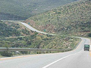
Allon Road is the name given by Israel to Routes 458, 508, and 578 in the West Bank, running roughly south–north along the eastern watershed of the Judaean and Samarian Hills, between Highway 1 near Kfar Adumim east of Jerusalem and Highway 90 at Mehola in the central Jordan Valley.

Highway 13 is an expressway in southern Israel. It is 12 km long. It begins in the north at Tzihor junction with Highway 40 and ends in the south at Menuha junction with Highway 90. Thus, it connects between Highway 40, which runs north to Mizpe Ramon and Beersheba via the central Negev, and Highway 90, which traverses the Arava region on Israel's eastern border.

Highway 38 is an arterial road in the low plains of Judea in Israel. It serves as the main access route to Beit Shemesh and as a main north–south route in the region. Along the route are many nature preserves and archeological sites.
Highway 41 is an arterial road in south-central Israel. It connects Highway 4 and Highway 7 to the Port of Ashdod. The designation "41" also applied to the continuation of the road eastward to Gedera until that section of the road was upgraded and renamed "7".

Highway 99 is an east-west highway in the Finger of the Galilee in far northeast of Israel and the Golan Heights. It begins in the west at HaMetzodot junction in Kiryat Shmona, and it ends in the east at the Druze city of Mas'ade. After it reaches the Banias tributary, the road follows the path of Sa'ar River. Highway 99 is 24 km long.

Highway 98 is the primary north-south highway on the Israeli side of the Golan Heights. It is shaped like an archer's bow, and it runs parallel to the ceasefire line with Syria. The route runs from Tzemah junction south of the Kinneret, first through the Yarmuk valley, then it rises up a steep slope into the Golan Heights and crosses it until it reaches the lowest cable-car station on Mount Hermon. There it meets Route 999. Highway 98 is steep compared to the other highways in Israel, rising from 210 meters below sea level at the Kinneret to 1600 meters above sea level on the Hermon.

Highway 92 is a north-south highway in northeastern Israel. It follows the eastern edge of the Kinneret from Ma'agan junction in the south at Highway 98 to Yehudiya junction in the north at Highway 87. It is 26.15 km long.

Highway 87 is a 35 km long east-west highway in northern Israel and the Israeli-occupied Golan Heights. It extends from the northern shores of Lake Kinneret through the central Golan Heights. It begins in the west at Kfar Nahum/Capernaum and ends in the east at Bashan Junction.

The Petroleum Road or Tapline Road is a 47 km (29 mi) long, privately owned north-south asphalt road in the Golan Heights. The name Petroleum Road derives from the now defunct oil pipeline of the Trans-Arabian Pipeline Company, which the road runs adjacent to. It begins near Mount Peres on the east edge of the central Golan and ends in the northern Golan near the Israeli-occupied Golan-Lebanese frontier, nearby Ghajar.

Highway 66 is a north–south highway in the Jezreel Valley in northern Israel.

Highway 71 is an east-west highway that passes through the eastern Jezreel Valley and the Beit She'an Valley, below the north slopes of the Gilboa mountains, in northern Israel. The road follows a path parallel to the Harod Creek in the Harod Valley and to the Jezreel Valley railway. It is 35 kilometres (22 mi) long and leads from Afula in the west, via Beit She'an, to the Jordan River Border Crossing in the east. The Navot interchange located approximately 10 km southeast of Afula provides a shortcut via Route 675 through the Ta'anakh region from Highway 71 and Beit She'an to Highway 65 and central Israel.
Highway 77 is an east-west highway in northern Israel. It crosses the Lower Galilee in the region of the Beit Netofa Valley. The road leads from the Tel Qashish Interchange nearby Yokneam Illit to Tiberias. It is 48km long. Its western section, from the Tel Qashish Interchange to the Golani Interchange is a freeway.

Route 171 is a regional east-west road in southern Israel. It is the only east-west road in the Negev Mountains. It is 33 km long. It goes from Mount Harif junction on Highway 10 adjacent to Israel's border with Egypt to HaRuhot junction with Highway 40 about 5 km north of Mitzpe Ramon. The road passes mostly along the northern edge of Makhtesh Ramon and along the flowing path of Nahal Nitzana. In its eastern portion, it crosses HaRuhot Plain and passes by the Mitzpe Ramon Airport.

Route 999 is an east–west regional route in the northern Golan Heights, which Israel captured from Syria in the Six-Day War in 1967. Its access is restricted to Israeli army vehicles for almost its entire length. It begins from Si'on adjacent to the community Snir and the village Ghajar, where it splits north from Highway 99. About 2 km after this junction stands an IDF checkpoint. After the checkpoint, the road moves in a northeast direction and climbs steeply on Shebaa farms in parallel with the international border between Golan Heights and Lebanon. The road passes near the Shebaa farms while on its steep course in the Mount Hermon nature reserve. For the entire length of the road, IDF installations are standing, and it ends its length of 29 km with another IDF checkpoint near the lower cable car of Mount Hermon, where it meets Highway 98.
Route 978 is a regional north-south Israeli highway in the Golan Heights.
Route 959 is a regional east-west highway in the Golan Heights. It proceeds from Gonen junction in the west until Bar'on Junction in the east.

Route 918 is a north-south regional highway in the Israeli-occupied portion of the Golan Heights.
Route 977 is an east-west regional highway in the Israeli-occupied portion of the Golan Heights, stretching from the Goma junction to the Lehavot HaBashan junction.

Route 386 is a road in Israel that runs from Tzur Hadassah to Jerusalem.

Highway 45 is the official designation of a 3.3 km stretch of road forming a continuous connection between Route 443 from the Tel Aviv Metropolitan Area and Highway 50 to central Jerusalem and a 1.4 km spur serving the Atarot Industrial Park.


