Allon Road is the name given by Israel to Routes 458, 508, and 578 in the West Bank, running roughly south–north along the eastern watershed of the Judaean and Samarian Hills, between Highway 1 near Kfar Adumim east of Jerusalem and Highway 90 at Mehola in the central Jordan Valley.

Highway 10 is a road in the South District of Israel. It is one of the longest routes in Israel, extending for nearly the entire border of Israel with Egypt from the Gaza Strip in the north to Sayarim junction in the south. Under a military security advisory, its entire 113-mile length is almost permanently off-limits to civilian traffic.

Highway 13 is an expressway in southern Israel. It is 12 km long. It begins in the north at Tzihor junction with Highway 40 and ends in the south at Menuha junction with Highway 90. Thus, it connects between Highway 40, which runs north to Mizpe Ramon and Beersheba via the central Negev, and Highway 90, which traverses the Arava region on Israel's eastern border.

Highway 98 is the primary north-south highway on the Israeli side of the Golan Heights. It is shaped like an archer's bow, and it runs parallel to the ceasefire line with Syria. The route runs from Tzemah junction south of the Kinneret, first through the Yarmuk valley, then it rises up a steep slope into the Golan Heights and crosses it until it reaches the lowest cable-car station on Mount Hermon. There it meets Route 999. Highway 98 is steep compared to the other highways in Israel, rising from 210 meters below sea level at the Kinneret to 1600 meters above sea level on the Hermon.

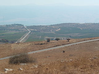
Highway 92 is a north-south highway in northeastern Israel. It follows the eastern edge of the Kinneret from Ma'agan junction in the south at Highway 98 to Yehudiya junction in the north at Highway 87. It is 26.15 km long.
Highway 42 is a north-south highway in central Israel. It leads from just south of Ashdod Interchange in the south to Gan Rave interchange in the north. The road is 19 km (12 mi) long.
Highway 9 is an east-west limited-access expressway in Israel that opened to traffic on July 24, 2014.

Highway 80 is a north-south highway in southern Israel, east of Beersheba. It connects Ar'arat an-Naqab in the south to Metzadot Yehuda in the north. It is 34 km long.
Route 264 is a north-south regional highway in southern Israel. It connects Highway 25 at HaNasi junction with Highway 40 at Kama junction. It is 14.5km long.

Route 999 is an east–west regional route in the northern Golan Heights, which Israel captured from Syria in the Six-Day War in 1967. Its access is restricted to Israeli army vehicles for almost its entire length. It begins from Si'on adjacent to the community Snir and the village Ghajar, where it splits north from Highway 99. About 2 km after this junction stands an IDF checkpoint. After the checkpoint, the road moves in a northeast direction and climbs steeply on Shebaa farms in parallel with the international border between Golan Heights and Lebanon. The road passes near the Shebaa farms while on its steep course in the Mount Hermon nature reserve. For the entire length of the road, IDF installations are standing, and it ends its length of 29 km with another IDF checkpoint near the lower cable car of Mount Hermon, where it meets Highway 98.
Route 978 is a regional north-south Israeli highway in the Golan Heights.
Route 959 is a regional east-west highway in the Golan Heights. It proceeds from Gonen junction in the west until Bar'on Junction in the east.

Route 918 is a north-south regional highway in the Israeli-occupied portion of the Golan Heights.
Route 899 is an east-west regional highway in the Upper Galilee in northern Israel. For almost its entire length of 63 km, it proceeds parallel to the nearby border between Israel and Lebanon. In Israel, Route 899 is commonly known as the "northern route".

Route 888 is a north-south regional highway in northern Israel. It begins at Beit Tzida junction with Highway 87 and ends at Beit HaMekhes junction with Highway 91.
Route 866 is a north-south regional highway in northern Israel. It begins at Hananya junction with Highway 85 in the south and ends at Meron junction with Highway 89 in the north.

Route 864 is a north-south regional highway in the Galilee in northern Israel. It begins in the south at Rameh junction with Highway 85 and ends in the north at Hosen junction with Highway 89.

Route 531, is a suburban freeway in the southern Sharon region of Israel, just north of the Tel Aviv Metropolitan Area. The highway begins at Highway 6 and terminates at the Ayalon Highway with an extension to the Coastal Highway.

Highway 45 is the official designation of a 3.3 km stretch of road forming a continuous connection between Route 443 from the Tel Aviv Metropolitan Area and Highway 50 to central Jerusalem and a 1.4 km spur serving the Atarot Industrial Park.

Route 505 is a regional Israeli highway in the West Bank.
