Highway 5 or the Trans-Samaria Highway, is one of Israel's main highways, connecting the Mediterranean coast immediately north of Tel Aviv with the central Sharon plain and eastwards to Ariel and other Israeli settlements in the northern West Bank.

Highway 2 is an Israeli highway located on the coastal plain of the Mediterranean Sea. It begins as a major arterial road within Tel Aviv, becoming a freeway as it exits the city northward, continuing to Haifa. North of Tel Aviv, the highway is also called The Coastal Highway.
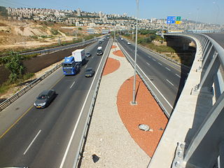
Highway 22, also known as the Bay Highway, is a suburban freeway in the Haifa metropolitan area connecting downtown Haifa with the city's northern exit to the Krayot. From there it continues northwards as a bypass of the Krayot, providing an alternative route to Highway 4.

Highway 3 is a highway in Israel. It begins at Highway 4 on the outskirts of Ashkelon, running east-northeast, passing through Kiryat Malakhi and Latrun, and ending just short of Modi'in.
Highway 7 is a highway in the South District of Israel from Ashdod to Yad Binyamin. It connects the Port of Ashdod with the Trans-Israel Highway.

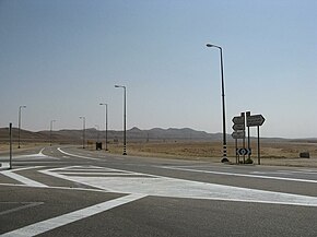
Highway 12 is a single carriageway road in the South District of Israel. It surrounds the mountains of Eilat from the north and west, and it connects Eilat to Highway 10 and Highway 40, which lead toward central Israel. Highway 10 continues north toward the Gaza Strip, whereas Highway 40 proceeds to Beersheba via Mizpe Ramon.

Highway 25 is a rural highway in southern Israel. It begins northwest of Nahal Oz at the border with the Gaza Strip, and it passes through Netivot, Beersheba and Dimona. It continues southeast toward Arava Junction, where it meets Highway 90. Its length is estimated by the Israeli Department of Transportation as 172 km and 780 meters.
Highway 34 is a highway in the South District of Israel that begins at Yad Mordechai in the north, passes through Sderot, and ends in the south at Netivot. Its length is 19.75 km.
Highway 41 is an arterial road in south-central Israel. It connects Highway 4 and Highway 7 to the Port of Ashdod. The designation "41" also applied to the continuation of the road eastward to Gedera until that section of the road was upgraded and renamed "7".

Highway 99 is an east-west highway in the Finger of the Galilee in far northeast of Israel and the Golan Heights. It begins in the west at HaMetzodot junction in Kiryat Shmona, and it ends in the east at the Druze city of Mas'ade. After it reaches the Banias tributary, the road follows the path of Sa'ar River. Highway 99 is 24 km long.

Highway 92 is a north-south highway in northeastern Israel. It follows the eastern edge of the Kinneret from Ma'agan junction in the south at Highway 98 to Yehudiya junction in the north at Highway 87. It is 24 km long.

Highway 91 is an east-west highway in northern Israel and the Golan Heights. It extends through the Jordan Rift Valley and the central Golan Heights. It begins in the west at Mahanayim junction with Highway 90, and it ends in the east at Zivan junction near the Israeli settlement Ein Zivan, where it meets Highway 98. The road is 28 km long.
Highway 42 is a north-south highway in central Israel. It leads from just south of Ashdod Interchange in the south to Gan Rave interchange in the north. The road is 19 km (12 mi) long.

Highway 87 is a 35 km long east-west highway in northern Israel and the Israeli-occupied Golan Heights. It extends from the northern shores of Lake Kinneret through the central Golan Heights. It begins in the west at Kfar Nahum/Capernaum and ends in the east at Bashan Junction.

Highway 80 is a north-south highway in southern Israel, east of Beersheba. It connects Ar'arat an-Naqab in the south to Metzadot Yehuda in the north. It is 34 km long.

Highway 71 is an east-west highway that passes through the eastern Jezreel Valley and the Beit She'an Valley, below the north slopes of the Gilboa mountains, in northern Israel. The road follows a path parallel to the Harod Creek in the Harod Valley and to the Jezreel Valley railway. It is 35 kilometres (22 mi) long and leads from Afula in the west, via Beit She'an, to the Jordan River Border Crossing in the east. The Navot interchange located approximately 10 km southeast of Afula provides a shortcut via Route 675 through the Ta'anakh region from Highway 71 and Beit She'an to Highway 65 and central Israel.
Route 264 is a north-south regional highway in southern Israel. It connects Highway 25 at HaNasi junction with Highway 40 at Kama junction. It is 14.5km long.

Route 888 is a north-south regional highway in northern Israel. It begins at Beit Tzida junction with Highway 87 and ends at Beit HaMekhes junction with Highway 91.

Route 864 is a north-south regional highway in the Galilee in northern Israel. It begins in the south at Rameh junction with Highway 85 and ends in the north at Hosen junction with Highway 89.

Highway 45 is the official designation of a 3.3 km stretch of road forming a continuous connection between Route 443 from the Tel Aviv Metropolitan Area and Highway 50 to central Jerusalem and a 1.4 km spur serving the Atarot Industrial Park.