
Ashdod is the sixth-largest city and the largest port in Israel accounting for 60% of the country's imported goods. Ashdod is located in the Southern District of the country, on the Mediterranean coast where it is situated between Tel Aviv to the north 32 kilometres away, and Ashkelon to the south 20 km (12 mi) away. Jerusalem is 53 km (33 mi) to the east. The city is also an important regional industrial center.
Highway 90 is the longest Israeli road, at about 480 kilometres (300 mi), and stretches from Metula and the northern border with Lebanon, along the western side of the Sea of Galilee, through the Jordan River Valley, along the western bank of the Dead Sea, through the Arabah valley, and until Eilat and the southern border with Egypt on the Red Sea. The central section of the road traverses the Israeli-occupied West Bank; while it passes near the city of Jericho, it runs through Area C and does not enter areas controlled by the Palestinian Authority.

Highway 1, is the main highway connecting Tel Aviv and Jerusalem in Israel and continuing eastwards to the Jordan Valley.
Beit Dagan is a town and local council in the Central District of Israel. it had a population of 7,285 in 2019. It was awarded local council status in 1958.

Highway 50, officially called Begin Boulevard and also referred to as Menachem Begin Expressway or Begin Highway, is an urban freeway in western Jerusalem named after Israel's sixth Prime Minister, Menachem Begin. Local Jerusalemites simply refer to it as 'Begin'. It continues into the Palestinian territories.

Highway 2 is an Israeli highway located on the coastal plain of the Mediterranean Sea. It begins as a major arterial road within Tel Aviv, becoming a freeway as it exits the city northward continuing to Haifa. North of Tel Aviv, the highway is also called The Coastal Highway
Highway 4 is an Israeli highway that runs along Israel's entire coastal plain of the Mediterranean Sea, from the Rosh HaNikra border crossing with Lebanon in the North to the Erez Border Crossing with the Gaza Strip in the South. The highway follows in part the route of the ancient Via Maris.
Highway 60 or is a south-north intercity road in Israel and the West Bank that stretches from Beersheba to Nazareth.
Be'er Tuvia Regional Council, is a regional council in the southern Coastal Plain region in Israel.
Highway 40 is a north-south intercity road in Israel. At 302 km long, it is the second longest highway in Israel, after Highway 90. The highway runs from Kfar Saba in the center of Israel to the Arabah in the south, serving as a main connection between central Israel and Be'er Sheva.

Highway 3 is a highway in Israel. It begins at Highway 4 on the outskirts of Ashkelon, running east-northeast, passing through Kiryat Malakhi and Latrun, and ending just short of Modi'in.
Highway 7 is a highway in the South District of Israel from Ashdod to Yesodot. It connects the Port of Ashdod with the Trans-Israel Highway.

Highway 38 is an arterial road in the low plains of Judea in Israel. It serves as the main access route to Beit Shemesh and as a main north–south route in the region. Along the route are many nature preserves and archeological sites.
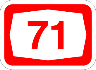
Highway 71 is an east-west highway that passes through the eastern Jezreel Valley and the Beit She'an Valley, below the north slopes of the Gilboa mountains, in northern Israel. The road follows a path parallel to the Harod Creek in the Harod Valley and to the Jezreel Valley railway. It is 35 kilometres (22 mi) long, and leads from Afula in the west, via Beit She'an, to the Jordan River Border Crossing in the east. The Navot interchange located approximately 10 km southeast of Afula provides a shortcut via Route 675 through the Ta'anakh region from Highway 71 and Beit She'an to Highway 65 and central Israel.

Route 411, is the designation of a regional route in the Shephelah region in Israel running southeasterly consolidating previous local roads and new construction. The western section begins at Highway 42 near Kfar Gevirol in western Rehovot and continues just past Route 410. The central section, completed in June 2014, continues to the entrance of Kvutzat Shiller. The eastern section begins just short of Highway 40 south of Rehovot and terminates at Highway 3 towards Jerusalem, bypassing the towns of Kiryat Ekron and Mazkeret Batya.

Highway-Route 412, is a regional road in the south-east of the Tel Aviv Metropolitan Area in Israel. The road connects Bilu Junction south of Rehovot, with Yehud Ma'arav Junction, running through Rehovot, Ness Ziona, Rishon LeZion and Beit Dagan and spanning a distance of approximately 22 km.
Route 505 is a regional highway in Israel and the occupied Palestinian West Bank.
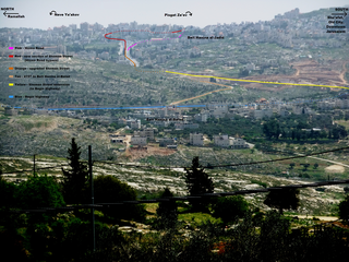
Jerusalem Road 20 is a combination of existing roads and new construction creating a continuous route between Jerusalem's Highway 50 and Pisgat Ze'ev via Beit Hanina. The number "20" is a designation used by the Jerusalem Municipality. Several segments of the road follow national road 4197. The cost of the project was NIS 180 million and was completed on 5 May 2013.
The 1961–62 Liga Gimel season saw 103 clubs competing in 9 regional divisions for promotion to Liga Bet.

