
Emek HaYarden Regional Council is a regional council comprising much of the western shore of the Sea of Galilee, the southern parts of its eastern shore, and the northern part of the Jordan Valley all the way to Beit She'an in the south.

Highway 10 is a road in the South District of Israel. It is one of the longest routes in Israel, extending for nearly the entire border of Israel with Egypt from the Gaza Strip in the north to Sayarim junction in the south. Under a military security advisory, its entire 113-mile length is almost permanently off-limits to civilian traffic.

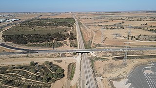
Highway 13 is an expressway in southern Israel. It is 12 km long. It begins in the north at Tzihor junction with Highway 40 and ends in the south at Menuha junction with Highway 90. Thus, it connects between Highway 40, which runs north to Mizpe Ramon and Beersheba via the central Negev, and Highway 90, which traverses the Arava region on Israel's eastern border.
Highway 31 is an inter-city highway in southern Israel. It begins at Lakiya Interchange with Highway 6 at Lakiya. It passes through Hura, Kuseife, Arad, and it terminates at Zohar Junction with Highway 90 south of Neve Zohar just west of the Dead Sea.

Highway 38 is an arterial road in the low plains of Judea in Israel. It serves as the main access route to Beit Shemesh and as a main north–south route in the region. Along the route are many nature preserves and archeological sites.

Highway 98 is the primary north-south highway on the Israeli side of the Golan Heights. It is shaped like an archer's bow, and it runs parallel to the ceasefire line with Syria. The route runs from Tzemah junction south of the Kinneret, first through the Yarmuk valley, then it rises up a steep slope into the Golan Heights and crosses it until it reaches the lowest cable-car station on Mount Hermon. There it meets Route 999. Highway 98 is steep compared to the other highways in Israel, rising from 210 meters below sea level at the Kinneret to 1600 meters above sea level on the Hermon.

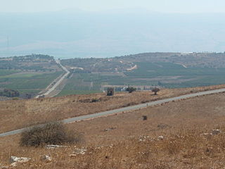
Highway 91 is an east-west highway in northern Israel and the Golan Heights. It extends through the Jordan Rift Valley and the central Golan Heights. It begins in the west at Mahanayim junction with Highway 90, and it ends in the east at Zivan junction near the Israeli settlement Ein Zivan, where it meets Highway 98. The road is 28 km long.

Highway 87 is a 35 km long east-west highway in northern Israel and the Israeli-occupied Golan Heights. It extends from the northern shores of Lake Kinneret through the central Golan Heights. It begins in the west at Kfar Nahum/Capernaum and ends in the east at Bashan Junction.

Highway 66 is a north–south highway in the Jezreel Valley in northern Israel.

Highway 71 is an east-west highway that passes through the eastern Jezreel Valley and the Beit She'an Valley, below the north slopes of the Gilboa mountains, in northern Israel. The road follows a path parallel to the Harod Creek in the Harod Valley and to the Jezreel Valley railway. It is 35 kilometres (22 mi) long and leads from Afula in the west, via Beit She'an, to the Jordan River Border Crossing in the east. The Navot interchange located approximately 10 km southeast of Afula provides a shortcut via Route 675 through the Ta'anakh region from Highway 71 and Beit She'an to Highway 65 and central Israel.

Highway 73 is a highway in the Jezreel Valley in northern Israel. It proceeds from the Nahalal junction in the west toward the Adashim junction in the east. It is 12 km long.
Route 899 is an east-west regional highway in the Upper Galilee in northern Israel. For almost its entire length of 63 km, it proceeds parallel to the nearby border between Israel and Lebanon. In Israel, Route 899 is commonly known as the "northern route".

Route 888 is a north-south regional highway in northern Israel. It begins at Beit Tzida junction with Highway 87 and ends at Beit HaMekhes junction with Highway 91.
Route 866 is a north-south regional highway in northern Israel. It begins at Hananya junction with Highway 85 in the south and ends at Meron junction with Highway 89 in the north.

Highway 45 is the official designation of a 3.3 km stretch of road forming a continuous connection between Route 443 from the Tel Aviv Metropolitan Area and Highway 50 to central Jerusalem and a 1.4 km spur serving the Atarot Industrial Park.

Route 505 is a regional Israeli highway in the Israeli-occupied West Bank.

Route 227 is a 34-kilometre (21 mi) road in the eastern Negev desert of Israel. It starts from an intersection with Route 206 in the northwest and ends in Ir Ovot in the southeast, intersecting with Highway 90. It has one at-grade intersection at 19 km. The original road was laid by British land surveyors in 1927. Prior to 1956, this was the primary route from Beersheba to Eilat.
Highway 989 is a regional route in the northern Golan, connecting Sa'ar on Highway 99 with Majdal Shams on Highway 98.
Route 204 is a regional road in the Negev, Israel. It starts at the Halukim junction with Highway 40, passes by the town of Yeruham and ends at the Dimona junction on Highway 25, near Dimona.

The Petroleum Road or Tapline Road is a transverse road that was paved in 1941 by the Iraq Petroleum Company, hence its name. Today the route is marked as Route 224 in the western part connecting the Negev junction to Yeruham, a short section on Route 204 in the middle, and Route 225 in the eastern part, from Yeruham to HaMakhtesh HaGadol. Added to these is a dirt road about two kilometres long inside HaMakhtesh HaGadol.


