Highway 1 is the main highway in Israel, connecting Tel Aviv and Jerusalem, and continuing eastwards to the Jordan Valley in the West Bank.

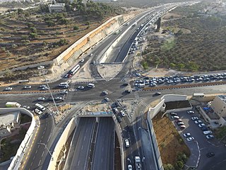
Highway 50, officially called Begin Boulevard and also referred to as Menachem Begin Expressway or Begin Highway, is a north-south urban freeway, through western Jerusalem, named after Israel's sixth Prime Minister, Menachem Begin. Local Jerusalemites simply refer to it as 'Begin'. It enters Area C of the West Bank on the north end and East Jerusalem on both ends.

Route 443 is also known as Ma'ale Beit Horon, following the ancient east-west trade route connecting the Via Maris and the Way of the Patriarchs. It is the main highway connecting Tel Aviv and Gush Dan with Jerusalem via Modi'in. While technically listed as a regional road, it is, for the most part, a divided, four-lane highway which utilizes some grade separation and interchanges, as well as major at-grade intersections, and thus is not classified as a motorway, even though there is a short motorway section on its western end, connecting it to westbound Highway 1.

Highway 60 or is a south–north intercity road in Israel and the Palestinian West Bank that stretches from Beersheba to Nazareth.

Transport in Jerusalem is characterized by a well-developed inter-city network and an emerging, developing intra-city network. Ben Gurion International Airport serves as Jerusalem's closest international airport. Egged bus lines and Israel Railways connect the city of Jerusalem to much of Israel, and a high-speed rail line to the airport and Tel Aviv is currently under construction, while the segment to Ben Gurion Airport is already in limited operation. Within the city, the roads, rather than the rails, are the primary mode of transportation.

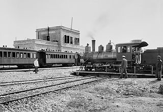
The Jaffa–Jerusalem railway is a railway that connected Jaffa and Jerusalem. The line was built in the Mutasarrifate of Jerusalem by the French company Société du Chemin de Fer Ottoman de Jaffa à Jérusalem et Prolongements and inaugurated in 1892. The project was headed by Joseph Navon, an Ottoman Jewish entrepreneur from Jerusalem, after previous attempts by the British-Jewish philanthropist Sir Moses Montefiore failed. While the first rail track in the Middle East was laid elsewhere, the line is considered to be the first Middle Eastern railway.

Highway 38 is an arterial road in the low plains of Judea in Israel. It serves as the main access route to Beit Shemesh and as a main north–south route in the region. Along the route are many nature preserves and archeological sites.

Highway 44 is an arterial road in central Israel. It connects Tel Aviv-Yafo and Holon to Ramla, Lod and the Shefela. It is numbered as a north–south road and follows a north-west to south-east path.

Highway 71 is an east-west highway that passes through the eastern Jezreel Valley and the Beit She'an Valley, below the north slopes of the Gilboa mountains, in northern Israel. The road follows a path parallel to the Harod Creek in the Harod Valley and to the Jezreel Valley railway. It is 35 kilometres (22 mi) long and leads from Afula in the west, via Beit She'an, to the Jordan River Border Crossing in the east. The Navot interchange located approximately 10 km southeast of Afula provides a shortcut via Route 675 through the Ta'anakh region from Highway 71 and Beit She'an to Highway 65 and central Israel.

The Tel Aviv–Jerusalem railway is a railway line in Israel connecting the cities of Tel Aviv and Jerusalem. The line serves as the main rail link between the two cities, complementing the old Jaffa–Jerusalem railway. As such, the railway is often referred to in Israel as the high-speed railway to Jerusalem to distinguish it from the older, longer and slower line. In spite of that name, the line is not high-speed under the definition used by the International Union of Railways: both its design speed of 200 km/h (125 mph) and its current operational speed of 160 km/h (99 mph) are below the 250 km/h (155 mph) threshold used by the UIC to define high-speed railways, and it is traversed by IR's regular rolling stock instead of the UIC requirement for specially-designed high-speed trains.

Route 411, is the designation of a regional route in the Shephelah region in Israel running southeasterly consolidating previous local roads and new construction. The western section begins at Highway 42 near Kfar Gevirol in western Rehovot and continues just past Route 410. The central section, completed in June 2014, continues to the entrance of Kvutzat Shiller. The eastern section begins just short of Highway 40 south of Rehovot and terminates at Highway 3 towards Jerusalem, bypassing the towns of Kiryat Ekron and Mazkeret Batya.

The Jerusalem corridor is an area between Jerusalem and the Shephelah in Israel. Its northern border is the old road to Jerusalem; its southern border, the Elah Valley; and its western border, Sha'ar HaGai/Bab el-Wad and the road to Beit Shemesh. The largest towns in the Jerusalem corridor are Beit Shemesh, Mevasseret Zion, Abu Ghosh, Tzur Hadassah and Kiryat Ye'arim.

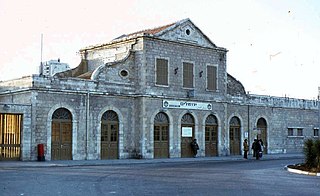
The Jerusalem railway station is a historic railway station in Jerusalem, located between Hebron Road and Bethlehem Road, near the German Colony. It is also known as the Jerusalem–Khan railway station after the caravanserai building, now the Khan Theater located across the road, to differentiate it from the Jerusalem–Malha and Jerusalem–Yitzhak Navon stations opened after its closure. It was part of the Jaffa–Jerusalem railway until its closure in 1998.

Route 386 is a road in Israel that runs from Tzur Hadassah to Jerusalem.

Route 417 is an intercity road in Israel and the West Bank that stretches from the west side of Jerusalem to Ma'ale Adumim and Highway 1 east to the Jordan Valley.

Highway 45 is the official designation of a 3.3 km stretch of road forming a continuous connection between Route 443 from the Tel Aviv Metropolitan Area and Highway 50 to central Jerusalem and a 1.4 km spur serving the Atarot Industrial Park.

Route 505 is a regional Israeli highway in the West Bank.

Highway 16 is a highway at the western entrance to Jerusalem providing direct access to the southern and central sections of the city from the west. Most of the road is located inside newly built tunnels. The project cost approximately 1.5 billion shekels, and was inaugurated a year ahead of schedule on August 31, 2022.

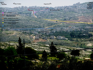
Jerusalem Road 20 is a combination of existing roads and new construction creating a continuous route between Jerusalem's Highway 50 and Pisgat Ze'ev via Beit Hanina. The number "20" is a designation used by the Jerusalem Municipality. Several segments of the road follow national road 4197. The cost of the project was NIS 180 million and was completed on 5 May 2013.


