Lake Winnipeg is a very large, relatively shallow 24,514-square-kilometre (9,465 sq mi) lake in North America, in the province of Manitoba, Canada. Its southern end is about 55 kilometres (34 mi) north of the city of Winnipeg. Lake Winnipeg is Canada's sixth-largest freshwater lake and the third-largest freshwater lake contained entirely within Canada, but it is relatively shallow excluding a narrow 36 m (118 ft) deep channel between the northern and southern basins. It is the eleventh-largest freshwater lake on Earth. The lake's east side has pristine boreal forests and rivers that were in 2018 inscribed as Pimachiowin Aki, a UNESCO World Heritage Site. The lake is 416 km (258 mi) from north to south, with remote sandy beaches, large limestone cliffs, and many bat caves in some areas. Manitoba Hydro uses the lake as one of the largest reservoirs in the world. There are many islands, most of them undeveloped.

The Saskatchewan River is a major river in Canada. It stretches about 550 kilometres (340 mi) from where it is formed by the joining of the North Saskatchewan River and South Saskatchewan River just east of Prince Albert, Saskatchewan, to Lake Winnipeg. It flows roughly eastward across Saskatchewan and Manitoba to empty into Lake Winnipeg. Through its tributaries the North Saskatchewan and South Saskatchewan, its watershed encompasses much of the prairie regions of Canada, stretching westward to the Rocky Mountains in Alberta and north-western Montana in the United States.

The South Saskatchewan River is a major river in the Canadian provinces of Alberta and Saskatchewan. The river begins at the confluence of the Bow and Oldman Rivers in southern Alberta and ends at the Saskatchewan River Forks in central Saskatchewan. The Saskatchewan River Forks is the confluence of the South and North Saskatchewan Rivers and is the beginning of the Saskatchewan River.

Alberta is one of the thirteen provinces and territories of Canada. Located in Western Canada, the province has an area of 661,190 km2 (255,290 sq mi) and is bounded to the south by the United States state of Montana along 49° north for 298 km (185 mi); to the east at 110° west by the province of Saskatchewan for 1,223 km (760 mi); and at 60° north the Northwest Territories for 644 km (400 mi). The southern half of the province borders British Columbia along the Continental Divide of the Americas on the peaks of the Rocky Mountains, while the northern half borders British Columbia along the 120th meridian west. Along with Saskatchewan it is one of only two landlocked provinces or territories.

The Athabasca Basin is a region in the Canadian Shield of northern Saskatchewan and Alberta, Canada. It is best known as the world's leading source of high-grade uranium and currently supplies about 20% of the world's uranium.

The Sturgeon River is a 260-kilometre-long (160 mi) river in central Alberta. It is a major tributary of the North Saskatchewan River. The river crosses Sturgeon County, which was named for this river. For much of its length, the Sturgeon is the northwestern-most major river in the Hudson Bay drainage basin, as the river runs close to and parallel to the Arctic Divide.

The North Saskatchewan River is a glacier-fed river that flows from the Canadian Rockies continental divide east to central Saskatchewan, where it joins with the South Saskatchewan River to make up the Saskatchewan River. Its water flows eventually into the Hudson Bay.
Battle River is a river in central Alberta and western Saskatchewan, Canada. It is a major tributary of the North Saskatchewan River.

Beaver River is a large river in east-central Alberta and central Saskatchewan, Canada. It flows east through Alberta and Saskatchewan and then turns sharply north to flow into Lac Île-à-la-Crosse on the Churchill River which flows into Hudson Bay.
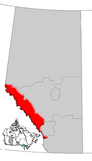
Alberta's Rockies comprise the Canadian Rocky Mountains in Alberta, Canada. On the southwestern part of the province along the British Columbia border, the region covers all but the south of Census Division 15.

The Rural Municipality of Britannia No. 502 is a rural municipality (RM) in the Canadian province of Saskatchewan within Census Division No. 17 and SARM Division No. 6. It is located in the west-central portion of the province.

Meadow Lake Provincial Park is a northern boreal forest provincial recreational park along the Waterhen and Cold Rivers in the Canadian province of Saskatchewan. The park was founded on 10 March 1959, is the largest provincial park in Saskatchewan, and encompasses over 25 lakes in an area of 1,600 km2 (620 sq mi). The park was named "Meadow Lake" after the city of Meadow Lake and Meadow Lake. The city and the lake are not in the park and are located about 40 kilometres (25 mi) south-east of the nearest park entrance, which is about 5 kilometres (3.1 mi) north of Dorintosh. The length of the park stretches about 113 kilometres (70 mi) from Cold Lake on the Saskatchewan / Alberta border in the west to the eastern shore of Waterhen Lake in the east.
Etters Beach is a resort village in the Canadian province of Saskatchewan within Census Division No. 11. It is on the west shore of Last Mountain Lake in the Rural Municipality of Big Arm No. 251.

Lac Île-à-la-Crosse is a Y-shaped lake in the north-central region of the Canadian province of Saskatchewan along the course of the Churchill River. At the centre of the "Y" is the town of Île-à-la-Crosse, the second oldest town in Saskatchewan. Situated at the confluence of the Churchill and Beaver Rivers, the lake was an important fur trading centre in the 18th and 19th centuries. The lake, and the community of Île-à-la-Crosse, are named after the game of Lacrosse as French voyageurs had witnessed local Indians playing the game on an island in the lake.
Pierce Lake is a lake in Meadow Lake Provincial Park in the Canadian Province of Saskatchewan. It is situated along the course of the Cold River in the boreal forest ecozone of Canada. Upstream along Cold River from Pierce Lake is Cold Lake and downstream are Lepine Lake and Lac des Îles. Pierce Lake and Cold River are in the Beaver River watershed, which is part of the Churchill River and Hudson Bay drainage basin.
Lower Fishing Lake is a lake in the east-central part of the Canadian province of Saskatchewan in Narrow Hills Provincial Park. It is situated in the Cub Hills and the boreal forest ecozone of Canada. The lake is accessed from Highway 920, which connects to Hanson Lake Road and Highway 120. The Fishing Lakes Fire of 1977 burned much of the region upstream and around the lake and now the area is now dominated by jack pine, which is a tree species that is well adapted fire burned forests.
Candle Lake Provincial Park is a provincial park in the central region of the Canadian province of Saskatchewan. Prior to the park's establishment in 1986, it was a provincial recreation site. Located in the Rural Municipality of Paddockwood No. 520, Candle Lake Provincial Park surrounds most of Candle and Torch Lakes in the boreal forest ecozone of Canada. The park has a variety of activities including camping, boating, fishing, swimming, mini golfing, hiking, and golfing. Around the lake there are also boat launches and several marinas. Natural attractions include a purple sand beach, sand dunes, mature forests, crystal clear lake water, and several natural sand beaches.