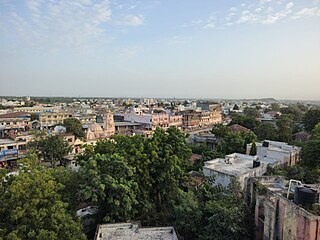
The village is 10km southwest of Junagadh. The main road (Bazaar) divides village from the center. It connects Station and Ozat gates. It is about 3km long and 30 feet wide, which is wider than other older villages' roads. It has paved sidewalks on both sides. The main road has more than 500 retail stores/businesses, banks, post offices, village administration office (Gram Panchayat Office) temples, mosques, vegetable market, fruit sellers, grocery shops, Pan Masala, bookstores, hotels, snack bars, cafés, repair shops, tailors, goldsmiths, blacksmiths, shoe makers, barber shops, clothes shops, STD/PCO stores, medical stores, electric stores, lumber and hardware stores, agricultural supply stores, sweet stores, etc.
Because of its connection with Junagadh-State's Navabs; Shapur was the most planned and developed village of the State. No village of its time in India was as organized as Shapur was. Since then (and even today), the village is protected by a strong fort with four main gates around. These gates are known as Station, Ozat, Khan and Ashram gates. Perhaps today, Shapur is the only "fort-village" of India with 15 feet tall fort with 3.5 feet wide walkway and guard-rail on its top. You can take a nice walk on top-of-fort from wide stairways constructed next to both sides of each gate of the fort. Each gate has big hall on its top, from where Navab's security guards used to monitor the outside activities of the village. The roads and streets of the village are parallel and perpendicular from one end to other end of the village.
Other main roads of the village are Ashram road, Kharakuva road, Khan Darvaja road, Patel Samaj road, Civil Hospital road, Society road and Navdurga road.
The various areas of the village are known as Kshatriya Kadiya Chowk, Patel Chock (cross section), Bank of Baroda Chock, Panchayat Chock, Navdurga Chock, Azad Chock, Banglapat, Jalaram Chock, Navafari, Rabari pa, Koli pa, Soni pa, Kandarvaja, Kharakuva, Raval ni pipal and Aadarsh Society.
Shapur is as old as the Muslim-ruled Junagadh state. Before Indian Independence the village was the main military-base and Janana (Muslim Queens) residence of Muslim-ruled Junagadh state. The Navabs of Junagadh-State used to visit Shapur almost every day to meet their wives and children residing at Shapur. Later on Mahatma Gandhi, Sardar Vallabhbhai Patel and Indira Gandhi visited this villages for various independence and political reasons. Even after Indian independence Shapur remained important in regional and State politics, business, education and social advancement. Kumar Shri Duleepsinhji visited the first and the only public utility Thermal Power Station in that state, at that time located in Shahpur. He wanted to see personally the working conditions and the amenities provided for the villagers housing and the recreation facilities as this power station was using crushed coal as fuel for boilers and chlorination for the cooling water system, which normally polluted the local atmosphere.
The village-economy was almost destroyed after the flooding of 22 June 1983. Indian Prime Minister Mrs. Indira Gandhi was rushed to Shapur and was shocked after seeing villagers' loss of home, business, and crops. Later on the villagers and local leaders rebuilt the economy.
Demographics
The village is residence place of Hindus and Muslims. The Hindu community includes Gurjar Kshatriya Kadia, Prajapati Kumbhar, Patel, Rabari, Koli, Lohana, Mochi, Dargi, Soni, Bramhins, Bavagis, Satvara, and Dalit. The Muslim community is made of Khoja, Gameti, Naghori and Sayads.
Economy
Shapur is known for lignite based power generation plant owned by Gujarat Electricity Board. This is one of the biggest power generation facilities in Saurastra region and employs more than 2000 people locally.
Almost 50% of village business and shoppers come from smaller villages around Shapur. Along the main road, there are several retail shops inside the village. Shapur provides better employment / business / earning opportunities to local workers in farms, industries, retail businesses, ferries, vegetable and beauty stall –Laris etc. Shapur is also famous for oil, engineering, cement products and dairy industries around the region. They provide good deal of internal and external employment and business and economy. Some of the well known industries are:
Thermal Power Station
Nova Precision Industry.
Trimurti ginning mill (Shashikant & Co.)
Patel Oil mill (Mavji Hari oil cake industry)
Press Oil and Cotton mill (Nanji Kalidas and group)
After Junagadh became Municipal Corporation, Shapur is one of the best places to do business in real estate and farming land transfer. Farmers having farms on Junagadh-road get very good value of their farms. People, who work in Junagadh but cannot afford living in Junagadh, live in Shapur as commute to Junagadh is only 15 minutes. They save much money in taxes, grocery, and education and get an urban lifestyle and facilities in this modern village. By looking at the growth of region, it looks like Shapur has been partially merged with Junagadh and will be under corporation's control within next few years.
Agriculture and farming
Shapur is only 1.5km away from the Ozat River. Ozat is the third-largest river of Saurastra (128km) with its most watersheds used for drinking water to Junagadh, Vanthali, Shapur and neighbor villages. After construction of Ozat-Vear dam near Shapur the tube wells of the region became so live with full of water, which made irrigation easy and affordable for farming. That is why the areas around Ozat river are the most greenest and best harvested in Junagadh district. These farms produce world-famous 'Kesar/saffron' mango -best in test and flavor among all species of mangos.
The farmers of Shapur take three crops per year that keeps farms green and live around the year. Farmers produces fruits, vegetables and flowers like mango, chiku, banana, sitafal, coconut, watermelon, cantaloupe, pupnus, grapes, egg-plants (bringers) peppers, cubage, cucumber, zucchini, turia, tomato, potato, cilantro, lemon, wheat, peanut (ground nut), beans, cotton, castrol, and spices are common produces of the area.
Because of the big production of fruits, vegetables and grains; the local farmers/vendors get opportunity to do business with cities like Junagadh, Rajkot, Ahmedabad, Baroda, Surat and up to Mumbai. On the other hand, these produces are very cheap in local market, making easy and wealthy lifestyle for local people.
The Patel and Rabari community mostly engaged in farming and dairy business. They sell milk and milk products to inside and outside of the village. Shapur's 'Hari Oum’ and 'Kismat' are well reputed dairy and sweet producers in the district, state and outside the country.
Transport
Shapur is the last rail road junction on Junagadh-Veraval and Junagadh-Saradiya railroads. Even the train station is farther than the bus station it is always full of travelers because availability of longer distance trains. Frequent commuting facilities of trains, buses, and private taxi/cabs to Junagadh made Shapur as a part of Junagadh urban area. Commuter can find buses and cabs/autos for Junagadh in every five minutes.
Air: The nearest airports from Shapur are Keshod -25km (at present not in use) and Rajkot -120km.
Rail: The railway station of Shapur lies on Ahmadabad /Rajkot – Veraval,(Only local trains stop) connects it the major cities of the country.
Road: State transport and Junagadh municipal corporation buses link Shapur with all the major cities of the state.
Education
Shapur was educational and cultural hub for neighbor villagers. The villagers take pride to have one of the best educational systems, schools, and teaching staffs in the district. Students come from nearby towns and villages including Vanthali (Taluka place) and Junagadh! The village has following schools:
Sarvoday Ashram's Bal Mandir.
Government primary school for boys.
Government primary school for girls
Government primary school for boys and girls at power house.
Javahar Vinay Mandir's high school for boys and girls.
Sarvoday Ashram primary school.
Sarvoday Ashram high school.
Sarvoday Ashram Adhyapan Mandir - PTC College
Vivekananda education trust's primary school for boys and girls
Vivekananda education trust's higher school for boys and girls
Vivekananda education trust's higher secondary school for boys and girls
Sanskar Vidhyalay
Shapur has an average literacy rate of 82%, higher than the national average of 59.5%:
Nadiad is a city in the state of Gujarat, India and the administrative centre of the Kheda district. The city is managed by the Nadiad Municipality. It is known for the Santram Mandir, the Mai Mandir, the historic Swaminarayan temple built in 1824, and the Anand and Hari Om Ashram. Nadiad is also where Shrimad Rajchandra composed Shri Atmasiddhi Shatra, a 142 verse spiritual treatise in 1895. Nadiad is located 90 kilometres (56 mi) away from Gandhinagar, the capital of Gujarat. It has a major railway junction and is a main station on the Ahmedabad-Mumbai route. It is the birthplace of Sardar Vallabhbhai Patel, the first Deputy Prime Minister of India. Nadiad Municipality was Founded in 1866.
Kumar Shri Duleepsinhji was a cricketer who played for England. Playing in the era before the Indian cricket team, he is considered one of India's first great batsmen, alongside his uncle Ranjitsinhji, who also represented England. Born in present-day Gujarat, he was educated at the Rajkumar College, Rajkot, before moving to England as a boy, where he attended Cheltenham College, and Cambridge University. The Duleep Trophy, long one of the premier competitions in Indian first class cricket, is named after him.
Beawar is a city in Beawar district of Indian state of Rajasthan. Beawar was the financial capital of Merwara state of Rajputana. As of 2011, the population of Beawar is 342,935. It is located 60 kilometres south from Ajmer, the divisional headquarter and 184 kilometres (114 mi) southwest of the state capital Jaipur, amidst Aravali hills. The city used to be a major center for trade, especially in raw cotton, and used to have cotton presses and the Krishna cotton mills. Currently, major industries include mineral-based units, machine-based units, machine tools and accessories, pre-stressed concrete pipes, plastic products, textiles, wooden furniture and asbestos cement pipes. Beawar is the largest producer of cement in northern India and home to Shree Cement. It is situated in a mineral-rich region having reserves of feldspar, quartz, asbestos, soapstone, magnesite, calcite, limestone, mica, emerald, granite, and masonry stone. Reserves of barytes, fluorite, wollastonite and vermiculite have also been found. Nearest airports are Jodhpur (145 km), Kishangarh and Jaipur (190 km). It is also connected by RSRTC operated buses to all parts of Rajasthan, and neighboring Delhi NCR, Ahmedabad (Gujarat), Gwalior. It also has railway connectivity with Delhi, Mumbai, Ahmadabad, Bangalore (bi-weekly), Haridwar, Dehradun (weekly), Bareilly and Muzzafarpur.
Junagadh district is a district of the Indian state of Gujarat. Its administrative headquarters is the city of Junagadh.
Gondal is a city of about 115,000 residents and a municipality of about 175,000 in the Rajkot district of the Indian state of Gujarat. Gondal Village was one of the eight first-class princely states of Kathiawar Agency, Bombay Presidency in British India. Ruled by a Hindu Rajput dynasty of the Jadeja.
Bhadran is a village in the state of Gujarat, in far western India. It is in the Anand district. Bhadran was nicknamed the "Paris of Gaekwad state" due to its prosperity and civil works carried out by Maharaja Sayajirao Gaekwad III, the visionary ruler of Baroda. It has been called the greatest village in India by Vallabhbhai Patel.
Paldi is an area located in South Western Ahmedabad, India. Corporate offices and city centres of many national and international companies like ICICI Bank, Royal Bank of Scotland, Religare, Claris, Gujarat Gas are located within Paldi. It accommodates Sanskar Kendra museum by the renowned architect Le Corbusier as well as Tagore Memorial Hall. The National Institute of Design is located in Paldi. M K Gandhi's first ashram in India, Kochrab Ashram is also located in Paldi. This area has many houses of the Art Deco period. Hanumanji temple in Paldi Gau is the oldest temple, it is part of 70/80 years ago, it is the biggest festival of Janmashtami, which has been going on for many years, it is different from 50/60 years. It is known that the biggest Janmashtami festival is held here in Ahmedabad.
Dhoraji is a town situated on the banks of the River Safura, a tributary of the River Bhadar. It is a municipality in the Rajkot district in the state of Gujarat, India.
Pandhurna is the 54th district of Madhya Pradesh, India. Pandhurna town is an important city from the business point of view. It is located on National Highway-47 (NH-47). The city is situated on the banks of the 'Jam' river. The famous Gotmar Fair is organized every year on the banks of this river.
Rajula is a city and municipality in Amreli district in the Indian state of Gujarat. City was known as Rajgadh at the time of local ruler daha dhakhda. He founded the official gadh in 1759 AD according to statistical accounts of Bhavnagar state.
Ode is a small town and a municipality in Anand district in the Indian state of Gujarat.
Bijainagar is a city and headquarters of Bijainagar tehsil in the Beawar district of the Indian state of Rajasthan.It was founded by Shri Rao Saheb Vijay Singh ji Of Masuda in 1919 CE,This city is situated along the Khari River close to the southern border of Ajmer District.
Gadhakda is a village in Savarkundla tehsil in the Amreli district of Indian state Gujarat. Gadhakda was formerly under the control of Junagadh State. Although it is now a part of the Amreli district, it was once a part of the Bhavnagar district.
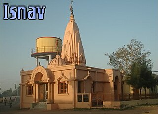
Isnav is a little village from one of the 22 Gam Patidar Samaj, situated at coordinates: 22°31'59"N | 72°45'51"E just nearby small town called Sojitra. Isnav is surrounded by natural countryside. The village has an entrance from the State Highway 83 in Gujarat. From the Gateway, off the highway just after 0.80 km drive is the village Isnav.
Mavjinjava is a small village near Bagasara in the Amreli district of the Saurashtra region in the state of Gujarat, India. There is a population of around 3,754 people in Mavjinjava. More than 3000 people live outside of Manjinjava in places like Surat, Ahmedabad & Mumbai.
Panchpipla is a village in Rajkot district in the state of Gujarat, India. Villagers speak Gujarati, Hindi, and English. Panchpipla is the largest village among approximately 44 other villages of Jetpur tehsil. The population of the village is around 9500 to 12000.
Kasor is a village in Sojitra Taluka and Anand District, in Gujarat, India. The village has an entrance from the State Highway 83 in Gujarat. Entrance Gate of Kasor came off the highway just after 2.5 km drive. The 400 K.V.SS Power Station is considered as being in this village.
Bhayavadar is a small village in the Kunkavav Vadia Taluka of the Amreli district in Gujarat, India. The Patels form the majority of the village 1539 village residents.
Devda is a village in Porbandar district, Gujarat, India. It is on the bank of the Minsar river. The population of the village is around 4000 and most of people are doing farming. And major resources of farming water is wells and tube wells and major crops are cotton, groundnut, onion, and jira. Devda was also famous for its papaya and chilli but farmers no longer grow these crops.
Indra is a village in Junagdh District in the state of Gujarat, India. It is located 41 km towards west from District headquarters Junagadh.
References
1 2 3 "View Population". Office of the Registrar General & Census Commissioner, India. Retrieved 22 October 2020.
This page is based on this Wikipedia article Text is available under the CC BY-SA 4.0 license; additional terms may apply. Images, videos and audio are available under their respective licenses.