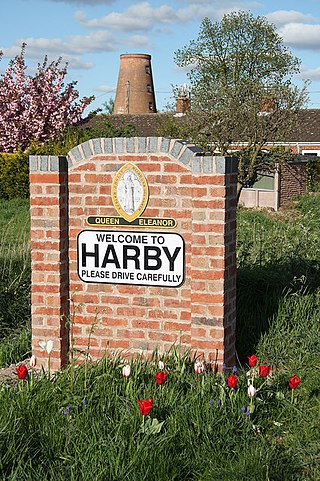
Harby is a village and civil parish in the Newark and Sherwood district of Nottinghamshire, England. It is close to Doddington, Lincolnshire, and is the easternmost settlement in Nottinghamshire, the boundary separating the two. According to the 2011 census, it had a population of 336, up from 289 at the 2001 census. It increased to 346 at the 2021 census.

Averham is a village and civil parish in the Newark and Sherwood district of Nottinghamshire, England. According to the 2001 census it had a population of 187, increasing to 294 at the 2011 census, however Averham alone reported 215 residents at the 2021 census. The village is just west of Newark-on-Trent. Staythorpe Power Station is south-west of the village.

Barnby in the Willows is a village and civil parish in the Newark and Sherwood district of Nottinghamshire, England, just east of Newark-on-Trent. According to the 2001 census it had a population of 244, increasing to 272 at the 2011 census, with a reduction to 255 at the 2021 census. Just to the south of the village is the River Witham, which also forms the border with Lincolnshire here.

Lambley is an English village and civil parish near Nottingham, England, hardly touched by urbanisation, as it lies in a green belt. The population recorded in the 2011 census was 1,247, marginally falling to 1,231 at the 2021 census. Its proximity to Nottingham has tended to raise the price of its real estate.

Carlton-on-Trent is a small village and civil parish in England, located between the River Trent and the A1 road near Newark-on-Trent in Nottinghamshire. The population of the civil parish was 228 at the 2001 census, increasing only marginally to 229 at the 2011 census and similarly to 230 at the 2021 census.

Langford is a village and civil parish in Nottinghamshire, England. It is located four miles north-east of Newark-on-Trent and two miles east from the River Trent. Population for the civil parish was 104 at the 2021 census. It lies along the A1133 which comes off of the A46 road.

Coddington is a village and civil parish in the Newark and Sherwood district of Nottinghamshire, England. It is 3 miles (4.8 km) east of Newark-on-Trent. According to the 2001 census it had a population of 972, which increased to 1,684 at the 2011 Census and to 1,538 at the 2021 census.

Girton is a village and civil parish in Nottinghamshire, England. According to the 2001 census it had a population of 143, reducing slightly to 140 at the 2011 census, and 138 at the 2021 census. It is located 17 miles west of Lincoln.

Holme is a hamlet and civil parish in Nottinghamshire, England. The population of the civil parish at the 2011 census was 165, Holme alone registered 80 residents at the 2021 census. It is within the district of Newark and Sherwood, on the east of the River Trent, less than half a mile from the riverside and 4 miles north of Newark-on-Trent.

Spalford is a hamlet and civil parish in the Newark and Sherwood district of Nottinghamshire, England. Spalford was listed in the Domesday Book (1086) as 'Spaldesforde'.

North Clifton is a village and civil parish about 12 miles north of Newark-on-Trent, in the Newark and Sherwood district, within the county of Nottinghamshire, England. In 2011, the parish had a population of 216, and this dropped to 176 at the 2021 census. The parish touches Thorney, Fledborough, Newton on Trent, South Clifton and Ragnall.

Thorney is a village and civil parish about 10 miles (16 km) north of Newark-on-Trent, in the Newark and Sherwood district, in the county of Nottinghamshire, England. The settlement is close to the eastern edge of the county. In the census of 2011, the parish had a population of 248, falling to 228 at the 2021 census. A small portion of Drinsey Nook mainly in Lincolnshire falls into the parish to the north, Thorney Moor is a hamlet to the south of the parish area. The parish borders other nearby parishes including Wigsley, Kettlethorpe, Newton on Trent, Saxilby with Ingleby, Harby, North Clifton, South Clifton and Hardwick.

Staythorpe is a hamlet and civil parish in the Newark and Sherwood district of Nottinghamshire, England. During the 2021 census, the population was recorded as 93 residents.

Staunton is a small village and civil parish in the Newark and Sherwood district of Nottinghamshire, England. It takes its name from the Vale of Belvoir and shares it with the local Staunton family, which has resided in the area since the Norman Conquest and possibly before, making them one of the few English families still resident on their estate.

Kersall is a hamlet and civil parish within the Newark and Sherwood district of central Nottinghamshire, England.
Fiskerton cum Morton is a civil parish in the Newark and Sherwood district, within the county of Nottinghamshire, England. The overall area had a population of 803 at the 2021 census. The parish lies in the south east of the county. It is 112 miles north of London, 12 miles north east of the city of Nottingham, 5 miles west of the town of Newark-on-Trent and 21⁄2 miles south east of the town of Southwell. The parish lies along the bank of the River Trent and is primarily a commuter residential area to both Nottingham and Newark.

Marnham is a civil parish in the Bassetlaw district, in the county of Nottinghamshire, England. The parish includes the village of Low Marnham and the hamlets of High Marnham and Skegby. In the census of 2021 the parish had a population of 136. The parish lies in the north east of the county, and south east within the district. It is 122 miles north of London, 23 miles north east of the city of Nottingham, and 17 miles north east of the market town of Mansfield. The parish touches Fledborough, Normanton on Trent, South Clifton, Tuxford and Weston. Marnham shares a parish council with Normanton on Trent. There are 7 listed buildings in Marnham.

High Marnham is a village within the Marnham civil parish in Bassetlaw district, of the county of Nottinghamshire, England. It is 120 miles north of London, 23 miles north east of the city of Nottingham, and 17 miles north east of the market town of Mansfield. There is one listed building in the village.

Skegby is a hamlet within the Marnham civil parish in Bassetlaw district, of the county of Nottinghamshire, England. It lies in the north east of the county, south east within the district and centre south of the parish. It is 122 miles (196 km) north of London, 23 mi (37 km) north east of the city of Nottingham, and 17 mi (27 km) north east of the market town of Mansfield. There are two listed buildings in the area.


