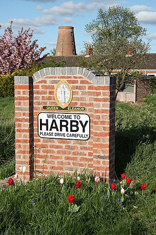
Harby is a village and civil parish in the Newark and Sherwood district of Nottinghamshire, England. It is close to Doddington, Lincolnshire, and is the easternmost settlement in Nottinghamshire, the boundary separating the two. According to the 2011 census, it had a population of 336, up from 289 at the 2001 census. It increased to 346 at the 2021 census.

Newark was a wapentake of the historic county of Nottinghamshire, England.

Felley is a civil parish in the Ashfield district, in Nottinghamshire, England, located between Hucknall and Sutton-in-Ashfield. According to the 2001 census, the parish had a population of four. At the 2011 census the population remained minimal, the count again confirmed as four residents at the 2021 census. Details are included in the Underwood ward of Ashfield Council. Prior to 1974 it was part of Basford Rural District.

Carlton-on-Trent is a small village and civil parish in England, located between the River Trent and the A1 road near Newark-on-Trent in Nottinghamshire. The population of the civil parish was 228 at the 2001 census, increasing only marginally to 229 at the 2011 census and similarly to 230 at the 2021 census.

Caunton is a village and civil parish in the Newark and Sherwood district of Nottinghamshire on the A616, six miles (9.7 km) north-west of Newark-on-Trent, in the NG23 postcode. The population of the civil parish at the 2011 census was 483, and this increased to 508 at the 2021 census.

Langford is a village and civil parish in Nottinghamshire, England. It is located four miles north-east of Newark-on-Trent and two miles east from the River Trent. Population for the civil parish was 104 at the 2021 census. It lies along the A1133 which comes off of the A46 road.

Coddington is an English village and civil parish in Nottinghamshire, 3 miles (4.8 km) east of Newark-on-Trent. According to the 2001 census it had a population of 972, which increased to 1,684 at the 2011 Census and to 1,538 at the 2021 census.

Girton is a village and civil parish in Nottinghamshire, England. According to the 2001 census it had a population of 143, reducing slightly to 140 at the 2011 census, and 138 at the 2021 census. It is located 17 miles west of Lincoln.

Spalford is a hamlet and civil parish in the Newark and Sherwood district of Nottinghamshire, England. Spalford was listed in the Domesday Book (1086) as 'Spaldesforde'.

North Clifton is a village and civil parish about 12 miles north of Newark-on-Trent, in the Newark and Sherwood district, within the county of Nottinghamshire, England. In 2011, the parish had a population of 216, and this dropped to 176 at the 2021 census. The parish touches Thorney, Fledborough, Newton on Trent, South Clifton and Ragnall.

Monkokehampton is a village and civil parish in West Devon, England. The village lies on the River Okement, about 3 miles (4.8 km) east-north-east of Hatherleigh. The parish is bounded by Hatherleigh, Exbourne, Broadwoodkelly and Iddesleigh, and had a population of 139 at the 2011 Census.

South Clifton is a village and civil parish in the Newark and Sherwood district of Nottinghamshire, England. It is 11 miles north of Newark-on-Trent. With the 2011 census, the parish had a population of 326, this fell to 308 at the 2021 census. The parish touches Thorney, Girton, Fledborough, Wigsley, Marnham, Normanton on Trent, Spalford and North Clifton.

Thrushelton or Thruselton is a village and civil parish about 2 and a half miles north of Coryton railway station, in the West Devon district, in the county of Devon, England. In 2011 the parish had a population of 197. The parish touches Bratton Clovelly, Bridestowe, Lewtrenchard, Stowford, Broadwoodwidger, Marystow and Germansweek.

Upper Broughton or Broughton-Sulney or Over-Broughton is a village and civil parish about seven miles north west of Melton Mowbray, in the Rushcliffe district of the county of Nottinghamshire, England. In 2011 the built-up area had a population of 327, the same as the parish. The parish touches Wymeswold, Hickling, Widmerpool, Broughton and Old Dalby and Willoughby on the Wolds. Upper Broughton is a conservation area that was designated in 1973 and is 16 hectares. It is near the boundary with Leicestershire, and Nether Broughton is across the county boundary.

West Markham or Markham Clinton is a village and civil parish 23 miles (37 km) north east of Nottingham, in the Bassetlaw district, in the county of Nottinghamshire, England. In the 2011 census, the parish had a population of 170, and this increased marginally to 175 residents at the 2021 census. The parish touches Bevercotes, West Drayton, East Markham, Bothamsall, Walesby and Tuxford. The A1 previously went through the village but its now been bypassed.

Staythorpe is a hamlet and civil parish in the Newark and Sherwood district of Nottinghamshire, England. During the 2021 census, the population was recorded as 93 residents.

Kersall is a hamlet and civil parish within the Newark and Sherwood district of central Nottinghamshire, England.
Fiskerton cum Morton is a civil parish in the Newark and Sherwood district, within the county of Nottinghamshire, England. The overall area had a population of 803 at the 2021 census. The parish lies in the south east of the county. It is 112 miles north of London, 12 miles north east of the city of Nottingham, 5 miles west of the town of Newark-on-Trent and 21⁄2 miles south east of the town of Southwell. The parish lies along the bank of the River Trent and is primarily a commuter residential area to both Nottingham and Newark.

Marnham is a civil parish in the Bassetlaw district, in the county of Nottinghamshire, England. The parish includes the village of Low Marnham and the hamlets of High Marnham and Skegby. In the census of 2021 the parish had a population of 136. The parish lies in the north east of the county, and south east within the district. It is 122 miles north of London, 23 miles north east of the city of Nottingham, and 17 miles north east of the market town of Mansfield. The parish touches Fledborough, Normanton on Trent, South Clifton, Tuxford and Weston. Marnham shares a parish council with Normanton on Trent. There are 7 listed buildings in Marnham.


