Southeast Side, Chicago

Last updated

The Southeast side of Chicago officially begins East of State Street going southwards. It extends south and east to the city limits, generally keeping between Lake Michigan and Lake Calumet. [1] Politically, the Southeast side is contiguous with the 10th Ward.

Chicago City in Illinois, United States

Chicago, officially the City of Chicago, is the most populous city in Illinois and the third most populous city in the United States. With an estimated population of 2,716,450 (2017), it is the most populous city in the Midwestern United States. Chicago is the county seat of Cook County, the second most populous county in the United States, and the principal city of the Chicago metropolitan area, which is often referred to as "Chicagoland." The Chicago metropolitan area, at nearly 10 million people, is the third-largest in the United States; the fourth largest in North America ; and the third largest metropolitan area in the world by land area.

Lake Michigan one of the Great Lakes of North America

Lake Michigan is one of the five Great Lakes of North America and the only one located entirely within the United States. The other four Great Lakes are shared by the U.S. and Canada. It is the second-largest of the Great Lakes by volume and the third-largest by surface area, after Lake Superior and Lake Huron. To the east, its basin is conjoined with that of Lake Huron through the wide Straits of Mackinac, giving it the same surface elevation as its easterly counterpart; the two are technically a single lake.

Lake Calumet is the largest body of water within the city of Chicago. Formerly a shallow, postglacial lake draining into Lake Michigan, it has been changed beyond recognition by industrial redevelopment and decay. Parts of the lake have been dredged, and other parts reshaped by landfill. Together with the rest of the city of Chicago, the remnant of the lake now drains into the Des Plaines River and the Mississippi River basin.

There are many neighborhoods within the boundaries of the Southeast side, including Windsor Park, Calumet, Hyde Park, Bronzeville, Chatham South Chicago, the East Side, Irondale, South Deering and Hegewisch. [2]

South Chicago, Chicago Community area in Illinois, United States

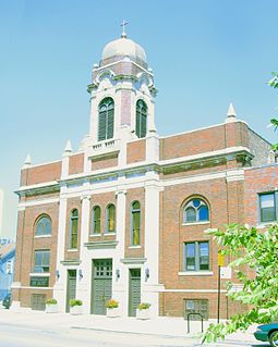
South Chicago, formerly known as Ainsworth, is one of the 77 well-defined community areas of Chicago, Illinois.

East Side, Chicago Community area in Illinois, United States

East Side is one of the 77 official community areas of Chicago, Illinois. It is on the far south side of the city, between the Calumet River and the Illinois-Indiana state line, 13 miles (21 km) south of downtown Chicago. The neighborhood has a park on Lake Michigan, Calumet Park, and a forest, Eggers Grove Forest Preserve. It is served by U.S. Highway 12, U.S. Highway 20, and U.S. Highway 41.

South Deering, Chicago Community area in Illinois, United States

South Deering, located on Chicago's far South Side, is the largest of the 77 official community areas of that city. It is part of the 10th Ward, once under the control of former Richard J. Daley ally Alderman Edward Vrdolyak. Primarily an industrial neighborhood, a small group of homes exists in the northeast corner and Lake Calumet takes up a large portion of the area. 80% of the community is zoned as industrial, natural wetlands, or parks. The remaining 20% is zoned for residential and small-scale commercial uses. The neighborhood is named for Charles Deering, an executive in the Deering Harvester Company that would later form a major part of International Harvester. International Harvester owned Wisconsin Steel, which was originally established in 1875 and was located along Torrence Avenue south of 106th Street to 109th Street.

Related Research Articles

Highland, Lake County, Indiana Town in Indiana, United States

Highland is a town in Lake County, Indiana, United States. The population was 23,727 at the 2010 census. The town was incorporated on April 4, 1910. It is a part of the Chicago metropolitan area and North Township, and is surrounded by Hammond to the north, Munster to the west, Schererville to the south and Griffith to the east.

Calumet River river in the United States of America

The Calumet River is a system of heavily industrialized rivers and canals in the region between the neighborhood of South Chicago in Chicago, Illinois, and the city of Gary, Indiana. Historically, the Little Calumet River and the Grand Calumet River were one, the former flowing west from Indiana into Illinois, then turning back east to its mouth at Lake Michigan at Marquette Park in Gary.

Indiana Harbor and Ship Canal

The Indiana Harbor and Ship Canal is an artificial waterway on the southwest shore of Lake Michigan, in East Chicago, Indiana, which connects the Grand Calumet River to Lake Michigan. It consists of two branch canals, the 1.25 mile (2 km) Lake George Branch and the 2 mile (3 km) long Grand Calumet River Branch which join to form the main Indiana Harbor Canal.

The Calumet Region is the geographic area drained by the Grand Calumet River and the Little Calumet River of northeastern Illinois and northwestern Indiana in the United States. It is part of the Great Lakes Basin, which eventually reaches the Atlantic Ocean. It is a sub-region of the greater Northwest Indiana region and the even larger Great Lakes region.

Calumet Park

Calumet Park is a 198-acre (79-hectare) park in Chicago, Illinois. It provides access to Lake Michigan from the East Side neighborhood on the city's Southeast Side. The park contains approximately 0.9 miles (1.5 km) of lake frontage from 95th Street to 102nd Street. The park is listed on the National Register of Historic Places.

Illinoiss 2nd congressional district

Illinois's 2nd congressional district is a congressional district in the U.S. state of Illinois. Based in the south suburbs of Chicago, the district includes southern Cook county, eastern Will county, and Kankakee county, as well as the city of Chicago's far southeast side.

Stony Island Avenue is a major street on South Side of the city of Chicago, designated 1600 East in Chicago's street numbering system. It runs from 56th Street south to the Calumet River. Stony Island Avenue continues sporadically south of the Calumet in the southern suburbs, running alongside the Bishop Ford Freeway, sometimes as a frontage road. It terminates at County Line Road on the border of Will and Kankakee Counties.

William W. Powers State Recreation Area

William W. Powers State Recreation Area is an Illinois state park administered by the Illinois Department of Natural Resources on 580 acres (230 ha) in the Hegewisch community area of the City of Chicago in Cook County, Illinois, United States. The area includes 419 acres (170 ha) of water in Wolf Lake that provides about 6 miles (10 km) of shoreline to fishermen. The park hosts about half a million visitors annually. The park contains numerous species, and is one of the most important biological sites in the Chicago region.

The Calumet/Giles Prairie District is a historic district in the South Side, Chicago community area of Chicago, Illinois, United States. The district was built between 1870 and 1910 by various architects. It was designated a Chicago Landmark on July 13, 1988.

95th Street is a major east–west highway on Chicago's South Side and in the southwest suburbs, designated as 9500 South in Chicago's address system. 95th Street is 11 miles (18 km) south of Madison Street.

Tinley Moraine

The Tinley Moraine is a moraine around the Lake Michigan basin in North America. It was formed during the Wisconsin Glaciation and is younger than the higher and wider terminal moraine called the Valparaiso Moraine, which is located farther from the lake than the Tinley Moraine. Compared to the Valparaiso Moraine, the Tinley Moraine is much narrower and occupies a similar swath, about 6 miles (10 km) closer to Lake Michigan, and passes through the communities of Flossmoor, Western Springs, and Arlington Heights. The moraine probably was named after the village of Tinley Park, a village southwest of Chicago that lies on the moraine.

Calumet Shoreline

The Calumet Shoreline is an ancient shoreline of Lake Michigan located in the Lake Michigan Basin. It can be clearly seen as a sand ridge along Ridge Road south of Chicago. Closer to the lake from the Calumet Shoreline, there are the Tolleston shorelines and farther from the lake are the Glenwood Shoreline, the Tinley Moraine, and the Valparaiso Moraine. The shoreline is named after the Calumet Region of Northern Indiana.

Indian Village, Chicago human settlement in United States of America

Indian Village Is the nickname given to the southeast portion of the Kenwood community area of Chicago, Illinois, United States. It is roughly bounded by Lake Shore Drive to the east Burnham Park to the north, 51st Street to the south, Harold Washington Park to the southeast, and the Illinois Central Railroad tracks used by the Metra's South Shore and Metra Electric Lines to the West. Many of the buildings in the neighborhood are named after Native American Indian tribes including the National Register of Historic Places-designated (NRHP) Narragansett and the Chicago Landmark Powhatan Apartments. Other buildings include several Algonquin Apartment buildings and the Chippewa.

Pill Hill, Chicago human settlement in United States of America

Pill Hill is a neighborhood in the Calumet Heights community area on the South Side of Chicago.

Grand Calumet River river in the United States

The Grand Calumet River is a 13.0-mile-long (20.9 km) river that flows primarily into Lake Michigan. Originating in Miller Beach in Gary, it flows through the cities of Gary, East Chicago and Hammond, as well as Calumet City and Burnham on the Illinois side. The majority of the river's flow drains into Lake Michigan via the Indiana Harbor and Ship Canal, sending about 1,500 cubic feet (42 m3) per second of water into the lake. A smaller part of the flow, at the river's western end, enters the Calumet River and ultimately drains into the Illinois and ultimately the Mississippi River.

T.J. OBrien Lock and Dam

Thomas J. O'Brien Lock & Dam is a lock on the Calumet River on the south side of Chicago. The dam is 326 river miles (525 km) from the Mississippi-Illinois confluence. The up-river side of the dam is at Lake Michigan's level, 577 feet (176 m) above sea level. The lock dimensions are 1,000 by 110 feet.

Chicago Harbor

Generally, the Chicago Harbor comprises the public rivers, canals, and lakes within the territorial limits of the City of Chicago and all connecting slips, basins, piers, breakwaters, and permanent structures therein for a distance of three miles from the shore between the extended north and south lines of the city. The greater Chicago Harbor includes portions of the Chicago River, the Calumet River, the Ogden Canal, the Chicago Sanitary and Ship Canal, Lake Calumet, and Lake Michigan.

References

  1. "South Side Tour Guides: Where Nature and History Merge". Chicago Wilderness Magazine, Inc. March 2002. Retrieved September 30, 2007.
  2. "sechicmap". North Eastern Illinois University. Retrieved September 30, 2007.

Coordinates: 41°46′N87°34′W / 41.767°N 87.567°W / 41.767; -87.567

Geographic coordinate system Coordinate system

A geographic coordinate system is a coordinate system that enables every location on Earth to be specified by a set of numbers, letters or symbols. The coordinates are often chosen such that one of the numbers represents a vertical position and two or three of the numbers represent a horizontal position; alternatively, a geographic position may be expressed in a combined three-dimensional Cartesian vector. A common choice of coordinates is latitude, longitude and elevation. To specify a location on a plane requires a map projection.