
Newport Cathedral, also known as St Gwynllyw's or St Woolos' Cathedral, is the cathedral of the Diocese of Monmouth within the Church in Wales, and the seat of the Bishop of Monmouth. Its official title is Newport Cathedral of St Woolos, King and Confessor. The name of the saint, Woolos, is an anglicisation of the Welsh name Gwynllyw.

Whitson is a village on the outskirts of the city of Newport, South Wales. It is located about 7 miles (11 km) south east of Newport city centre on the Caldicot Levels, a large area of coastal land reclaimed from the sea. Administratively, Whitson is part of the community of Goldcliff.
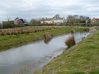
Goldcliff is a village, parish and community to the south east of the city of Newport in South Wales. It lies within the Newport city boundaries in the historic county of Monmouthshire and the preserved county of Gwent. Administratively, the community of Goldcliff includes the village/parish of Whitson. The population in 2001 was 233; by 2011 it had risen to 329.

Redwick is a small village and community (parish) to the south east of the city of Newport, in Wales, United Kingdom. It lies within the Newport city boundaries, in the historic county of Monmouthshire and the preserved county of Gwent. In 2011 the population was 206.
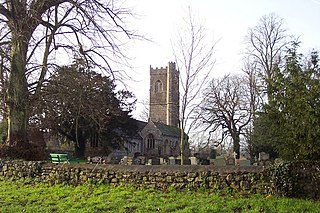
Mathern is a historic community (parish) and village in Monmouthshire, south east Wales, about 3 miles (4.8 km) south west of the town of Chepstow, close to the Severn estuary, the Bristol Channel and the M48 motorway. The village is designated as a Conservation Area. It is now bisected by the motorway, which passes over the road through the village, with the original village located to the south and the more recent development, known as Newton Green, to the north.

Llangwm is a small rural village and former community, now in the community of Llantrisant Fawr, in Monmouthshire, south east Wales. It is located 3 miles (4.8 km) east of Usk, on the B4235 Chepstow to Usk road. The main village is at Llangwm Uchaf, with a smaller and more dispersed settlement about 1 mile (1.6 km) to the north-east at Llangwm Isaf .The other settlement in the community is Llansoy. In 2022 the community was abolished and merged with Llantrisant Fawr.

Llantrisant is a village in Monmouthshire, south east Wales, United Kingdom. The community population at the 2011 census was 475.
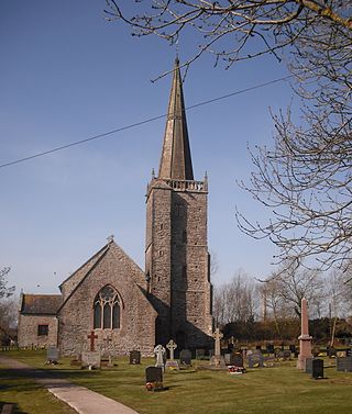
Nash is a village and community to the south of the city of Newport, South Wales, in the Lliswerry ward.

Goldcliff Priory was a Benedictine monastery in Goldcliff, Newport, South Wales. It was established in 1113 by Robert de Chandos as a subsidiary house of the Abbey of Bec in Normandy. The priory was built on a coastal site, now the land of Hill Farm. In the 1950s, the Monmouthshire writer Hando noted the outlines of buildings visible as grass patterns or crop marks, but by the 1970s the only remaining structural element was part of a cellar in the farm house.

St David's Church, Llangeview, is a redundant church sited in a round churchyard adjacent to the junction of the A449 and A472 roads 1 mile (1.6 km) to the east of the town of Usk in Monmouthshire, Wales. It has been designated by Cadw as a Grade I listed building, and is under the care of the Friends of Friendless Churches. It is Grade I listed because of its "exceptional interior" including a 15th-century rood-loft and "rare pre-Victorian box pews and fittings". The church stands in a churchyard that is almost circular, and is surrounded by a bank and the traces of a ditch.

St Mary's Church, Llanfair-yng-Nghornwy is a medieval parish church in the north-west of Anglesey, north Wales. The date of foundation of the church, which is in the village of Llanfair-yng-Nghornwy, is unknown, but the oldest parts date from the 11th or 12th century. It has twice been enlarged: in the 15th century, when the chancel was rebuilt, and in the 16th century, when a chapel was added to the south of the chancel, separated by three arches. The tower at the west end is from the 17th century. A south porch of unknown date has been converted into a vestry, and the church is now entered through the tower.

St Mary's Priory Church, in Whitecross Street, Monmouth, Monmouthshire, Wales, is an Anglican church founded as a Benedictine priory in 1075. The current church dates mostly from the 18th and 19th centuries. It was designated a Grade II* listed building in 1952. It is one of 24 buildings on the Monmouth Heritage Trail.

The Church of St Martin, Cwmyoy, Monmouthshire, Wales, was begun in the 12th century, although most of the current structure dates from the 13th century. The church is most notable for its extreme tilt, the result of a landslide. This has led to many attempts to strengthen the church and prevent its collapse, through the use of massive tie beams and buttresses. The church is in the Gothic style, and has a chancel, nave, south porch, and western tower. A round-headed north window dates to the 12th century, and the nave roof has been dated to the late 13th or early 14th century. St Martin's is a Grade I listed building and an active parish church. It is dedicated to St Martin of Tours.

St Cadoc's Church, Raglan, Monmouthshire, south east Wales, is the parish church of the village of Raglan. The church is situated at a cross-roads in the centre of the village. Built originally by the Clare and Bluet families in the thirteenth and fourteenth centuries, it was rebuilt, and expanded by the Herbert's of Raglan Castle in the fifteenth century. In the nineteenth century, the church was subject to a major restoration by Thomas Henry Wyatt.

Monmouthshire is a county and principal area of Wales. It borders Torfaen and Newport to the west; Herefordshire and Gloucestershire to the east; and Powys to the north. The largest town is Abergavenny, with the other major towns being Chepstow, Monmouth, and Usk. The county is 850 km2 in extent, with a population of 95,200 as of 2020. The present county was formed under the Local Government (Wales) Act 1994, which came into effect in 1996, and comprises some sixty percent of the historic county. Between 1974 and 1996, the county was known by the ancient title of Gwent, recalling the medieval Welsh kingdom. In his essay on local government in the fifth and final volume of the Gwent County History, Robert McCloy suggests that the governance of "no county in the United Kingdom in the twentieth century was so transformed as that of Monmouthshire".

St Cenedlon's is a parish church in the village of Rockfield, Monmouthshire, Wales. The dedication to St Cenedlon is unusual and the history of the saint is obscure. Some sources suggest that she was a daughter of Brychan king of Brycheiniog while others identify her as the wife of King Arthfael ab Ithel, king of Glywysing. The existing church dates from the Middle Ages but only the tower remains from that period. After the English Reformation, the surrounding area of north Monmouthshire became a refuge for Catholics and Matthew Pritchard (1669-1750), Roman Catholic bishop and Vicar Apostolic of the Western District is buried at the church. By the mid-19th century the church was in ruins and a complete reconstruction was undertaken by the ecclesiastical architects John Pollard Seddon and John Prichard in around 1860. St Cenedlon's is an active parish church in the Diocese of Monmouth. It is designated by Cadw as a Grade II listed building.
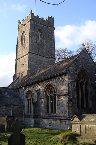
St Tewdric's Church is a Church in Wales parish church in Mathern, Monmouthshire, Wales. It is purportedly built over the resting place of Saint Tewdrig for whom it is named. A church has been located on the site since the 6th century. It was reconstructed by the Normans in the Early English style, and later was renovated by the Victorians. It is a Grade I listed building.

The Church of St Madoc, Llanbadoc, Monmouthshire is a parish church with its origins in the 14th century. A Grade II* listed building, the church remains an active parish church.

The Church of St Andrew, Tredunnock, Monmouthshire is a parish church with its origins in the 12th or 13th century. A Grade II* listed building, the church remains an active parish church.
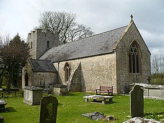
St Mary Magdalene's Church stands in the village of Goldcliff, to the southeast of the city of Newport, Wales. An active parish church and a Grade II listed building, it is situated directly behind the Farmer's Arms public house.


