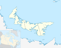
Queens County is a county in the province of Prince Edward Island, Canada. It is the largest county in the province by population with 89,770 (2021) and land. Charlottetown is the county seat of Queens County, and is the largest city and the capital of Prince Edward Island.

Kings County is located in eastern Prince Edward Island, Canada.

Cavendish is an unincorporated rural community in the township of Lot 23, Queens County, Prince Edward Island, Canada.

Prince County is located in western Prince Edward Island, Canada. The county's defining geographic feature is Malpeque Bay, a sub-basin of the Gulf of St. Lawrence, which creates the narrowest portion of Prince Edward Island's landmass, an isthmus upon which the city of Summerside is located.

Miscouche is a municipality that holds community status in Prince Edward Island, Canada. It is located in Prince County.
Belmont is a Canadian rural farming community located in the larger community of Lot 16 in central Prince County, Prince Edward Island. Lot 16 is actually three communities: Belmont, Central, and Southwest Lot 16, and is one of the last communities on Prince Edward Island to continue using their lot designation from the original Island survey by Samuel Holland in the 18th century.

Linkletter Provincial Park is a provincial park in Prince Edward Island, Canada located at Bedeque Bay a short distance west of Linkletter, Prince Edward Island and Summerside, Prince Edward Island.
Freeland is a Canadian rural community in Prince County, Prince Edward Island.
Hunter River is a municipality that holds community status in Prince Edward Island, Canada. It is located in Queens County southwest of North Rustico. It is situated on the Hunter River.
The community of Brackley Beach, formerly Brackley Point, is a small Canadian rural farming community located in central Prince Edward Island on the province's north shore, approximately 10 km north of the community of Brackley, from which it derives its name.
Parkdale is a neighbourhood of the city of Charlottetown in central Queens County, Prince Edward Island, Canada.
East Royalty is a neighbourhood of the Canadian city of Charlottetown, Prince Edward Island.
Bedeque is a former municipality that previously held community status in the Canadian province of Prince Edward Island. It was dissolved through its amalgamation with the Community of Central Bedeque on November 17, 2014 to create the Community of Bedeque and Area.
Tryon is an unincorporated area in Prince County, Prince Edward Island, Canada. Situated on Route 1 and Route 10, it lies within the township of Lot 28 which in 2006 had a population of 880 people. Tryon is not far from Crapaud, Prince Edward Island.
Hillsborough Bay is a 244 km2 (94 sq mi) bay on the south shore of Prince Edward Island, Canada and is a sub-basin of the Northumberland Strait.
Wilmot is a neighbourhood in the Southeastern part of the Canadian city of Summerside, Prince Edward Island.

North Shore is a rural municipality within Queens County in Prince Edward Island that was incorporated on September 28, 2018, through an amalgamation of three municipalities. The municipalities that amalgamated were the rural municipalities of Grand Tracadie, North Shore, and Pleasant Grove.

Rusticoville is an unincorporated rural community in the township of Lot 23, Queens County, Prince Edward Island, Canada.

South Rustico, formerly called Rustico, is an unincorporated rural community in the township of Lot 24, Queens County, Prince Edward Island, Canada.
Oyster Bed Bridge is an unincorporated rural community in the township of Lot 24, Queens County, Prince Edward Island, Canada.


