Sturgeon-Noblestown, Pennsylvania

Last updated
Sturgeon-Noblestown
CDP
Map of Sturgeon-Noblestown, Allegheny County, Pennsylvania Highlighted.png
Location within Allegheny county
USA Pennsylvania location map.svg
Red pog.svg
Sturgeon-Noblestown
Location within the U.S. state of Pennsylvania
Coordinates: 40°23′2″N80°12′33″W / 40.38389°N 80.20917°W / 40.38389; -80.20917 Coordinates: 40°23′2″N80°12′33″W / 40.38389°N 80.20917°W / 40.38389; -80.20917
Country United States
State Pennsylvania
County Allegheny
Area
  Total2.9 sq mi (8 km2)
  Land2.9 sq mi (8 km2)
Population
 (2000)
  Total1,764
  Density610/sq mi (230/km2)
Time zone UTC-5 (Eastern (EST))
  Summer (DST) UTC-4 (EDT)

Sturgeon-Noblestown was a census-designated place (CDP) for the 2000 United States Census in Allegheny County, Pennsylvania, United States. The population was 1,764 at that time. In the 2010 census the CDP was split into the two separate CDP's of Sturgeon and Noblestown.

Contents

Geography

Sturgeon-Noblestown was located at 40°23′2″N80°12′33″W / 40.38389°N 80.20917°W / 40.38389; -80.20917 (40.383875, -80.209191). [1]

According to the United States Census Bureau, the CDP had a total area of 2.9 square miles (7.4 km2), all of it land.

Demographics

As of the census [2] of 2000, there were 1,764 people, 676 households, and 504 families residing in the CDP. The population density was 615.5 people per square mile (237.3/km2). There were 715 housing units at an average density of 249.5/sq mi (96.2/km2). The racial makeup of the CDP was 96.77% White, 2.27% African American, 0.11% Native American, 0.06% Asian, 0.06% from other races, and 0.74% from two or more races. Hispanic or Latino of any race were 0.45% of the population.

There were 676 households, out of which 37.9% had children under the age of 18 living with them, 63.8% were married couples living together, 7.2% had a female householder with no husband present, and 25.3% were non-families. 21.6% of all households were made up of individuals, and 10.4% had someone living alone who was 65 years of age or older. The average household size was 2.61 and the average family size was 3.05.

In the CDP, the population was spread out, with 27.0% under the age of 18, 4.7% from 18 to 24, 35.7% from 25 to 44, 19.6% from 45 to 64, and 13.0% who were 65 years of age or older. The median age was 36 years. For every 100 females, there were 98.0 males. For every 100 females age 18 and over, there were 98.9 males.

The median income for a household in the CDP was $48,056, and the median income for a family was $58,571. Males had a median income of $34,500 versus $22,042 for females. The per capita income for the CDP was $18,948. About 4.5% of families and 6.7% of the population were below the poverty line, including 10.3% of those under age 18 and 6.4% of those age 65 or over.

Related Research Articles

Valencia West, Arizona CDP in Arizona, United States

Valencia West is a census-designated place (CDP) in Pima County, Arizona, United States. The population was 9,355 at the 2010 census, a 293% increase over the population of 2,380 at the 2000 census.

East Foothills, San Jose Census designated place in California, United States

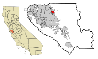
East Foothills is a census-designated place (CDP) in Santa Clara County, California, United States and a neighborhood of San Jose. The population was 8,269 at the 2010 census. The area is more commonly referred to as East San Jose, and is located about 4 miles east of downtown San Jose. This should not be confused with the former city of East San Jose which was annexed by the city of San Jose in 1911. There have remained some unincorporated pockets surrounded by incorporated San Jose which are now part of a city/county agreement to annex the remaining pockets.

South Beach, Florida Census-designated place in Florida, United States

South Beach is a census-designated place (CDP) on Orchid Island in Indian River County, Florida, United States. The population was 3,501 at the 2010 census. It is ranked tenth in Florida locations by per capita income as of 2010.

Fremd Village-Padgett Island was a census-designated place (CDP) in Palm Beach County, Florida, United States. The population was 2,264 at the 2000 census.

Dillard, Georgia City in Georgia, United States

Dillard is a city in Rabun County, Georgia, United States. As of the 2000 census, the city population was 198.

Wailuā Homesteads, Hawaii Census-designated place in Hawaii, United States

Wailua Homesteads is a census-designated place (CDP) in Kauaʻi County, Hawaiʻi, United States. The population was 5,188 at the 2010 census, up from 4,567 at the 2000 census.

Los Chavez, New Mexico CDP in New Mexico, United States

Los Chavez is a census-designated place (CDP) in Valencia County, New Mexico, United States. The population was 5,033 at the 2000 census. It is part of the Albuquerque Metropolitan Statistical Area.

Glenmoor, Ohio Census-designated place in Ohio, United States

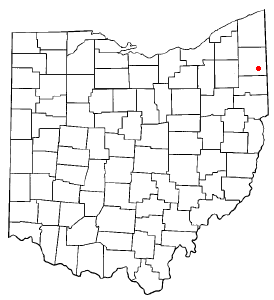
Glenmoor is a census-designated place (CDP) in Columbiana County, Ohio, United States. The population was 1,987 at the 2010 census.

La Croft, Ohio Census-designated place in Ohio, United States

La Croft is a census-designated place (CDP) in Columbiana County, Ohio, United States. The population was 1,144 at the 2010 census.

Vienna Center, Ohio CDP in Ohio, United States

Vienna Center is a census-designated place (CDP) in Vienna Township, Trumbull County, Ohio, in the United States. As of the 2000 census, the CDP population was 994.

Carnot-Moon, Pennsylvania Census-designated place in Pennsylvania, United States

Carnot-Moon is a census-designated place (CDP) in central Moon Township, Allegheny County, Pennsylvania, United States. The population was 11,372 at the 2010 census.

McMurray, Pennsylvania Census-designated place in Pennsylvania, United States

McMurray is a census-designated place (CDP) in Peters Township, Washington County, Pennsylvania. The population was 4,647 at the 2010 census. Its zip code is 15317, which it shares with neighboring borough Canonsburg.

Thompsonville, Pennsylvania Census-designated place in Pennsylvania, United States

Thompsonville is a census-designated place (CDP) in Washington County, Pennsylvania, United States. The population was 3,520 at the 2010 census.

Wolfdale is a census-designated place (CDP) in Washington County, Pennsylvania, United States. The population was 2,888 at the 2010 census.

Grapeville, Pennsylvania CDP in Pennsylvania, United States

Grapeville is a census-designated place (CDP) in Hempfield Township, Westmoreland County, Pennsylvania, United States. The population was 676 at the 2000 census.

Oakland, South Carolina CDP in South Carolina, United States

Oakland is a census-designated place (CDP) in Sumter County, South Carolina, United States. The population was 1,272 at the 2000 census. It is included in the Sumter, South Carolina Metropolitan Statistical Area. Part of the area of the census-designated place is located within the Stateburg Historic District

Bellwood, Virginia CDP in Virginia, United States

Bellwood is a census-designated place (CDP) in Chesterfield County, Virginia, United States. The population was 6,352 at the 2010 census.

Fairwood, Spokane County, Washington CDP in Washington, United States

Fairwood is a census-designated place (CDP) in Spokane County, Washington, United States. The population was 7,905 at the 2010 census.

Cassville, West Virginia CDP in West Virginia, United States

Cassville is a census-designated place (CDP) in Monongalia County, West Virginia, United States. The population was 701 at the 2010 census. It is included in the Morgantown, West Virginia Metropolitan Statistical Area. Cassville was named after Lewis Cass, a prominent American statesman who served as Secretary of War, Secretary of State, and Governor of Michigan.

Ranchettes, Wyoming Census-designated place in Wyoming, United States

Ranchettes is a census-designated place (CDP) in Laramie County, Wyoming, United States. It is part of the Cheyenne, Wyoming Metropolitan Statistical Area. The population was 5,798 at the 2010 census.

References

  1. "US Gazetteer files: 2010, 2000, and 1990". United States Census Bureau. 2011-02-12. Retrieved 2011-04-23.
  2. "U.S. Census website". United States Census Bureau . Retrieved 2008-01-31.