Sutton, Nebraska

Last updated

Sutton, Nebraska
Sutton, Nebraska Saunders Ave 1.JPG
Downtown Sutton: Saunders Avenue, looking north
Clay County Nebraska Incorporated and Unincorporated areas Sutton Highlighted.svg
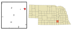
Location of Sutton, Nebraska
Coordinates: 40°36′26″N97°51′32″W / 40.60722°N 97.85889°W / 40.60722; -97.85889
Country United States
State Nebraska
County Clay
Area
[1]
  Total1.75 sq mi (4.52 km2)
  Land1.74 sq mi (4.51 km2)
  Water0.00 sq mi (0.01 km2)
Elevation
[2]
1,677 ft (511 m)
Population
 (2020)
  Total1,447
  Density831.13/sq mi (320.87/km2)
Time zone UTC-6 (Central (CST))
  Summer (DST) UTC-5 (CDT)
ZIP code
68979
Area code 402
FIPS code 31-47955 [3]
GNIS feature ID838277 [2]

Sutton is a city in Clay County, Nebraska, United States. The population was 1,447 at the 2020 census. It is part of the Hastings, Nebraska Micropolitan Statistical Area.

Contents

History

Sutton was laid out in 1871 when the Burlington and Missouri River Railroad was extended to that point. [4] It was named after the town of Sutton, Massachusetts. [5]

Geography

According to the United States Census Bureau, the city has a total area of 1.99 square miles (5.15 km2), all land. [6]

Demographics

Historical population
CensusPop.Note
1890 1,541
1900 1,365−11.4%
1910 1,70224.7%
1920 1,603−5.8%
1930 1,540−3.9%
1940 1,403−8.9%
1950 1,353−3.6%
1960 1,252−7.5%
1970 1,3618.7%
1980 1,4164.0%
1990 1,353−4.4%
2000 1,4476.9%
2010 1,5023.8%
2020 1,447−3.7%
U.S. Decennial Census [7]

2010 census

As of the census [8] of 2010, there were 1,502 people, 612 households, and 414 families living in the city. The population density was 754.8 inhabitants per square mile (291.4/km2). There were 666 housing units at an average density of 334.7 per square mile (129.2/km2). The racial makeup of the city was 93.1% White, 0.1% African American, 1.1% Native American, 0.3% Asian, 4.6% from other races, and 0.7% from two or more races. Hispanic or Latino of any race were 8.6% of the population.

There were 612 households, of which 30.2% had children under the age of 18 living with them, 58.8% were married couples living together, 7.7% had a female householder with no husband present, 1.1% had a male householder with no wife present, and 32.4% were non-families. 30.1% of all households were made up of individuals, and 15.1% had someone living alone who was 65 years of age or older. The average household size was 2.41 and the average family size was 3.02.

The median age in the city was 43.1 years. 25.8% of residents were under the age of 18; 6.5% were between the ages of 18 and 24; 20.6% were from 25 to 44; 25.7% were from 45 to 64; and 21.6% were 65 years of age or older. The gender makeup of the city was 48.9% male and 51.1% female.

2000 census

As of the census [3] of 2000, there were 1,447 people, 586 households, and 407 families living in the city. The population density was 853.4 inhabitants per square mile (329.5/km2). There were 650 housing units at an average density of 383.3 per square mile (148.0/km2). The racial makeup of the city was 97.72% White, 0.07% African American, 0.21% Native American, 0.35% Asian, 1.52% from other races, and 0.14% from two or more races. Hispanic or Latino of any race were 3.80% of the population.

There were 586 households, out of which 30.9% had children under the age of 18 living with them, 62.1% were married couples living together, 4.6% had a female householder with no husband present, and 30.5% were non-families. 28.5% of all households were made up of individuals, and 17.1% had someone living alone who was 65 years of age or older. The average household size was 2.41 and the average family size was 2.97.

In the city, the population was spread out, with 25.6% under the age of 18, 5.5% from 18 to 24, 23.1% from 25 to 44, 22.0% from 45 to 64, and 23.8% who were 65 years of age or older. The median age was 42 years. For every 100 females, there were 87.9 males. For every 100 females age 18 and over, there were 88.0 males.

As of 2000 the median income for a household in the city was $34,830, and the median income for a family was $42,273. Males had a median income of $28,452 versus $20,536 for females. The per capita income for the city was $17,683. About 6.0% of families and 7.9% of the population were below the poverty line, including 13.3% of those under age 18 and 3.9% of those age 65 or over.

Notable people

Related Research Articles

<span class="mw-page-title-main">Larkin Charter Township, Michigan</span> Charter township in Michigan, United States

Larkin Charter Township is a charter township of Midland County in the U.S. state of Michigan. The population was 5,331 at the 2020 census.

<span class="mw-page-title-main">Louisville, Nebraska</span> City in Nebraska, United States

Louisville is a city in northern Cass County, Nebraska, United States. The population was 1,319 at the 2020 census.

<span class="mw-page-title-main">Bennington, Nebraska</span> City in Douglas County, Nebraska, United States

Bennington is a city in Douglas County, Nebraska, United States. The population was 2,026 at the 2020 U.S. Census.

<span class="mw-page-title-main">Valley, Nebraska</span> City in Douglas County, Nebraska, United States

Valley is a city in Douglas County, Nebraska, United States. The population was 3,037 at the 2020 census.

<span class="mw-page-title-main">Beaver City, Nebraska</span> City in Nebraska, United States

Beaver City is a city in Furnas County, on the southern border of Nebraska, United States. The population was 609 at the 2010 census. It is the county seat of Furnas County.

<span class="mw-page-title-main">Burwell, Nebraska</span> City in Nebraska, United States

Burwell is a city in Garfield County, Nebraska, United States. The population was 1,210 at the 2010 census. It is the county seat of Garfield County.

<span class="mw-page-title-main">Bloomfield, Nebraska</span> City in Nebraska, United States

Bloomfield is a city in Knox County, Nebraska, United States. The population was 1,028 at the 2010 census.

<span class="mw-page-title-main">Creighton, Nebraska</span> City in Nebraska, United States

Creighton is a city in Knox County, Nebraska, United States. The population was 1,154 at the 2010 census.

<span class="mw-page-title-main">Syracuse, Nebraska</span> City in Nebraska, United States

Syracuse is a city in Otoe County, Nebraska, United States. The population was 1,941 at the 2020 census.

<span class="mw-page-title-main">Pawnee City, Nebraska</span> City in and county seat of Pawnee County, Nebraska, United States

Pawnee City is a city in and the county seat of Pawnee County, Nebraska, United States. The population was 878 at the 2010 census.

<span class="mw-page-title-main">Grant, Nebraska</span> City in Nebraska, United States

Grant is a city and county seat of Perkins County, Nebraska, United States. The population was 1,165 at the 2010 census.

<span class="mw-page-title-main">Osmond, Nebraska</span> City in Nebraska, United States

Osmond is a city in Pierce County, Nebraska, United States. It is part of the Norfolk, Nebraska Micropolitan Statistical Area. The population was 791 at the 2020 census.

<span class="mw-page-title-main">Bassett, Nebraska</span> City in and county seat of Rock County, Nebraska, United States

Bassett is a city in Rock County, Nebraska, United States. The population was 619 at the 2010 census. It is the county seat of Rock County.

<span class="mw-page-title-main">Crete, Nebraska</span> City in Saline County, Nebraska, United States

Crete is a city in and the most populous municipality of Saline County, Nebraska, United States. The population was 7,099 at the 2020 census. The city is home to Doane University.

<span class="mw-page-title-main">Springfield, Nebraska</span> City in Sarpy County, Nebraska, United States

Springfield is a city in Sarpy County, Nebraska, United States. The population was 1,501 at the 2020 census.

<span class="mw-page-title-main">Ashland, Nebraska</span> City in Saunders County, Nebraska, United States

Ashland is a city in Saunders County, Nebraska, United States. The population was 3,086 at the 2020 census.

<span class="mw-page-title-main">Yutan, Nebraska</span> City in Saunders County, Nebraska, United States

Yutan is a city in Saunders County, Nebraska, United States.

<span class="mw-page-title-main">Stanton, Nebraska</span> Village in and county seat of Stanton County, Nebraska, United States

Stanton is a city in Stanton County, Nebraska, United States. The population was 1,577 at the 2010 census. It is the county seat of Stanton County. Stanton was platted in 1870. Both the city and county are named after Edwin Stanton, secretary of war for president Abraham Lincoln during the American Civil War.

<span class="mw-page-title-main">Fort Calhoun, Nebraska</span> City in Washington County, Nebraska, United States

Fort Calhoun is a city in Washington County, Nebraska, United States. The population was 908 at the 2010 census. The city includes Fort Atkinson, the first fort built west of the Missouri River.

<span class="mw-page-title-main">Pilot Rock, Oregon</span> City in Oregon, United States

Pilot Rock is a city in Umatilla County, Oregon, United States. The population was 1,502 at the 2010 census. It is part of the Pendleton–Hermiston Micropolitan Statistical Area. The main industries are timber and agriculture. Pilot Rock is home to the Boise Cascade /Kinzua Lumber lumber and pole mill as well as Pilot Rock High School. The name of Pilot Rock refers to a large basalt rock formation which is visible from the old Oregon Trail and was used in navigating wagon trains through the area.

References

  1. "ArcGIS REST Services Directory". United States Census Bureau. Retrieved September 18, 2022.
  2. 1 2 U.S. Geological Survey Geographic Names Information System: Sutton, Nebraska
  3. 1 2 "U.S. Census website". United States Census Bureau . Retrieved January 31, 2008.
  4. "Sutton, Clay County". Center for Advanced Land Management Information Technologies. University of Nebraska. Retrieved August 3, 2014.
  5. Fitzpatrick, Lillian L. (1960). Nebraska Place-Names. University of Nebraska Press. p. 43. ISBN   0803250606. A 1925 edition is available for download at University of Nebraska—Lincoln Digital Commons.
  6. "US Gazetteer files 2010". United States Census Bureau. Archived from the original on January 25, 2012. Retrieved June 24, 2012.
  7. "Census of Population and Housing". Census.gov. Retrieved June 4, 2015.
  8. "U.S. Census website". United States Census Bureau . Retrieved June 24, 2012.