Swamps of Belarus

Last updated

Swamp in Bialowieza Forest, on the Belarus-Poland border Puszcza Bialowieska stanowisko 2 13.07.2009 p.jpg
Swamp in Białowieża Forest, on the Belarus–Poland border

Swamps, marshes, mires, bogs, and fens are important parts of the natural landscape in Belarus. Vast swamplands historically covered the country, and currently there are around 2.5 million hectares of wetlands in Belarus. Notable swamp regions are Pinsk Marshes and Olmany swamps in Polesia and Yelnya Swamp in Vitebsk region.

Contents

Names

Swamps, marshes, mires, bogs, and fens are all usually called "Балота" (balota) in Belarusian, [1] though there are many synonyms: Багна, Дрыгва, Гiжня, etc. [2] [3]

Current situation

Swamps in Belarus in 1958 and 2000 SwampsInBelarus (cropped).jpg
Swamps in Belarus in 1958 and 2000

In the early 20th century, almost 40% of the territory, 8 million hectares, were wetlands. Around 2.56 [4] to 2.94 [5] million hectares were swamps and marshes (more than 12% of Belarus's territory). Today, about 4% of the territory is swamps, or 863 thousand hectares. [4] Over half of Belarus's swamps were drained for agricultural and forestry purposes between the 1960s and 1970s, leading to loss of biodiversity, increased droughts and frosts, and depleted groundwater levels in some areas. Efforts to revive and rehydrate drained peatlands in order to restore their ecological functions began in the 2010s. [6] [7] [8] [4]

There are 9,192 swamps in Belarus. [4] Low type peat deposit area is 81.6% (2,103.800 ha), transitional area is 3.4% (106.200 ha), and high one is 15.0% (333.700 ha). [5] Yelnya Swamp, one of the oldest swamps, was formed about 13,000 years ago. [9]

History of melioration

Peat mining near Rudzensk Belarus-Peat Mining near Rudzensk-4.jpg
Peat mining near Rudzensk

The draining of wetlands in Belarus has a long history, going back to the Western Swamp Drainage Reclamation Expedition (1872–1902) (Russian : Западная экспедиция по осушению болот) under the direction of General Iosif Zhilinsky  [ ru ]. This massive project constructed thousands of kilometers of drainage canals throughout Polesia, converting swamps into meadows, arable land, and timber transport waterways. While innovative for its time, it disrupted the natural hydrology of the region. Around 410,000 hectares of swamps were drained. [10]

In 1911, the Minsk Swamp Experimental Station (Russian : Минская болотная опытная станция) was opened, under its first director botanist Alexander Flerov  [ ru ]. It started research on the Kamarouskae swamp  [ be ] in Minsk. By the late 1920s, this swamp covering 218 hectares had been completely drained after works began in 1925. In 1930, the station became the All-Union Research Institute of Soil Science and Melioration, with a goal of systematically studying the wetlands of the Soviet Union. [6] [11]

Belarus has one of the world's largest deposits of peat. Peat has been mined industrially since 1896, and in Soviet times it was the main fuel for power plants. [12]

Large-scale swamp draining efforts were revived in the Soviet era during the 1960s–1970s, with over 60% of Belarus's wetlands being drained, primarily for agriculture and peat mining. Though increasing production in the short term, severe disruption of wetland ecosystems led to soil degradation, groundwater depletion, biodiversity loss, and local climate changes. [8] [4]

Reviving the swamps

Recognizing the important ecological roles that swamps play, including storing carbon, maintaining hydrological cycles, and providing habitat for flora and fauna, Belarus has made efforts since the 2010s to restore portions of its drained peatlands. This "rewetting" process involves techniques like blocking drainage canals to raise water tables. [7]

International environmental organizations like the UN Development Programme have partnered with the Belarus government to fund and execute restoration projects on over 60,000 hectares of degraded peatlands so far. While still a small fraction of what was lost, these restored swamps aim to revive ecological functions and mitigate impacts like wildfires, greenhouse gas emissions, and biodiversity decline caused by draining. [7] [13] [14]

Biodiversity

Belarus's swamps and wetlands host a diverse array of flora and fauna: 267 species of flowering plants and ferns, including 37 woody species, 167 herbaceous species, and 63 species of mosses. The wetlands provide habitat for over 50 valuable medicinal plants, as well as berry plants like cranberry, lingonberry, and bilberry. Rare and threatened species found here include insectivorous plants, sphagnum mosses, cotton grass, and plants listed in the Belarus Red Book. The wetlands are vital for conserving bird populations, sheltering significant portions of European populations of species like the aquatic warbler, black stork, white stork, lesser spotted eagle, and great snipe. Mammal species like elk, raccoon dog, and wolf also depend on these wetlands. Belarus has designated 20 potential territories of international and national importance, covering 2.9% of the country's area, to safeguard this exceptional biodiversity concentrated in fen complexes, bog complexes, river floodplains, forest–floodplain–lake mosaics, fishery ponds, and forests. [5]

In culture

"Marsh. Polissia", painting by Ivan Shishkin, 1890 Marsh. Polissia.jpg
"Marsh. Polissia", painting by Ivan Shishkin, 1890

Swamps played a big role in Belarusian literature, with many authors writing about "swampy land" or "swampy country", like Yakub Kolas's novella The Morass ("Дрыгва", 1933), Yanka Maur's novella The Robinsons of Palesse  [ be ] ("Палескія рабінзоны", 1930), and Ivan Melezh's novel People on the Marshes  [ be ] ("Людзі на балоце", 1962). Uladzimir Karatkevich's novella King Stakh's Wild Hunt ("Дзікае паляванне Караля Стаха", 1964) is set in a swamp area. Swamps are often seen as a symbol of Belarus; swampy lands were the cheapest and their agricultural output was very poor, so the theme of melioration and developing a better land was popular in Soviet times. [15] Belarusian poets described Polesia as the land of swamps and forests. [16] In Victor Martinovich's 2013 novel, Sphagnum, Belarus is compared to a peat moss, sphagnum. [17]

List of largest swamps

NameNative namesPhotoStatusArea (ha)Turf typeCoordinatesDescription
Yelnya Swamp Ельня PANO 20210531 193814.jpg Republican landscape reserve, Ramsar site [18] 18,794 Raised bog 55°33′N27°51′E / 55.550°N 27.850°E / 55.550; 27.850 One of the largest raised bogs in Belarus with numerous lakes scattered throughout. Located in Vitebsk Oblast, Miory district.
Olmany swamps Альманскія балоты
Ольманские болота
Olmanskie swamps in Belarus - May 2021 04.jpg Republican landscape reserve, Ramsar site [19] Poddybiche - 48,292; Vilya - 4,741Raised, transitional, fen 51°47′N27°21′E / 51.783°N 27.350°E / 51.783; 27.350 The largest complex of raised, transitional and fen bogs in Europe located in Stolin district, Brest region.
Pinsk Marshes
(or Pripet Marshes, Polesie Marshe)
Прыпяцкія балоты
Припятские болота
Prypiat.jpg National park, Ramsar siteKandel-Yalovets-Olkhovo - 22,020; Mezhch - 25,326Transitional 52°09′N27°00′E / 52.150°N 27.000°E / 52.150; 27.000 Vast complex of transitional and raised bogs in the extensive floodplain of the Pripyat River in Lelchitsy district, Gomel region.
Yukhvichy SwampЮховичское болотоRepublican landscape reserve1,655Raised bog 56°02′37″N28°36′39″E / 56.0435°N 28.6108°E / 56.0435; 28.6108 Raised bog overgrown with pine and birch in Rossony district, Vitebsk region.
Sporava Swamp  [ be ]Спораўскае балота
Споровские болота
Republican biological reserve, Ramsar site [20] Total: 19,384; Peschanka - 2,224; Berestovets - 2,671; Oborovskoye - 6,597Fen 52°25′N25°19′E / 52.417°N 25.317°E / 52.417; 25.317 Complex of fen floodplain bogs along the Yaselda River in Brest region. Habitat of globally threatened Aquatic Warbler.
Zvanets Swamp  [ be ]ЗванецRepublican biological reserve, Ramsar site [21] 10,441Fen 52°02′N24°52′E / 52.033°N 24.867°E / 52.033; 24.867 One of the largest fen bogs in Europe, habitat for the globally threatened Aquatic Warbler in Drogichin district, Brest region.
Mokh Swamp  [ be ]Мох Ciacierki - Miorski rajon - 2.jpg Republican hydrological reserve4,298Transitional 55°37′21″N27°26′48″E / 55.6226°N 27.4466°E / 55.6226; 27.4466 Regulates water levels of surrounding lakes in Miory district, Vitebsk region. Transition mire with open sections.
Kozyansky SwampsКозьянские болотаRepublican landscape reserve, Ramsar site [22] Obol - 4,900; Yamilshcha - 2,087Raised bog 55°27′N29°21′E / 55.450°N 29.350°E / 55.450; 29.350 Raised bogs with numerous small lakes scattered throughout in Polotsk and Shumilina districts, Vitebsk region.
Domzheritskoye Swamp  [ ru ]Домжерицкое болотоNational park, Ramsar site8,995Raised bog 54°43′27″N28°22′02″E / 54.7241°N 28.3672°E / 54.7241; 28.3672 Large raised bog in Berezinsky Biosphere Reserve, Lepiel district, Vitebsk region. Up to 6 endangered plant species per m2.
Slobodskoye SwampСлободское болотоNational park, Ramsar site2,565Raised bog 54°41′44″N28°36′49″E / 54.6955°N 28.6136°E / 54.6955; 28.6136 Raised bog in Berezinsky Biosphere Reserve, Lepiel district, Vitebsk region. High diversity of endangered plant species.
Osveyskoye Swamp  [ be ]Асвейскае
Освейское
Asvieyskaye Lake 1.jpg Republican landscape reserve, Ramsar site [23] 3,357Raised bog 56°04′N28°09′E / 56.067°N 28.150°E / 56.067; 28.150 Raised bog adjoining Lake Osveya, the second largest natural lake overgrown with peat in Belarus. In Verhnedvinsk district, Vitebsk region.
Servech SwampБолото СервечьRepublican hydrological reserve, Ramsar site [24] Servech - 4,542; B. Sitse - 1,607Raised, fen 54°58′N27°29′E / 54.967°N 27.483°E / 54.967; 27.483 
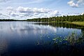
Wetland complex including Lake Servech and Servech River floodplain. Northernmost habitat of the Aquatic Warbler in Belarus. In Dokshitsy district, Vitebsk region.
Vygonoshchanskoye Swamp  [ ru ]Выганашчанскае балота
Болото Выгонощанское
Republican landscape reserve, Ramsar site40,207Fen 52°41′37″N25°49′18″E / 52.6935°N 25.8217°E / 52.6935; 25.8217 One of the largest preserved wetlands on the divide between the Black and Baltic Sea basins in Ivatsevichi and Lyakhovichi districts, Brest region.
Marochna Swamp  [ be ]Марочна
Морочно
Republican wetland reserve, Ramsar siteMarochna - 5,969; Marochna-1 - 1,314Raised bog 51°51′12″N26°35′31″E / 51.8532°N 26.5919°E / 51.8532; 26.5919 Largest raised bog in western Polesie, important cranberry site and water regulator. In Stolin district, Brest region.
Stary Zhaden SwampБолото Старый ЖаденRepublican wetland reserve, Ramsar site [25] Smolyarnya - 3,101; Shchashchits - 3,143Fen, raised bog 51°54′N27°36′E / 51.900°N 27.600°E / 51.900; 27.600 Complex of fen and raised bogs in Zhsykavichy and Lelchycy districts, Gomel region.

Continued:

Duleba Swamp  [ be ]Астравы Дулебы
Болото Дулебское
Ostrova Duleby.jpg Republican hydrological reserve, Ramsar site [26] 30,772Raised bog 53°47′N29°29′E / 53.783°N 29.483°E / 53.783; 29.483 Raised bogs and old-growth forests, former military site, in Klichaw and Byalynichy districts, Mogilev region.
Zaozerye SwampБолото ЗаозерьеRepublican hydrological reserve, Ramsar site4,965Raised bog 53°50′39″N29°27′21″E / 53.8442°N 29.4557°E / 53.8442; 29.4557 Boreal raised bogs in Byalynichy district, Mogilev region.
Dokudovskoye Swamp  [ be ]Дакудаўскае
Докудовское
Dakudauskae balota.JPG Republican biological reserve933Raised bog 53°48′01″N25°26′53″E / 53.8004°N 25.4481°E / 53.8004; 25.4481 Remnant raised bog in Lida district, Grodno region. Swan Lake in center.
Kotrya SwampКотрянское болотоRepublican landscape reserve, Ramsar site6,138Fen 53°49′03″N24°22′01″E / 53.8175°N 24.3670°E / 53.8175; 24.3670 Large forest-bog complex at the headwaters of the Kotra River in Kotra Forest, Shchuchyn district, Grodno region.
Mokhovoye SwampБолото МоховоеNational park983Raised bog 54°54′28″N27°05′43″E / 54.9078°N 27.0953°E / 54.9078; 27.0953 Raised bog surrounding Lake Dyagili in Narochansky National Park, Myadel district, Minsk region.
Gaby Swamp  [ ru ]ГабыNational park4,397Raised bog 54°52′02″N27°19′49″E / 54.8673°N 27.3303°E / 54.8673; 27.3303 Large raised bog with well-developed ridge-hollow complexes in Narochansky National Park, Myadel district, Minsk region.
Lebediny MohЛебединый МохLocal wetland reserve, Ramsar site2,584Transition, raised bog 55°44′05″N29°03′29″E / 55.7347°N 29.0581°E / 55.7347; 29.0581 Complex of forests, bogs and lakes including Lake Stradan in Polatsk district, Vitebsk region.
Drozhbitka SwampБолото ДрожбиткаRepublican wetland reserve, Ramsar site [27] 2,293Fen 55°35′N29°23′E / 55.583°N 29.383°E / 55.583; 29.383 Wetland complex including fens, bogs and 14 lakes in Polatsk district, Vitebsk region.
Dikoe Swamp  [ be ]Дзікое
Дикое
National park, Ramsar site [28] 6,967Fen 52°47′N24°14′E / 52.783°N 24.233°E / 52.783; 24.233 One of the three largest undisturbed fen bogs in Polesie region, located in the watersheds of the Yaselda and Narew rivers. Limited cranberry harvesting occurs. In Belavezhskaya Pushcha National Park.
Zhada Swamp  [ be ]Болото ЖадаRepublican wetland reserve4,555Forest-mire 55°25′45″N28°01′00″E / 55.4291°N 28.0168°E / 55.4291; 28.0168 A large forest-mire massif in the upper reaches of the Plavno River. Part of the swamp was previously drained and has become re-wetted. Includes open raised, transitional bogs and forested wetlands. In the central part there are two dystrophic lakes: Ilovo and Strechnо.
VileityВилейтыRamsar site [29] 8,452Fens and transitional mires 55°15′N26°46′E / 55.250°N 26.767°E / 55.250; 26.767 "a waterlogged forest with a complex of fen and transitional mires, floodplain meadows and marshes, rivers, oxbow lakes and a system of channels overgrown with woods."
Vydrytsa  [ be ]Выдрыца
Выдрица
R. Vydrytsa.jpg Ramsar site [30] 17,403Forested peatlands 52°44′N29°40′E / 52.733°N 29.667°E / 52.733; 29.667 "lies on a floodplain between the Berezina and Vydritsa rivers ... is a system of oxbow lakes, forested peatlands, meadows, marshes, swamps and drainage channels"

Source: [31]

Map

See also

Related Research Articles

<span class="mw-page-title-main">Swamp</span> A forested wetland

A swamp is a forested wetland. Swamps are considered to be transition zones because both land and water play a role in creating this environment. Swamps vary in size and are located all around the world. The water of a swamp may be fresh water, brackish water, or seawater. Freshwater swamps form along large rivers or lakes where they are critically dependent upon rainwater and seasonal flooding to maintain natural water level fluctuations. Saltwater swamps are found along tropical and subtropical coastlines. Some swamps have hammocks, or dry-land protrusions, covered by aquatic vegetation, or vegetation that tolerates periodic inundation or soil saturation. The two main types of swamp are "true" or swamp forests and "transitional" or shrub swamps. In the boreal regions of Canada, the word swamp is colloquially used for what is more formally termed a bog, fen, or muskeg. Some of the world's largest swamps are found along major rivers such as the Amazon, the Mississippi, and the Congo.

<span class="mw-page-title-main">Peat</span> Accumulation of partially decayed vegetation

Peat is an accumulation of partially decayed vegetation or organic matter. It is unique to natural areas called peatlands, bogs, mires, moors, or muskegs. Sphagnum moss, also called peat moss, is one of the most common components in peat, although many other plants can contribute. The biological features of sphagnum mosses act to create a habitat aiding peat formation, a phenomenon termed 'habitat manipulation'. Soils consisting primarily of peat are known as histosols. Peat forms in wetland conditions, where flooding or stagnant water obstructs the flow of oxygen from the atmosphere, slowing the rate of decomposition. Peat properties such as organic matter content and saturated hydraulic conductivity can exhibit high spatial heterogeneity.

<span class="mw-page-title-main">Wetland</span> Type of land area that is flooded or saturated with water

A wetland is a distinct semi-aquatic ecosystem whose groundcovers are flooded or saturated in water, either permanently, for years or decades, or only seasonally for a shorter periods. Flooding results in oxygen-poor (anoxic) processes taking place, especially in the soils. Wetlands form a transitional zone between waterbodies and dry lands, and are different from other terrestrial or aquatic ecosystems due to their vegetation's roots having adapted to oxygen-poor waterlogged soils. They are considered among the most biologically diverse of all ecosystems, serving as habitats to a wide range of aquatic and semi-aquatic plants and animals, with often improved water quality by the plants removing excess nutrients such as nitrates and phosphates.

<span class="mw-page-title-main">Fen</span> Type of wetland fed by mineral-rich ground or surface water

A fen is a type of peat-accumulating wetland fed by mineral-rich ground or surface water. It is one of the main types of wetland along with marshes, swamps, and bogs. Bogs and fens, both peat-forming ecosystems, are also known as mires. The unique water chemistry of fens is a result of the ground or surface water input. Typically, this input results in higher mineral concentrations and a more basic pH than found in bogs. As peat accumulates in a fen, groundwater input can be reduced or cut off, making the fen ombrotrophic rather than minerotrophic. In this way, fens can become more acidic and transition to bogs over time.

<span class="mw-page-title-main">Bog</span> Type of wetland with peat-rich soil

A bog or bogland is a wetland that accumulates peat as a deposit of dead plant materials – often mosses, typically sphagnum moss. It is one of the four main types of wetlands. Other names for bogs include mire, mosses, quagmire, and muskeg; alkaline mires are called fens. A bayhead is another type of bog found in the forest of the Gulf Coast states in the United States. They are often covered in heath or heather shrubs rooted in the sphagnum moss and peat. The gradual accumulation of decayed plant material in a bog functions as a carbon sink.

<span class="mw-page-title-main">Transboundary protected area</span> Conservation region spanning the boundaries of multiple states

A transboundary protected area (TBPA) is an ecological protected area that spans boundaries of more than one country or sub-national entity. Such areas are also known as transfrontier conservation areas (TFCAs) or peace parks.

<span class="mw-page-title-main">Ramsar site</span> Wetland site as designated by the Ramsar Convention

A Ramsar site is a wetland site designated to be of international importance under the Ramsar Convention, also known as "The Convention on Wetlands", an international environmental treaty signed on 2 February 1971 in Ramsar, Iran, under the auspices of UNESCO. It came into force on 21 December 1975, when it was ratified by a sufficient number of nations. It provides for national action and international cooperation regarding the conservation of wetlands, and wise sustainable use of their resources. Ramsar identifies wetlands of international importance, especially those providing waterfowl habitat.

<span class="mw-page-title-main">Burns Bog</span> Peat bog in Delta, British Columbia

Burns Bog is an ombrotrophic peat bog located in Delta, British Columbia, Canada. It is the largest raised peat bog and the largest undeveloped urban land mass on the West Coast of the Americas. Burns Bog was originally 4,000–4,900 hectares before development. Currently, only 3,500 hectares remain of the bog.

<span class="mw-page-title-main">Čepkeliai Marsh</span>

The Čepkeliai Marsh is the largest bog in Lithuania. Located in Varėna District Municipality, south of Marcinkonys village and north of Kotra River, which flows along the Belarus–Lithuania border in this area. Its area is a nature reserve and a Ramsar site.

<span class="mw-page-title-main">Kotra (river)</span> River in Belarus, Lithuania

The Kotra is a 109-kilometre-long (68 mi) river in Belarus and Lithuania. The river is an example of a rare phenomenon of river bifurcation.

<span class="mw-page-title-main">Wetlands of New Zealand</span>

New Zealand has several notable wetlands but 90% of wetland areas have been lost following European settlement.

<i>Aulacomnium palustre</i> Species of moss

Aulacomnium palustre, the bog groove-moss or ribbed bog moss, is a moss that is nearly cosmopolitan in distribution. It occurs in North America, Hispaniola, Venezuela, Eurasia, and New Zealand. In North America, it occurs across southern arctic, subboreal, and boreal regions from Alaska and British Columbia to Greenland and Quebec. Documentation of ribbed bog moss's distribution in the contiguous United States is probably incomplete. It is reported sporadically south to Washington, Wyoming, Georgia, and Virginia.

<span class="mw-page-title-main">Peatland</span> Wetland terrain without forest cover, dominated by living, peat-forming plants

A peatland is a type of wetland whose soils consist of organic matter from decaying plants, forming layers of peat. Peatlands arise because of incomplete decomposition of organic matter, usually litter from vegetation, due to water-logging and subsequent anoxia. Like coral reefs, peatlands are unusual landforms that derive mostly from biological rather than physical processes, and can take on characteristic shapes and surface patterning.

<span class="mw-page-title-main">Meshchyora National Park</span> National park in Russia

Meshchyora National Park covers extensive wetlands and pine/birch woodlands in the Meshchera Lowlands on the East European Plain in Vladimir Oblast, about 120 km east of Moscow. The wetland habitat provides for extremely rich biodiversity among the plants and animals. The area is associated with the medieval Meshchera tribe, from which the area takes its name. "Meshchyora" National Park (Мещёра) is not to be confused with "Meshchersky" (Мещёрский) National Park, which is just to the south, over the border in Ryazan Oblast. The Meshchyora NP is located entirely within the Oka River watershed. A small corner of the park touches on the border of the Moscow region. About 39% of the park territory is used and managed for agricultural purposes by local communities.

<span class="mw-page-title-main">Meshchyorsky National Park</span>

Meshchyorsky National Park covers extensive wetlands and pine/birch woodlands in the Meshchera Lowlands on the East European Plain in the northern section of Ryazan Oblast, Russia, about 120 km east of Moscow. The wetland habitat provides for extremely rich biodiversity among the plants and animals. "Meshchersky" (Мещёрский) National Park is not to be confused with "Meshchyora" (Мещёра) National Park, which is just to the north, over the border in Vladimir Oblast. The park protects a section of the Pra River, Lake Beloye, and associated wetlands and forests. About 54% of the park territory is used and managed for agricultural purposes by local communities.

Paludiculture is wet agriculture and forestry on peatlands. Paludiculture combines the reduction of greenhouse gas emissions from drained peatlands through rewetting with continued land use and biomass production under wet conditions. “Paludi” comes from the Latin “palus” meaning “swamp, morass” and "paludiculture" as a concept was developed at Greifswald University. Paludiculture is a sustainable alternative to drainage-based agriculture, intended to maintain carbon storage in peatlands. This differentiates paludiculture from agriculture like rice paddies, which involve draining, and therefore degrading wetlands.

<span class="mw-page-title-main">Studenčište Marsh</span> Marsh in North Macedonia

Studenchishte Marsh is the last remains of a previously extensive wetland habitat on the eastern shore of ancient Lake Ohrid in North Macedonia. It is also the final major coastline wetland at Lake Ohrid and one of only seven marshes with relict communities that still exist in North Macedonia. With several millennia of natural history, it is a site of key conservation interest and part of the Lake Ohrid Wetland of International Importance under the Ramsar Convention.

<span class="mw-page-title-main">Yelnya Swamp</span> Wetland nature reserve in Belarus

Yelnya Swamp is the biggest swamp complex in Belarus. The swamps cover 253.01 square kilometers and considered to be more than 9000 years old. The Landscape Reserve "Yelnya" was founded in 1968.

<span class="mw-page-title-main">Olmany swamps</span> Wetland area in Belarus

Olmany swamps or Аĺmanskija swamps (Альманскія балоты; Ольманские болота; Olmany swamps reserve or Olmany Mires Zakaznik is a protected area in the Brest Voblast of Belarus. It is one of many important swamps of Belarus and one of the largest natural complexes of bogs in Europe.

<span class="mw-page-title-main">Peatland restoration</span> Restoration of wetlands

Peatland restoration is a term describing measures to restore the original form and function of peatlands, or wet peat-rich areas. This landscape globally occupies 400 million hectares or 3% of land surface on Earth. Historically, peatlands have been drained for several main reasons; peat extraction, creation of agricultural land, and forestry usage. However, this activity has caused degradation affecting this landscape's structure through damage to habitats, hydrology, nutrients cycle, carbon balance and more.

References

  1. Kopach, Aleh. "Grammatical way of naming American and Belarusian swamps." SYMBOLAE EUROPAEAE: 49.
  2. "Люди высокой воды: Полесье. Выживание, покорение природы или устойчивый баланс?". bahna.land (in Russian). Retrieved 30 May 2024.
  3. "Якая розніца між багнай і дрыгвой? Пяцьдзясят адценняў слова "балота"".
  4. 1 2 3 4 5 Груммо, Д.Г.; Козулин, А.В.; Зеленкевич, Н.А.; Созинов, О.В. "Болота Беларуси" (PDF). НАН Беларуси. Retrieved 30 May 2024.
  5. 1 2 3 Bambalov, N; Kozulin, A; Rakovich, V (2005). "Peatlands in Belarus" (PDF). Stapfia 85, zugleich Kataloge der OÖ. Landesmuseen Neue Serie (35): 221–232. Retrieved 30 May 2024.
  6. 1 2 "Зачем осушали полесские болота, и что из этого получилось?". Природа України (in Ukrainian). Retrieved 29 May 2024.
  7. 1 2 3 "Как Беларусь использует повторное заболачивание нарушенных торфяников для сохранения уникального биоразнообразия своих болот". UNDP (in Russian). Retrieved 29 May 2024.
  8. 1 2 "Уничтожим болота и настанет "время Великой суши"". bahna.land (in Russian). Retrieved 29 May 2024.
  9. "Болото Ельня оказалось намного старше, чем предполагали ученые". 34travel.me (in Russian). 19 December 2023. Retrieved 29 May 2024.
  10. Мееровский, А. С.; Филиппов, В. Н. (5 February 2022). "Западная экспедиция по осушению болот в истории мелиорации Беларуси". Мелиорация (in Russian) (4): 52–57. ISSN   2070-4828 . Retrieved 29 May 2024.
  11. "История". niimel.by. Институт мелиорации. Retrieved 3 June 2024.
  12. "Первичный анализ торфяной промышленности Беларуси". bahna.land.
  13. "Экономика восстановленных болот: почему мы инвестировали в реабилитацию болота Жада". UNDP (in Russian). Retrieved 29 May 2024.
  14. "Зачем нам нужно знать о каждом из наших болот?" . Retrieved 30 May 2024.
  15. Gapova, Elena (2 January 2017). ""The Land under the White Wings": The Romantic Landscaping of Socialist Belarus". Rethinking Marxism. 29 (1): 173–198. doi:10.1080/08935696.2017.1316104.
  16. "ПАЛЕССЕ ЯК КАНЦЭПТ У ПАЭЗІІ ЯКУБА КОЛАСА". bsu.by. Retrieved 18 June 2024.
  17. "В Варшаве и онлайн покажут спектакль по роману «Сфагнум» Виктора Мартиновича". belsat.eu.
  18. "Yelnia | Ramsar Sites Information Service". rsis.ramsar.org. Retrieved 31 May 2024.
  19. "Olmany Mires Zakaznik | Ramsar Sites Information Service". rsis.ramsar.org. Retrieved 31 May 2024.
  20. "Sporovsky Biological Reserve | Ramsar Sites Information Service". rsis.ramsar.org. Retrieved 31 May 2024.
  21. "Zvanets | Ramsar Sites Information Service". rsis.ramsar.org. Retrieved 31 May 2024.
  22. "Kozyansky | Ramsar Sites Information Service". rsis.ramsar.org. Retrieved 31 May 2024.
  23. "Osveiski | Ramsar Sites Information Service". rsis.ramsar.org. Retrieved 31 May 2024.
  24. "Servech | Ramsar Sites Information Service". rsis.ramsar.org. Retrieved 31 May 2024.
  25. "Stary Zhaden | Ramsar Sites Information Service". rsis.ramsar.org. Retrieved 31 May 2024.
  26. "Duleby Islands-Zaozerye | Ramsar Sites Information Service". rsis.ramsar.org. Retrieved 31 May 2024.
  27. "Drozbitka-Svina | Ramsar Sites Information Service". rsis.ramsar.org. Retrieved 31 May 2024.
  28. "Dikoe Fen Mire | Ramsar Sites Information Service". rsis.ramsar.org. Retrieved 31 May 2024.
  29. "Vileity | Ramsar Sites Information Service". rsis.ramsar.org. Retrieved 31 May 2024.
  30. "Vydritsa | Ramsar Sites Information Service". rsis.ramsar.org. Retrieved 31 May 2024.
  31. "25 лучших для посещения болот Беларуси". bahna.ngo (in Russian). Retrieved 29 May 2024.

Further reading