Related Research Articles
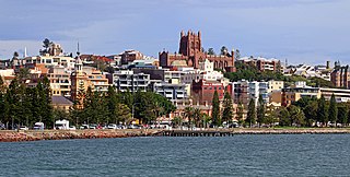
Newcastle, also commonly referred to as Greater Newcastle is a regional metropolitan area and the second-most-populous district of New South Wales, Australia. It includes the cities of Newcastle and Lake Macquarie and it is the hub of the Lower Hunter region, which includes most parts of the cities of Newcastle, Lake Macquarie, Maitland, Cessnock, and Port Stephens Council. Newcastle is also known by its colloquial nickname, Newy.
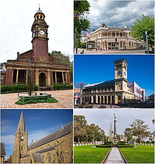
Maitland is a city in the Hunter Valley of New South Wales, Australia and the seat of Maitland City Council, situated on the Hunter River approximately 166 kilometres (103 mi) by road north of Sydney and 35 km (22 mi) north-west of Newcastle. It is on the New England Highway approximately 17 km (11 mi) from its origin at Hexham.
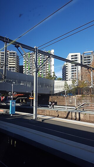
Redfern is an inner southern suburb of Sydney located 3 kilometres (1.9 mi) south of the Sydney central business district and is part of the local government area of the City of Sydney. Strawberry Hills is a locality on the border with Surry Hills. The area experienced the process of gentrification and is subject to extensive redevelopment plans by the state government, to increase the population and reduce the concentration of poverty in the suburb and neighbouring Waterloo.
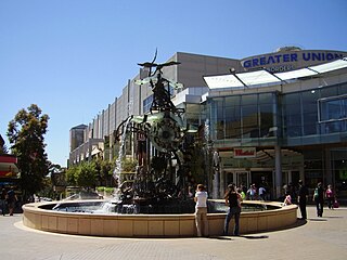
Hornsby is a suburb on the Upper North Shore of Sydney in the state of New South Wales, Australia, approximately 23 kilometres (14 mi) north-west of the Sydney central business district. It is the administrative centre of the local government area of Hornsby Shire.

Hexham is a suburb of the city of Newcastle, about 15 km (9 mi) inland from the Newcastle CBD in New South Wales, Australia on the bank of the Hunter River.

Burwood is a suburb in the Inner West of Sydney, in the state of New South Wales, Australia. It is 10 kilometres (6.2 mi) west of the Sydney central business district and is the administrative centre for the local government area of Municipality of Burwood.

Alexandria is an inner southern suburb of Sydney, New South Wales, Australia. Alexandria is located 5 kilometres south of the Sydney central business district and is part of the local government area of the City of Sydney. The postcode is 2015.

Strathfield railway station is a heritage-listed railway station located on the Main Suburban line in the Sydney suburb of Strathfield in the Municipality of Strathfield local government area of New South Wales, Australia. The station is served by Sydney Trains' T1 North Shore & Western Line, T9 Northern Line and T2 Inner West & Leppington Line suburban services as well as NSW TrainLink Intercity and regional services. The station is located on the Main Northern and Main Western railway lines, forming a major junction for regional and suburban rail services. The station and associated infrastructure was added to the New South Wales State Heritage Register on 2 April 1999.

Telarah railway station is located on the North Coast line in New South Wales, Australia. It serves the western Maitland suburb of Telarah. It is served by NSW TrainLink Hunter Line services.

Morpeth is a suburb of the city of Maitland in the Hunter Region of New South Wales, Australia. It is on the southern banks of the Hunter River at the border between the City of Maitland and Port Stephens Council LGAs. The major population centre, where almost all residents of the suburb reside, is the historical town of Morpeth which takes its name from Morpeth, Northumberland, near Newcastle upon Tyne, in England.

Maitland railway station is located on the Main Northern line in New South Wales, Australia. It serves the city of Maitland opening on in 1880 as West Maitland being renamed Maitland on 1 April 1949. It is the junction station for the Main Northern and North Coast lines. It was added to the New South Wales State Heritage Register on 2 April 1999.

Hamilton railway station is a heritage-listed railway station on the Newcastle line in the inner Newcastle suburb of Hamilton in New South Wales, Australia. It was added to the New South Wales State Heritage Register on 2 April 1999.

Victoria Street railway station is a heritage-listed railway station located on the Main Northern line in New South Wales, Australia. It serves the Victoria Street area of East Maitland. It was added to the New South Wales State Heritage Register on 2 April 1999.

East Maitland railway station is a heritage-listed railway station located on the Main Northern line in New South Wales, Australia serving East Maitland. It is the fourth site of the station known as East Maitland. It was added to the New South Wales State Heritage Register on 2 April 1999.

Greta is a small town in the Hunter Region of New South Wales, Australia.
East Maitland is a suburb in Maitland, New South Wales, Australia. It is on the New England Highway and it has two railway stations, Victoria Street and East Maitland. Both stations are served by NSW TrainLink. Hunter Valley Buses provides bus service.
Bolwarra Heights is a suburb in the City of Maitland in the Hunter Region of New South Wales, Australia. It is located on the eastern side of the Hunter River, approximately 5 km (3.1 mi) north of the Maitland central business district. Mainly a residential suburb, Bolwarra Heights is bordered to the east by Largs. The traditional owners and custodians of the Maitland area are the Wonnarua people.
South Maitland is an inner city suburb in the City of Maitland in the Hunter Region of New South Wales, Australia. It is located immediately south of the New England Highway and Main North railway line, which separate the suburb from the Maitland central business district. Pedestrian overpasses are provided to cross the highway allowing access to both High Street and Maitland stations from South Maitland. The suburb contains a mixture of parkland, rural and residential development, with a population of 471 in 2016.

Dunmore is a largely rural suburb of Shellharbour City in New South Wales, Australia. Dunmore is bisected north to south by the South Coast railway line and the Princes Highway.
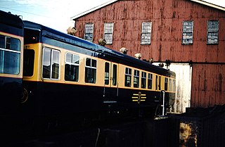
South Maitland Railway Workshops is a heritage-listed former railway workshops and now museum and industrial site at Junction Street, Telarah, New South Wales, Australia. It was added to the New South Wales State Heritage Register on 2 April 1999.
References
- ↑ Australian Bureau of Statistics (28 June 2022). "Telarah (suburb and locality)". Australian Census 2021 QuickStats. Retrieved 28 June 2022.
- ↑ "Origin & meaning". Homeville. Archived from the original on 26 April 2014. Retrieved 25 April 2014.
- ↑ "North Coast Line". www.nswrail.net. Retrieved 23 November 2006.
- ↑ "Aboriginal and Torres Strait Islander Peoples". Maitland City Council. 19 October 2017. Retrieved 8 September 2020.
- ↑ "South Maitland Railway Workshops". New South Wales State Heritage Register . Department of Planning & Environment. H00627. Retrieved 18 May 2018.
 Text is licensed by State of New South Wales (Department of Planning and Environment) under CC-BY 4.0 licence .