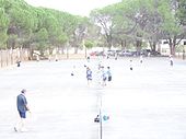
Padthaway is a small town in the Australian state of South Australia located in the state's south-east within the Limestone Coast region about 253 kilometres south east of the state capital of Adelaide and about 41 kilometres south-east of the municipal seat of Bordertown. The name is derived from the Potawurutj, the Aboriginal name word for cover or bury. Padthaway is in the Tatiara District Council, the state electorate of MacKillop and the federal Division of Barker.
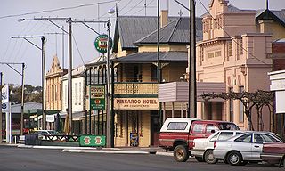
Pinnaroo is a town in the Murray Mallee region of South Australia, near the border with Victoria, 243 km east of Adelaide. Pinnaroo is on the north side of the Mallee Highway, and on the railway line between Tailem Bend and Ouyen. The roadhouse on the highway at Pinnaroo is the first "food and leg-stretch" stop on the bus route from Adelaide to Sydney.
Parilla is a town and a locality in the Australian state of South Australia located in the state's Murray Mallee region about 192 kilometres (119 mi) east of the state capital of Adelaide, about 32 kilometres (20 mi) west of the municipal seat of Pinnaroo and about 14 kilometres (8.7 mi) east of the town of Lameroo.
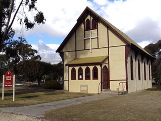
Lameroo is a town in the Murray Mallee region of South Australia. It is on the Mallee Highway and Pinnaroo railway line about 40 km west of the Victorian border, or 210 km east of Adelaide. It is primarily a service town for the surrounding rural areas, growing grain and sheep. Lameroo now includes the former settlements of Kulkami, Mulpata, Wirha and Gurrai, which were on the Peebinga railway line, and Wilkawatt, which was between Parrakie and Lameroo on the Pinnaroo railway.
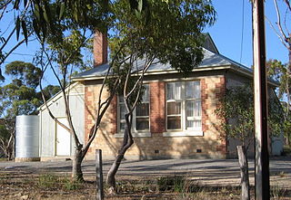
Jabuk is a locality in the Australian state of South Australia located about 142 kilometres (88 mi) south-east of the state capital of Adelaide and respectively about 78 kilometres (48 mi) west and 58 kilometres (36 mi) east of the municipal seats of Pinnaroo and Tailem Bend.

Coonalpyn is a town and a locality in the Australian state of South Australia located about 143 kilometres (89 mi) south-east of the state capital of Adelaide and about 61 kilometres (38 mi) south-east of the municipal seat in Tailem Bend. It is within the local government area of the Coorong District Council, the State electoratal district of MacKillop and the Federal division of Barker.

Wasleys is a small town north-west of Gawler, South Australia. Roseworthy College is located around 6 km (3.7 mi) south of the town.
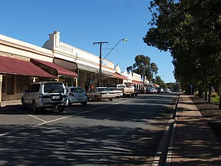
Orroroo is a town in the Yorke and Mid North region of South Australia. At the 2016 census, the locality of Orroroo had a population of 610 while its urban centre had a population of 537. The Wilmington-Ucolta Road passes through here, intersecting with the RM Williams Way which leads to the Birdsville and Oodnadatta Tracks. The Peterborough–Quorn railway line extended from Peterborough to Orroroo also in 1881 and Quorn in 1882, connecting with the new Central Australia Railway from Port Augusta. These railways have now been abandoned. Orroroo is situated near Goyder's Line, a line drawn up in 1865 by Surveyor General Goyder which he believed indicated the edge of the area suitable for agriculture.
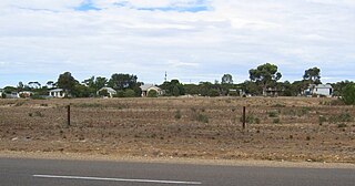
Wynarka is a very small town in South Australia 120 kilometres (75 mi) southeast of Adelaide on the Karoonda Highway (B55) and Loxton railway line in the Murray Mallee. Wynarka lies within the District Council of Karoonda East Murray.
Ungarra is a small swamp town located on the Eyre Peninsula, in the Australian state of South Australia about 248 kilometres (154 mi) from the state's capital, Adelaide and around 80 kilometres (50 mi) north of Port Lincoln. At the 2021 census, Ungarra had a population of 156. This has decreased since the 2006 census, when Ungarra is recorded to have a population of 241.

Coorong District Council is a local government area in South Australia located between the River Murray and the Limestone Coast region. The district covers mostly rural areas with small townships, as well as part of the Coorong National Park.

Smoky Bay is a town and locality located in the Australian state of South Australia on the west coast of the Eyre Peninsula. Previously used as a port, the town is now a residential settlement and popular tourist destination known for its recreational fishing, with a boat ramp and jetty located in the town.

Parrakie, South Australia is a small town on the Mallee Highway and Pinnaroo railway line approximately 26 kilometres west of Lameroo. The name is derived from the Aboriginal word perki which means cave or limestone sink hole. The town was surveyed in 1907.

Paruna is a township in eastern South Australia on the Browns Well Highway, where it crosses the former Barmera railway line, 237 kilometres (147 mi) east of the state capital, Adelaide.

Lake Indawarra is an artificial lake, created as a rubble pit for railway construction, located in the town of Tintinara in the Murray Mallee region of South Australia. The lake was created by railroad workers in 1905 as a railway reservoir and was given its name in the 1980s. It is an important part of Tintinara's identity, a popular place for picnics, camping, swimming and canoeing.
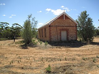
Maggea is a town and locality in the Murray Mallee region of South Australia. It is on the Stott Highway between Swan Reach and Loxton and was on the former Waikerie railway line. The town is almost deserted now that the railway line has closed.
In South Australia, one of the states of Australia, there are many areas which are commonly known by regional names. Regions are areas that share similar characteristics. These characteristics may be natural such as the Murray River, the coastline, desert or mountains. Alternatively, the characteristics may be cultural, such as common land use. South Australia is divided by numerous sets of regional boundaries, based on different characteristics. In many cases boundaries defined by different agencies are coterminous.
Karte is a town and a locality in the Australian state of South Australia located in the state’s east about 192 kilometres (119 mi) east of the state capital of Adelaide, about 30 kilometres (19 mi) north-west of the municipal seat of Pinnaroo and about 35 kilometres (22 mi) north-east of the town of Lameroo.
Mount Boothby Conservation Park, formerly the Mount Boothby National Park, is a protected area in the Australian state of South Australia located in the locality of Field about 147 kilometres (91 mi) south-east of the state capital of Adelaide and about 14 kilometres (8.7 mi) west of the Culburra town centre on the Dukes Highway.
Mount Clarence Station is a locality in the Australian state of South Australia located about 771 kilometres (479 mi) north-west of the state capital of Adelaide and about 37 kilometres (23 mi) west of the town of Coober Pedy.

