Tourism in Namibia

Last updated

the plains zebra, an example of Namibian wildlife L15zebras.jpg
the plains zebra, an example of Namibian wildlife
the Wolwedans Dunes Lodge, an example of lodges in the Namib (
.mw-parser-output .geo-default,.mw-parser-output .geo-dms,.mw-parser-output .geo-dec{display:inline}.mw-parser-output .geo-nondefault,.mw-parser-output .geo-multi-punct,.mw-parser-output .geo-inline-hidden{display:none}.mw-parser-output .longitude,.mw-parser-output .latitude{white-space:nowrap}
25deg05'47''S 15deg58'09''E / 25.0965degS 15.9693degE / -25.0965; 15.9693 Wolwedans Dunes Lodge, Namibia (2017).jpg
the Wolwedans Dunes Lodge, an example of lodges in the Namib ( 25°05′47″S15°58′09″E / 25.0965°S 15.9693°E / -25.0965; 15.9693

Tourism in Namibia is a major industry, contributing N$7.2 billion ( equal to US$ 390 million ) to the country's gross domestic product. Annually, over one million travelers visit Namibia, with roughly one in three coming from South Africa, then Germany and finally the United Kingdom, Italy and France. The country is among the prime destinations in Africa and is known for ecotourism which features Namibia's extensive wildlife. [1]

Contents

In December 2010, Lonely Planet named Namibia 5th best tourist destination in the world in terms of value. [2]

History

The first rough estimate took place in 1989, when it was predicted that 100,000 non-domestic tourists stayed in the country. This figure has risen over time to 1,176,000 visitors in 2014.[ citation needed ]

Employment

In 1996, around 600 jobs were related directly to the country's tourism sector.[ dubious discuss ] In 2008 it was estimated that 77,000 jobs directly or indirectly depend on Namibia's tourism, amounting to 18.2% of all formal jobs in Namibia. [3] Tourism in Namibia also has had a positive impact on resource conservation and rural development. Some 50 communal conservancies have been established across the country, covering 11.8 million hectares of land and resulting in enhanced land management [1] while providing tens of thousands of rural Namibians with much-needed income.[ citation needed ]

Rankings and evaluation

Lonely Planet ranked Namibia fifth on a world-wide chart of value-for-money destinations in 2010. [4] In 2020, Namibia ranked 13th out of 30 of the world’s top 30 emerging travel destinations for 2020 by TravelLemming.com. During this awards. [5] The Etosha National Park, Fish River Canyon, Sossusvlei and the Namib-Naukluft National Park have been selected as Namibia’s top attractions. [5]

Tourist destinations

Windhoek

Windhoek skyline Windhoek-Skyline.jpg
Windhoek skyline

Windhoek, the capital and biggest city, is the main entrance point for people flying into the country, usually at Windhoek Hosea Kutako International Airport. Important tourist sites in Windhoek include: the Tintenpalast, (which is the seat of both the National Council and the National Assembly), Windhoek Country Club Resort (opened in 1995 as host to the Miss Universe 1995 and is one of the premier hotels and golf tournaments in the country), Zoo Park and other places. Windhoek also has the first five star hotel in the country known as Hilton Windhoek (opened in 2011 marking Hilton's 50th hotel in the Middle East and Africa.) [6]

Walvis Bay

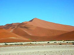
Dunes near Walvis Bay Dune 7 in the Namib Desert.jpeg
Dunes near Walvis Bay

Walvis Bay, as the second biggest town in Namibia and the main port of the country. The town is served by the Walvis Bay International Airport. Geographically, the town is uniquely situated. It is the meeting place of extreme landscapes – on the one side the Namib desert, the oldest desert in the world, and on the other side a massive lagoon and harbour flowing from the Atlantic Ocean. Both of these landscapes lend themselves towards some of the most unusual sightseeing opportunities in Namibia.

The lagoon and harbour is home to various species and large numbers of sea mammals and bird life. The Namib desert on the other side is called "The Living Desert", because of the large number of living species found there.

Walvis Bay is a tourist hotspot that offers a number of activities. Water-related activities include shore angling, boat angling, shark angling, sightseeing and photographic boat cruises, sea kayaking, wind- and kite surfing. Every year Walvis Bay hosts one of the international legs of speed kite and windsurfing competitions.

Land activities include Sandwich Harbour sightseeing tours, desert sightseeing tours, 4X4 dune driving tours into the majestic dunes south of the Kuiseb river, dune hang gliding, dune boarding and dune skiing, guided educational, historic and anthropologic quad biking tours into the Kuiseb Delta, visits to the Topnaar people, descendants of the Khoin-Khoin, and living desert tours.

Swakopmund

Swakopmund (2017)

22deg40'51''S 014deg31'17''E / 22.68083degS 14.52139degE / -22.68083; 14.52139 Seebrucke Swakopmund, Namibia.jpg
Swakopmund (2017)
22°40′51″S014°31′17″E / 22.68083°S 14.52139°E / -22.68083; 14.52139

Swakopmund is a beach resort and an example of German colonial architecture. It was founded in 1892 as the main harbour for German South-West Africa. Attractions include spectacular sand dunes near Langstrand south of the Swakop River. The city is known for extreme sports. Nearby is a farm that offers camel rides to tourists and the Martin Luther steam locomotive, dating from 1896 and abandoned in the desert. The city is also known for its surf culture being located close to the famous Skeleton Coast

The Swakopmund Skydiving Club has operated from the Swakopmund Airport since 1974.

National Parks

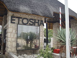
Entrance to Etosha National Park in March 2007 Etoshagate.JPG
Entrance to Etosha National Park in March 2007

Namibia has many prominent National Parks, the oldest, most visited and best known is Etosha National Park. Other national parks in Namibia are:

*In November 2012, the Namibian government approved the renaming of the Sperrgebiet National Park to Tsau ǁKhaeb (Sperrgebiet) National Park. Tsau ǁKhaeb derives from the local Nama language and means "deep sandy soils". [7]

Kaokoveld

Koakoveld (also known as 'Kaokoland'), remains one of the country's most pristine regions. [8] Puros Lodge and Okahirongo Elephant Lodge offer accommodation in an area regularly visited by desert elephants. [9]

Extreme Sports

Namibia's harsh climate and arid conditions make the country a top spot for different extreme sport events like desert runs and ultra-triathlons.

One such event, the 2009 250 km RacingThePlanet: Namibia ultramarathon through the Fish River Canyon, across the Namib Desert, and along the Skeleton Coast to Lüderitz had 213 runners from 38 countries start the 7-day, 6-stage race and 167 finish.

The Namibia Tourism Board

The Namibia Tourism Board (NTB) was established by an Act of Parliament: the Namibia Tourism Board Act, 2000 (Act 21 of 2000). Its primary objectives are to regulate the tourism industry and to market Namibia as a tourist destination. As a statutory body, the NTB is the only legal national tourism organization or authority in Namibia mandated by Government to regulate the industry. [10] [11] The following sectors of business within or relating to the Namibian tourism industry are sectors that are regulated by the Namibia Tourism Board: [12]

Trade Associations

There are a number of trade associations that represent the tourism sector in Namibia, they include the following: [13]

  1. Namibia Travel & Tourism Forum
  2. Federation of Namibia Tourism Associations (the umbrella body for all tourism associations in Namibia) [13]
  3. Hospitality Association of Namibia
  4. Association of Namibian Travel Agents
  5. Car Rental Association of Namibia
  6. Tour and Safari Association of Namibia

Statistics

Most visitors arriving to Namibia were from the following countries of nationality: [14]

Country2016201520142013
Flag of Angola.svg  Angola 420,763492,866519,191477,828
Flag of South Africa.svg  South Africa 355,391381,854329,850317,563
Flag of Zambia.svg  Zambia 240,117168,899167,407167,044
Flag of Germany.svg  Germany 124,15293,93991,90084,121
Flag of Zimbabwe.svg  Zimbabwe 87,18178,20567,80962,778
Flag of Botswana.svg  Botswana 54,96050,90840,31136,556
Flag of the United Kingdom.svg  United Kingdom 32,71227,36529,01625,351
Flag of the United States.svg  United States 28,65926,33925,29121,884
Flag of France.svg  France 23,79420,59820,54916,837
Flag of the Netherlands.svg  Netherlands 20,59614,53912,01510,782
Total1,574,1481,519,6181,477,5931,372,602

See also

Related Research Articles

<span class="mw-page-title-main">Geography of Namibia</span>

At 824,292 km2 (318,261 sq mi), Namibia is the world's thirty-fourth largest country. After Mongolia, Namibia is the second least densely populated country in the world. Namibia got its name from the Namib desert that stretches along the coast of the Atlantic. It is also known for its wildlife.

<span class="mw-page-title-main">Walvis Bay</span> Coastal town in Namibia

Walvis Bay is a city in Namibia and the name of the bay on which it lies. It is the second largest city in Namibia and the largest coastal city in the country. The city covers an area of 29 square kilometres (11 sq mi) of land. The bay is a safe haven for sea vessels because of its natural deep-water harbour, protected by the Pelican Point sand spit, being the only natural harbour of any size along the country's coast. Being rich in plankton and marine life, these waters also draw large numbers of southern right whales, attracting whalers and fishing vessels.

<span class="mw-page-title-main">Namib</span> Desert in Southern Africa

The Namib is a coastal desert in Southern Africa. According to the broadest definition, the Namib stretches for more than 2,000 kilometres (1,200 mi) along the Atlantic coasts of Angola, Namibia, and northwest South Africa, extending southward from the Carunjamba River in Angola, through Namibia and to the Olifants River in Western Cape, South Africa. The Namib's northernmost portion, which extends 450 kilometres (280 mi) from the Angola-Namibia border, is known as Moçâmedes Desert, while its southern portion approaches the neighboring Kalahari Desert. From the Atlantic coast eastward, the Namib gradually ascends in elevation, reaching up to 200 kilometres (120 mi) inland to the foot of the Great Escarpment. Annual precipitation ranges from 2 millimetres (0.079 in) in the aridest regions to 200 millimetres (7.9 in) at the escarpment, making the Namib the only true desert in southern Africa. Having endured arid or semi-arid conditions for roughly 55–80 million years, the Namib may be the oldest desert in the world and contains some of the world's driest regions, with only western South America's Atacama Desert to challenge it for age and aridity benchmarks.

<span class="mw-page-title-main">Namib-Naukluft National Park</span> National park in Namibia

The Namib-Naukluft Park is a national park in western Namibia, situated between the coast of the Atlantic Ocean and the edge of the Great Escarpment. It encompasses part of the Namib Desert, the Naukluft mountain range, and the lagoon at Sandwich Harbour. The best-known area of the park and one of the main visitor attractions in Namibia is Sossusvlei, a clay pan surrounded by dunes, and Sesriem, a small canyon of the Tsauchab. The desert research station of Gobabeb is situated within the park.

<span class="mw-page-title-main">Kuiseb River</span> River in Erongo, Namibia

The Kuiseb River is an ephemeral river in western-central Namibia. Its source is in the Khomas Highland west of Windhoek. From there it flows westwards through the Namib-Naukluft National Park and the Namib desert to Walvis Bay. Several settlements of the Topnaar people are on the banks of the lower Kuiseb, for instance Homeb, Sandfontein, Rooibank, and Utuseb. Inflows of the Kuiseb are Gomab, Ojab, Chausib, Gaub, Koam, Nausgomab and Goagos.

<span class="mw-page-title-main">Sandboarding</span> Boardsport

Sandboarding is a boardsport and extreme sport similar to snowboarding that involves riding across or down a sand dune while standing on a board, either with both feet strapped in or while standing loose, without bindings. Sandboarding can also be practised sitting down or lying on the belly or the back. It typically involves a sandboard, although it is also possible to use sleds, surfboards, a skateboard deck, or snowboards.

<span class="mw-page-title-main">Swakopmund</span> City in Erongo, Namibia

Swakopmund is a city on the coast of western Namibia, 352 km (219 mi) west of the Namibian capital Windhoek via the B2 main road. It is the capital of the Erongo administrative district. As of 2011, the town had 44,725 inhabitants and 196 km2 (76 sq mi) of land. In 2023, the population had increased to 75,921 people.

<span class="mw-page-title-main">TransNamib</span> Railway operator in Namibia

TransNamib Holdings Limited, commonly referred to as TransNamib, is a state-owned railway company in Namibia. Organised as a holding company, it provides both rail and road freight services, as well as passenger rail services. Its headquarters are in the country’s capital Windhoek.

<span class="mw-page-title-main">Solitaire, Namibia</span> Settlement in Khomas Region, Namibia

Solitaire is a small settlement in the Khomas Region of central Namibia near the Namib-Naukluft National Park. It currently features the only gasoline station, bakery, cafe, and the only general dealer between the dunes at Sossusvlei and the coast at Walvis Bay, as well as on the road to the capital Windhoek. Solitaire belongs to the Windhoek Rural electoral constituency.

<span class="mw-page-title-main">Sossusvlei</span> Salt and clay pan in the Namib Desert, Namibia

Sossusvlei is a salt and clay pan surrounded by high red dunes, located in the southern part of the Namib Desert, in the Namib-Naukluft National Park of Namibia. The name "Sossusvlei" is often used in an extended meaning to refer to the surrounding area. These landmarks are some of the major visitor attractions of Namibia.

Sandwich Harbour, also known as Sandwich Bay, Sandvishawe, Sandvisbaai and Sandfisch Bai is an area on the Atlantic coast of Namibia that includes a bay in the north and a lagoon at the southern end. Sandwich Harbour might have been named after an English whaling ship, the Sandwich, which worked during the 1780s, or the name may be a corruption of the German word "sandfische", a species of shark found in the area. Formerly, the bay was a moderately-sized commercial port based around whaling and small-scale fishing, but it is now best known for its birdlife in the lagoon to the south of the bay.

<span class="mw-page-title-main">Tsauchab</span> River in central Namibia

The Tsauchab is an ephemeral river in the Hardap Region of central Namibia. Its source is in the southern Naukluft Mountains, from where it flows westwards through the Namib-Naukluft National Park into Sossusvlei, an endorheic basin. The lower river has in the past had a slightly different courses and also formed two other basins, the Deadvlei and the Hiddenvlei.

<span class="mw-page-title-main">Tsau ǁKhaeb Sperrgebiet National Park</span> Diamond mining area in the Namib Desert, southwestern Namibia

The Tsau ǁKhaeb (Sperrgebiet) National Park, formerly known as Sperrgebiet, is a diamond mining area in southwestern Namibia, in the Namib Desert. It spans the Atlantic Ocean-facing coast from Oranjemund on the border with South Africa, to around 72 kilometres (45 mi) north of Lüderitz, a distance of 320 km (200 mi) north. It extends to around 100 km (62 mi) inland, and its total area of 26,000 km2 (10,000 sq mi), makes up three percent of Namibia's land mass. However, mining only takes place in five percent of the Sperrgebiet, with most of the area acting as a buffer zone. Members of the public are banned from entering most of the area, despite the creation of a national park there in 2004.

<span class="mw-page-title-main">B2 road (Namibia)</span> National highway of Namibia

B2 is a major road in Namibia. The highway runs east–west between the major sea port of Walvis Bay and the nation's capital Windhoek.

<span class="mw-page-title-main">Walvis Bay railway station</span> Railway station in Namibia

Walvis Bay railway station is a railway station serving the port city of Walvis Bay in Namibia. It is part of the TransNamib railway network.

<span class="mw-page-title-main">Rail transport in Namibia</span>

The rail service in Namibia is provided by TransNamib. The Namibian rail network consists of 2,687 km of tracks (2017).

Utuseb is a small settlement in the Erongo Region in western central Namibia. It is situated in the Namib Desert, approximately 40 kilometres (25 mi) from Walvis Bay on the banks of Kuiseb River. Utuseb has approximately 700 inhabitants and belongs to the Walvis Bay Rural electoral constituency. The people living here belong to the ǂAonin community, a subtribe of the Nama people.

<span class="mw-page-title-main">Dorob National Park</span> National park of Namibia

The Dorob National Park is a protected area in the Erongo region, along the central Namibian coast, gazetted as a national park under the Nature Conservation Ordinance No.4 of 1975 on 1 December 2010. It is 1,600 kilometres (990 mi) in length, and with Namib-Naukluft Park it covers an area of 107,540 square kilometres (41,520 sq mi).

The Topnaar people (ǂAonin) are a clan of the Nama people in Namibia. Their settlements are all situated on the Kuiseb River in the Erongo Region of central Namibia, the largest one is Utuseb.

References

  1. 1 2 Hartman, Adam (30 September 2009). "Tourism in good shape - Minister". The Namibian .
  2. Namibia gets top tourist accolade Archived 2010-12-25 at the Wayback Machine The Namibian, 22 December 2010
  3. "A Framework/Model to Benchmark Tourism GDP in South Africa". Pan African Research & Investment Services. March 2010. p. 34.
  4. Kisting, Denver (22 December 2010). "Namibia gets top tourist accolade". The Namibian. Archived from the original on 2010-12-25.
  5. 1 2 "'Namibia is the future of adventure tourism'- Namibia ranks among 2020's top travel destinations | Namibia Economist" . Retrieved 2023-05-16.
  6. "Hilton Windhoek Opens As Hilton Worldwide's 50th Hotel In The Middle East And Africa". May 27, 2011. Archived from the original on 2012-05-10.
  7. "Sperrgebiet renamed to Tsau //Khaeb - Travel News Namibia". travelnewsnamibia.com. Archived from the original on 2012-12-21.
  8. "Kaokoveld (Kaokoland)". Archived from the original on 2019-04-25.
  9. "My Namibia ™".
  10. "Namibia Tourism Board | Namibia Information". businessdirectory.na. Archived from the original on 2014-04-01. Retrieved 2015-12-07.
  11. "Namibia Tourism Board". www.namibia-1on1.com. Retrieved 2015-12-07.
  12. "Government Gazette of the Republic of Namibia" (PDF). Archived from the original (PDF) on 2016-12-27. Retrieved 2017-08-26.
  13. 1 2 "FENATA | Federation of Namibian Tourism Association in Namibia". www.fenata.org. Archived from the original on 2016-03-08. Retrieved 2016-03-08.
  14. Tourist Statistical Report 2016