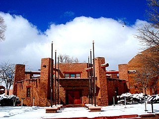
Apache Flats is a populated place situated with the city of Sierra Vista in Cochise County, Arizona. It has an estimated elevation of 4,951 feet (1,509 m) above sea level.

Apache Wells is a populated place situated within the boundaries of Mesa in Maricopa County, Arizona. It has an estimated elevation of 1,427 feet (435 m) above sea level.

Greer Place is a populated place situated in Apache County, Arizona. It has an estimated elevation of 5,463 feet (1,665 m) above sea level.

Heap Place is a populated place situated in Apache County, Arizona. It has an estimated elevation of 5,577 feet (1,700 m) above sea level.

Horse Mesa is a populated place situated along the border with New Mexico in Apache County, Arizona. It is one of two populated places in the state with this name, the other being situated in Maricopa County. It has an estimated elevation of 5,653 feet (1,723 m) above sea level.

Hunt is a populated place situated on the Little Colorado River at the mouth of Concho Creek in Apache County, Arizona. It is named after Colonel James Hunt, who served at Fort Apache in the 1870s. It has an estimated elevation of 5,433 feet (1,656 m) above sea level.

Navajo is a populated place situated in Apache County, Arizona. It has an estimated elevation of 5,676 feet (1,730 m) above sea level.

Paulcell Place is a populated place situated in Apache County, Arizona. It has an estimated elevation of 5,312 feet (1,619 m) above sea level.

Potter Place is a populated place situated in Apache County, Arizona. It has an estimated elevation of 5,554 feet (1,693 m) above sea level.

Salina, also known as Salina Springs, Salinas Springs, and Tselani, is a populated place situated in Apache County, Arizona. It has an estimated elevation of 6,542 feet (1,994 m) above sea level. The name of Salina became official as a result of decision by the Board on Geographic Names in 1960.

Sand Springs is a populated place situated in Apache County, Arizona. It is one of two locations in Arizona with this name, the other being located in Coconino County. It has an estimated elevation of 5,092 feet (1,552 m) above sea level.

Tahchee is a populated place situated in Apache County, Arizona. It has an estimated elevation of 6,653 feet (2,028 m) above sea level.

Tes Nez Iah is a populated place situated in the far north of Apache County, Arizona, just south of the Colorado border. It is along the banks of the Chinle Wash, approximately four miles west of Mexican Water. It has an estimated elevation of 4,751 feet (1,448 m) above sea level. The name is derived from the Navajo t'iis nééz íí'á, meaning "tall cottonwood trees".

Three Forks is a populated place situated in Apache County, Arizona. It has an estimated elevation of 8,225 feet (2,507 m) above sea level.

Totacon, also known as Sweetwater, Tolacon, and Totlacon, is a populated place situated in Apache County, Arizona. It has an estimated elevation of 5,348 feet (1,630 m) above sea level.

Troweek is a populated place situated in Apache County, Arizona, right along the state border with New Mexico. It has an estimated elevation of 8,448 feet (2,575 m) above sea level.

Twin Falls is a populated place situated in Apache County, Arizona, along the border with New Mexico. It has an estimated elevation of 6,391 feet (1,948 m) above sea level.

Wheatfields is a populated place situated in Apache County, Arizona, right along the border with New Mexico. It has an estimated elevation of 7,287 feet (2,221 m) above sea level. It is one of two places in Arizona with this name, the other being a CDP in Gila County.

Woodspring Trading Post, Arizona is a populated place situated in Apache County, Arizona. It has an estimated elevation of 6,913 feet (2,107 m) above sea level.

Yazzi is a populated place situated in Apache County, Arizona. It has an estimated elevation of 6,240 feet (1,900 m) above sea level.


