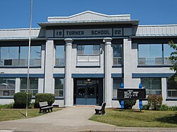
Turner, Oregon

Last updated

Turner, Oregon
Turner Oregon School.JPG
Turner Elementary School (built as the K-12 Turner School)
Motto: 
The Good Neighbor Town
Marion County Oregon Incorporated and Unincorporated areas Turner Highlighted.svg
Location in Oregon
Coordinates: 44°50′56″N122°57′07″W / 44.84889°N 122.95194°W / 44.84889; -122.95194
Country United States
State Oregon
County Marion
Incorporated 1905
Government
   Mayor Steve Horning[ citation needed ]
Area
[1]
  Total1.45 sq mi (3.76 km2)
  Land1.43 sq mi (3.71 km2)
  Water0.02 sq mi (0.05 km2)
Elevation
[2]
407 ft (124 m)
Population
 (2020) [3]
  Total2,944
  Density1,712.49/sq mi (661.26/km2)
Time zone UTC-8 (Pacific)
  Summer (DST) UTC-7 (Pacific)
ZIP codes
97359, 97392
Area code 503
FIPS code 41-75150 [4]
GNIS feature ID2412115 [2]
Website http://www.cityofturner.org/

Turner is a city in Marion County, Oregon, United States. The population was 2,944 at the 2020 census. It is part of the Salem Metropolitan Statistical Area. The community was incorporated by the Oregon Legislative Assembly on February 10, 1905. [5]

Contents

Since 1971, it is the location of the Enchanted Forest amusement park.

Geography

According to the United States Census Bureau, the city has a total area of 1.45 square miles (3.76 km2), of which, 1.43 square miles (3.70 km2) is land and 0.02 square miles (0.05 km2) is water. [6] Turner is situated near Mill Creek, a Tributary of Willamette. [7]

Demographics

Historical population
CensusPop.Note
1880 85
1910 191
1920 28951.3%
1930 283−2.1%
1940 41446.3%
1950 61047.3%
1960 77026.2%
1970 8469.9%
1980 1,11631.9%
1990 1,28114.8%
2000 1,199−6.4%
2010 1,85454.6%
2020 2,45432.4%
U.S. Decennial Census [8] [3]

2010 census

As of the census of 2010, there were 1,854 people, 710 households, and 513 families living in the city. The population density was 1,296.5 inhabitants per square mile (500.6/km2). There were 768 housing units at an average density of 537.1 per square mile (207.4/km2). The racial makeup of the city was 93.2% White, 0.6% African American, 1.7% Native American, 0.5% Asian, 2.0% from other races, and 2.0% from two or more races. Hispanic or Latino of any race were 7.3% of the population. [4]

There were 710 households, of which 33.1% had children under the age of 18 living with them, 57.6% were married couples living together, 8.9% had a female householder with no husband present, 5.8% had a male householder with no wife present, and 27.7% were non-families. 23.5% of all households were made up of individuals, and 15.3% had someone living alone who was 65 years of age or older. The average household size was 2.61 and the average family size was 3.07. [4]

The median age in the city was 39 years. 25.5% of residents were under the age of 18; 7.1% were between the ages of 18 and 24; 24.8% were from 25 to 44; 24.4% were from 45 to 64; and 18.3% were 65 years of age or older. The gender makeup of the city was 48.1% male and 51.9% female. [4]

2000 census

As of the census of 2000, there were 1,199 people, 491 households, and 330 families living in the city. The population density was 778.0 inhabitants per square mile (300.4/km2). There were 522 housing units at an average density of 338.7 per square mile (130.8/km2). The racial makeup of the city was 93.83% White, 0.08% African American, 1.67% Native American, 0.25% Asian, 2.00% from other races, and 2.17% from two or more races. Hispanic or Latino of any race were 4.34% of the population. [4]

There were 491 households, out of which 27.1% had children under the age of 18 living with them, 56.8% were married couples living together, 7.1% had a female householder with no husband present, and 32.6% were non-families. 27.5% of all households were made up of individuals, and 20.0% had someone living alone who was 65 years of age or older. The average household size was 2.44 and the average family size was 2.99. [4]

In the city, the population was spread out, with 23.8% under the age of 18, 7.4% from 18 to 24, 24.3% from 25 to 44, 22.4% from 45 to 64, and 22.1% who were 65 years of age or older. The median age was 41 years. For every 100 females, there were 92.8 males. For every 100 females age 18 and over, there were 88.5 males. [4]

The median income for a household in the city was $36,250, and the median income for a family was $43,906. Males had a median income of $38,125 versus $23,636 for females. The per capita income for the city was $26,234. About 4.8% of families and 9.2% of the population were below the poverty line, including 9.8% of those under age 18 and 7.3% of those age 65 or over. [4]

Education

Turner is serviced by the Cascade School District, [9] which operates Cascade Senior High School, Cascade Junior High, and Three Elementary Schools.

Notable people

See also

Related Research Articles

<span class="mw-page-title-main">Haines, Oregon</span> City in Oregon, United States

Haines is a city in Baker County, Oregon, United States. The population was 416 at the 2010 census.

<span class="mw-page-title-main">Canyonville, Oregon</span> City in Oregon, United States

Canyonville is a city in Douglas County, Oregon, United States. The population was 1,884 at the 2010 census. The main regional tourist attraction, the Seven Feathers Casino Resort is in Canyonville.

<span class="mw-page-title-main">Glendale, Oregon</span> City in Oregon, United States

Glendale is a city in Douglas County, Oregon, United States. The population was 874 at the 2010 census.

<span class="mw-page-title-main">Dunes City, Oregon</span> City in Oregon, United States

Dunes City is a city in Lane County, Oregon, United States. The population was 1,303 at the 2010 census.

<span class="mw-page-title-main">Harrisburg, Oregon</span> City in Oregon, United States

Harrisburg is a city in Linn County, Oregon, United States. The population was 3,567 at the 2010 census.

<span class="mw-page-title-main">Lyons, Oregon</span> City in Oregon, United States

Lyons is a city in Linn County, Oregon, United States. The population was 1,161 at the 2010 census. The center of population of Oregon is located in Lyons.

<span class="mw-page-title-main">Scio, Oregon</span> City in Oregon, United States

Scio is a city in Linn County, Oregon, United States. The population was 838 at the 2010 census.

<span class="mw-page-title-main">Sodaville, Oregon</span> City in Oregon, United States

Sodaville is a city in Linn County, Oregon, United States. The population was 308 at the 2010 census.

<span class="mw-page-title-main">Donald, Oregon</span> City in Oregon, United States

Donald is a city in Marion County, Oregon, United States. The population was 1,009 at the 2020 census. It is part of the Salem Metropolitan Statistical Area.

<span class="mw-page-title-main">Gervais, Oregon</span> City in Oregon, United States

Gervais is a city in Marion County, Oregon, United States. The population was 2,595 at the 2020 census. It is part of the Salem Metropolitan Statistical Area.

<span class="mw-page-title-main">Sublimity, Oregon</span> City in Oregon, United States

Sublimity is a city in Marion County, Oregon, United States. The population was 2,967 at the 2020 census. It is part of the Salem Metropolitan Statistical Area.

<span class="mw-page-title-main">Grass Valley, Oregon</span> City in Oregon, United States

Grass Valley is a city in Sherman County, Oregon, United States. The population was 164 at the 2010 census.

<span class="mw-page-title-main">Rufus, Oregon</span> City in Oregon, United States

Rufus is a city in Sherman County, Oregon, United States. The population was 249 at the 2010 census. The city was named for an early settler, Rufus Carrol Wallis.

<span class="mw-page-title-main">Pilot Rock, Oregon</span> City in Oregon, United States

Pilot Rock is a city in Umatilla County, Oregon, United States. The population was 1,502 at the 2010 census. It is part of the Pendleton–Hermiston Micropolitan Statistical Area. The main industries are timber and agriculture. Pilot Rock is home to the Boise Cascade /Kinzua Lumber lumber and pole mill as well as Pilot Rock High School. The name of Pilot Rock refers to a large basalt rock formation which is visible from the old Oregon Trail and was used in navigating wagon trains through the area.

<span class="mw-page-title-main">Island City, Oregon</span> City in Oregon, United States

Island City is a city in Union County, Oregon, United States. Its name originated from the city's location on an island between the Grande Ronde River and a nearby slough. However, the slough was later diverted, removing the city's island status. The population was 989 at the 2010 census.

<span class="mw-page-title-main">Banks, Oregon</span> City in Oregon, United States

Banks is a city in Washington County, Oregon, United States which is located in the Tualatin Valley. It is the southern anchor to the Banks–Vernonia State Trail, which is a 21-mile (34 km) long linear trail popular with bicyclists, hikers, and equestrians. The population was 1,777 at the 2010 census. The community was named for John and Nancy Banks, who owned a nearby dairy farm. Incorporated in 1921, it is located in the western part of the county where Oregon Route 6 intersects Oregon Route 47.

<span class="mw-page-title-main">Dundee, Oregon</span> City in Oregon, United States

Dundee is a city in Yamhill County, Oregon, United States. The population was 3,238 at the 2020 census.

<span class="mw-page-title-main">Cascade, Wisconsin</span> Village in Wisconsin, United States

Cascade is a village in Sheboygan County, Wisconsin, United States. The population was 709 at the 2010 census. It is included in the Sheboygan, Wisconsin Metropolitan Statistical Area. Wisconsin Highway 28 passes through Cascade.

<span class="mw-page-title-main">Rivergrove, Oregon</span> City in Oregon, United States

Rivergrove is a city in Clackamas County, Oregon, United States. A small portion of the city extends into nearby Washington County. Its name is a portmanteau of the Tualatin River, which forms its southern border, and Lake Grove, a community that is now part of Lake Oswego. The population was 370 at the 2010 census.

<span class="mw-page-title-main">Idanha, Oregon</span> City in Oregon, United States

Idanha is a city on the Marion County/Linn County line in Oregon, United States, on Oregon Route 22 and the Santiam River. The population was 156 at the 2020 census.

References

  1. "ArcGIS REST Services Directory". United States Census Bureau. Retrieved October 12, 2022.
  2. 1 2 U.S. Geological Survey Geographic Names Information System: Turner, Oregon
  3. 1 2 "Census Population API". United States Census Bureau. Retrieved October 12, 2022.
  4. 1 2 3 4 5 6 7 8 "U.S. Census website". United States Census Bureau . Retrieved December 21, 2012.
  5. Whitney, J. R. (1905). The Special Laws of the State of Oregon Enacted by The Twenty-third Legislative Assembly Regular Session. Salem, Oregon: State Printer. p. 155.
  6. "US Gazetteer files 2010". United States Census Bureau. Archived from the original on January 25, 2012. Retrieved December 21, 2012.
  7. "About Turner". www.cityofturner.org. Retrieved March 5, 2023.
  8. "Census of Population and Housing". Census.gov. Retrieved June 4, 2015.
  9. "2020 CENSUS - SCHOOL DISTRICT REFERENCE MAP: Marion County, OR" (PDF). U.S. Census Bureau . Retrieved July 20, 2022.