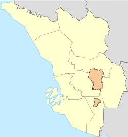
Ulu Kelang

Last updated
Ulu Kelang
Klang valley map.svg
Red pog.svg
Ulu Kelang
Ulu Kelang in Selangor, Malay Peninsular and Malaysia
West Malaysia location map.svg
Red pog.svg
Ulu Kelang
Ulu Kelang (Peninsular Malaysia)
Malaysia location map.svg
Red pog.svg
Ulu Kelang
Ulu Kelang (Malaysia)
Coordinates: 3°10′44.74″N101°46′3.69″E / 3.1790944°N 101.7676917°E / 3.1790944; 101.7676917
Country Flag of Malaysia 23px.svg  Malaysia
State Flag of Selangor.svg  Selangor
District Gombak
Government
  BodyAmpang Jaya Municipal Council
Area
  Total16.94 km2 (6.54 sq mi)
Time zone UTC+8 (MYT)
Postal code
68000

Ulu Kelang (alternately Hulu Kelang, Ulu Klang, or Hulu Klang), is a mukim and a state constituency in Gombak District, Selangor, Malaysia. It is one of five state constituencies administered by Majlis Perbandaran Ampang Jaya (MPAJ).

Contents

A map of Ulu Kelang within Gombak District. Map of Gombak District, Selangor.svg
A map of Ulu Kelang within Gombak District.

Geography

It has an area of 16.94 square kilometres, and is located northeast of Kuala Lumpur. The surface is relatively high; 500 metres above sea level, and the topography here is highland, lowland, or undulating land. As a result, it is a rain catchment area for the Klang River. Among the high locations are Bukit Antarabangsa, Bukit Kemensah, and Bukit Belacan. The hill is composed of limestone, which is brittle and dissolves during heavy rains. As a result, several landslides have occurred in this area, forcing people mainly living in flats, as well as some houses on the hillside, to evacuate. A notable incident is the collapse of Highland Towers in 1993. Moreover, the flow of the Klang River was straightened in several places, which caused water to flow faster, leading Kuala Lumpur to experience flash floods on June 10, 2007.

Public facilities

Many factories, housing estates, and tourist attractions have been built. A notable factory is Texas Instrument, and the DBP warehouse can also be found here. Zoo Negara has forests which are typically explored and developed, which has affected the environment. Other strategic places include waterfalls in Bukit Belacan and Hulu Kemensah, as well as a trail from Kemensah to the top of Gunung Nuang in Hulu Langat for mountain climbers.

List of residential areas

See also


Related Research Articles

<span class="mw-page-title-main">Hulu Langat District</span> District of Malaysia in Selangor

Hulu Langat District is a district of Malaysia located in the southeastern corner of Selangor, between Kuala Lumpur and Negeri Sembilan. It is bordered by the state of Pahang to the east and north, Gombak district to the north-west, Federal Territory of Kuala Lumpur and Petaling district to the west, Sepang district to the south-west, and state of Negeri Sembilan to the south.

<span class="mw-page-title-main">Highland Towers collapse</span> 1993 apartment building collapse in Gombak, Selangor, Malaysia

The Highland Towers collapse occurred on 11 December 1993 in Taman Hillview, Ulu Klang, Selangor, Malaysia. Tower Block 1 collapsed from a major landslide caused by heavy rains that burst diversion pipes. The Highland Towers consisted of three 12-storey buildings or "blocks". The collapse of Block 1 resulted in 48 deaths. Residents of the other two blocks and neighbouring establishments were evacuated due to safety concerns.

<span class="mw-page-title-main">Ampang, Kuala Lumpur</span> Place in Federal Territory of Kuala Lumpur, Malaysia

Ampang, or Ampang Hilir, is a ward and city district, in the eastern part of Kuala Lumpur (KL) in the Titiwangsa constituency. Its area in Kuala Lumpur can be identified as being along the Ampang Road and Ampang Hilir.

<span class="mw-page-title-main">Segambut</span> Place in Federal Territory of Kuala Lumpur, Malaysia

Segambut is a sub-district in Kuala Lumpur, Malaysia. The federal constituency represented in the Dewan Rakyat is Segambut.

<span class="mw-page-title-main">Setiawangsa</span> Suburb in Federal Territory of Kuala Lumpur, Malaysia

Setiawangsa is an eastern suburb in Kuala Lumpur, Malaysia, located less than 4 kilometres from the city centre and located right next to Ampang. There are 4 main residentials within this area;

  1. Taman Setiawangsa
  2. Tiara Setiawangsa
  3. Bukit Setiawangsa
  4. Puncak Setiawangsa

Bukit Antarabangsa is a hillside township located in Ulu Klang, Ampang District, Selangor, Malaysia. The area is well known for being an affluent residential suburb occupied by occasional celebrities and political figures alike.

Hillview is a township in Ulu Klang, Gombak District, Selangor, Malaysia. The township lies in a landslide-prone area. It is located next the Kuala Lumpur Middle Ring Road 2.

Jalan Ampang or Ampang Road is a major road in the Klang Valley region, Selangor and the Federal Territory of Kuala Lumpur, Malaysia. Built in the 1880s, it is one of the oldest roads in the Klang Valley. It is a main road to Ampang Jaya and is easily accessible from Jalan Tun Razak or Jalan Ulu Klang from the Hulu Kelang or Setapak direction. It is also accessible from Cheras through Jalan Shamelin, from Jalan Tun Razak through Jalan Kampung Pandan via Taman Cempaka, from Kampung Pandan through Jalan Kampung Pandan Dalam via Taman Nirwana, from the Kuala Lumpur Middle Ring Road 2 via Pandan Indah and Taman Kencana and from Hulu Langat town through the mountain pass. Wangsa Maju, Setapak, central Kuala Lumpur, Ampang Park and Salak South surround Ampang. Jalan Ampang became the backbone of the road system linking Ampang to Kuala Lumpur before being surpassed by the Ampang–Kuala Lumpur Elevated Highway (AKLEH) in 2001.

<span class="mw-page-title-main">Ampang Jaya</span> Town in Selangor, Malaysia

Ampang Jaya, more commonly known as just Ampang, is a town, a mukim and a parliamentary constituency straddling parts of the Hulu Langat District and Gombak District, in eastern Selangor, Malaysia. It is located just outside the eastern border of Kuala Lumpur Federal Territory.

Bukit, the Indonesian or Malay word for hill, may refer to:

The 2002 Taman Hillview landslide occurred on 20 November 2002 in Taman Hillview, Ulu Klang, Selangor, Malaysia, crushing the bungalow of the Affin Bank chairman General (RtD) Tan Sri Ismail Omar and killing eight people. Investigation showed the landslide occurred on an old landslide

Landslides in Malaysia are regular natural disasters in Malaysia which occur along hillsides and steep slopes.

Lembah Keramat is a place in Ulu Kelang, Gombak District, Selangor, Malaysia, but use Kuala Lumpur postcode. It is known as a Malay reserved residential area.

<span class="mw-page-title-main">Kampung Sungai Penchala</span>

Kampung Sungai Penchala is a small Malay village in the Segambut constituency in northwestern Kuala Lumpur, Malaysia, with the postcode 60000 KUALA LUMPUR, lying along the Federal Territory–Selangor border. This village is next to Taman Tun Dr Ismail in Kuala Lumpur, Malaysia which also shares the same 60000 KUALA LUMPUR postcode, and adjacent to Mutiara Damansara and Bandar Utama that were once part of a large oil palm plantation across the interstate border.

The 2008 Bukit Antarabangsa landslide was a landslide that occurred on the early morning of 6 December 2008, at the town of Bukit Antarabangsa of Selangor, Malaysia. 4 people were killed while 15 others were injured from the incident. 14 houses were destroyed during the process. The landslide was colloquially referred with the Highland Towers collapse of 1993, due to its close proximity and similar circumstances.

<span class="mw-page-title-main">SMART (Malaysia)</span> Malaysian disaster relief and rescue task force

The Special Malaysian Disaster Assistance and Rescue Team is a disaster relief and rescue task force established under the National Security Council based on the approval of the Cabinet on 18 May 1994. The SMART task force is a United Nations INSARAG certified Heavy USAR in June 2016.

Mohamed Azwan bin Ali, also known by his nickname as Diva AA, is a Malaysian television host and actor.

The following is an alphabetical list of articles related to Selangor.

Taman Sri Sinar is a township in Kuala Lumpur, Malaysia. It is located in the northwest of the Segambut constituency and is surrounded by Taman Sri Bintang, Segambut Jaya, Taman Seri Kepong Baru, Taman Bukit Segambut, Taman Segambut Aman and Taman Segambut Damai. It has an estimated population of 40,000 as of 2010. This township is in the Federal Territory of Kuala Lumpur with Kuala Lumpur City Hall (DBKL) as its local authority.

<span class="mw-page-title-main">Bukit Dinding</span> A hill in Kuala Lumpur

Bukit Dinding is a forested hill with published height of 291m in Kuala Lumpur sitting in between Setiawangsa and Wangsa Maju. There are variation of heights in different records where according to Google Earth (2022), the height of Bukit Dinding is 302m, but according to Kuala Lumpur Slope Information System (KULSIS), it is 311m.