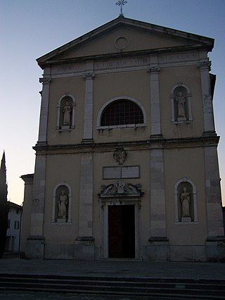
Aiello del Friuli is a comune (municipality) in the Regional decentralization entity of Udine in the Italian region of Friuli-Venezia Giulia, located about 45 kilometres (28 mi) northwest of Trieste and about 25 kilometres (16 mi) southeast of Udine.

Artegna is a comune (municipality) in the Regional decentralization entity of Udine in the Italian region of Friuli-Venezia Giulia, located about 80 kilometres (50 mi) northwest of Trieste and about 20 kilometres (12 mi) northwest of Udine. As of 2008, it had a population of 2,951 and an area of 11.2 square kilometres (4.3 sq mi).
Bagnaria Arsa is a comune (municipality) in the Regional decentralization entity of Udine in the Italian region of Friuli-Venezia Giulia, located about 50 kilometres (31 mi) northwest of Trieste and about 20 kilometres (12 mi) south of Udine.
Basiliano is a comune (municipality) in the Regional decentralization entity of Udine in the Italian region of Friuli-Venezia Giulia, located about 70 kilometres (43 mi) northwest of Trieste and about 12 kilometres (7 mi) southwest of Udine.

Bordano is a comune (municipality) in the Regional decentralization entity of Udine in the Italian region of Friuli-Venezia Giulia, located about 90 kilometres (56 mi) northwest of Trieste and about 30 kilometres (19 mi) northwest of Udine, on the right bank of the Tagliamento river.
Corno di Rosazzo is a comune (municipality) in the Regional decentralization entity of Udine in the Italian region of Friuli-Venezia Giulia, located about 45 kilometres (28 mi) northwest of Trieste and about 20 kilometres (12 mi) southeast of Udine. As of 31 December 2004, it had a population of 3,313 and an area of 12.5 square kilometres (4.8 sq mi).
Dignano is a comune (municipality) in the Regional decentralization entity of Udine in the Italian region of Friuli-Venezia Giulia, located about 80 kilometres (50 mi) northwest of Trieste and about 25 kilometres (16 mi) west of Udine.
Montenars is a comune (municipality) in the Regional decentralization entity of Udine in the Italian region of Friuli-Venezia Giulia, located about 80 kilometres (50 mi) northwest of Trieste and about 20 kilometres (12 mi) north of Udine. As of 31 December 2004, it had a population of 554 and an area of 20.6 square kilometres (8.0 sq mi).

Moruzzo is a comune (municipality) in the Regional decentralization entity of Udine in the Italian region of Friuli-Venezia Giulia, located about 80 kilometres (50 mi) northwest of Trieste and about 11 kilometres (7 mi) northwest of Udine. As of 31 December 2004, it had a population of 2,240 and an area of 17.9 square kilometres (6.9 sq mi).
Osoppo is a comune (municipality) in the Regional decentralization entity of Udine in the Italian region of Friuli-Venezia Giulia, located about 90 kilometres (56 mi) northwest of Trieste and about 25 kilometres (16 mi) northwest of Udine.

Povoletto is a comune (municipality) in the Regional decentralization entity of Udine in the Italian region of Friuli-Venezia Giulia, located about 70 kilometres (43 mi) northwest of Trieste and about 7 kilometres (4 mi) northeast of Udine. As of 31 December 2004, it had a population of 5,500 and an area of 39.0 square kilometres (15.1 sq mi).

Prepotto is a comune (municipality) in the Regional decentralization entity of Udine in the Italian region of Friuli-Venezia Giulia, located about 50 kilometres (31 mi) northwest of Trieste and about 20 kilometres (12 mi) east of Udine, on the border with Slovenia. As of 31 December 2004, it had a population of 894 and an area of 33.2 square kilometres (12.8 sq mi).
Rive d'Arcano is a comune (municipality) in the Regional decentralization entity of Udine in the Italian region of Friuli-Venezia Giulia, located about 80 kilometres (50 mi) northwest of Trieste and about 15 kilometres (9 mi) northwest of Udine. As of 31 December 2004, it had a population of 2,363 and an area of 22.5 square kilometres (8.7 sq mi).

Ruda is a comune (municipality) in the Regional decentralization entity of Udine in the Italian region of Friuli-Venezia Giulia, located about 40 kilometres (25 mi) northwest of Trieste and about 30 kilometres (19 mi) southeast of Udine.
San Vito al Torre is a comune (municipality) in the Regional decentralization entity of Udine in the Italian region Friuli-Venezia Giulia, located about 45 kilometres (28 mi) northwest of Trieste and about 20 kilometres (12 mi) southeast of Udine.
Tavagnacco is a comune (municipality) in the Regional decentralization entity of Udine in the Italian region of Friuli-Venezia Giulia, located about 70 kilometres (43 mi) northwest of Trieste and about 8 kilometres (5 mi) north of Udine. The municipal seat is in the frazione (borough) of Feletto Umberto.
Terzo d'Aquileia is a comune (municipality) in the Regional decentralization entity of Udine in the Italian region of Friuli-Venezia Giulia, located about 40 kilometres (25 mi) northwest of Trieste and about 30 kilometres (19 mi) south of Udine.
Torreano is a comune (municipality) in the Regional decentralization entity of Udine in the Italian region of Friuli-Venezia Giulia, located about 60 kilometres (37 mi) northwest of Trieste and about 15 kilometres (9 mi) northeast of Udine, on the border with Slovenia. As of 31 December 2004, it had a population of 2,301 and an area of 34.9 square kilometres (13.5 sq mi). According to the census 1971 24,5% of the population are Slovenes.

Tricesimo is a comune (municipality) in the Regional decentralization entity of Udine in the Italian region of Friuli-Venezia Giulia, located about 70 kilometres (43 mi) northwest of Trieste and about 9 kilometres (6 mi) north of Udine. As of 31 December 2004, it had a population of 7,471 and an area of 17.5 square kilometres (6.8 sq mi).

Forgaria nel Friuli is a comune (municipality) in the Regional decentralization entity of Udine, in the Italian region of Friuli-Venezia Giulia, located about 90 kilometres (56 mi) northwest of Trieste and about 25 kilometres (16 mi) northwest of Udine. As of 31 December 2004, it had a population of 1,944 and an area of 29.2 square kilometres (11.3 sq mi).


