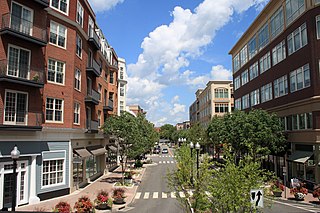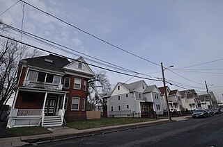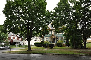
West Hartford is a town in Hartford County, Connecticut, United States, 5 miles (8.0 km) west of downtown Hartford. The population was 63,268 at the 2010 census.

The Fan is a district of Richmond, Virginia, so named because of the "fan" shape of the array of streets that extend west from Belvidere Street, on the eastern edge of Monroe Park, westward to the Boulevard. However, the streets rapidly resemble a grid after they go through what is now Virginia Commonwealth University. The Fan is one of the easterly points of the city's West End section, and is bordered to the north by Broad Street and to the south by VA 195, although the Fan District Association considers the southern border to be the properties abutting the south side of Main Street. The western side is sometimes called the Upper Fan and the eastern side the Lower Fan, though confusingly the Uptown district is located near VCU in the Lower Fan. Many cafes and locally owned restaurants are located here, as well as historic Monument Avenue, a boulevard featuring enormous equine statuary of Civil War Confederate generals and a statue of tennis icon Arthur Ashe. Development of the Fan district was strongly influenced by the City Beautiful movement of the late 19th century.

Plantsville is a neighborhood in the town of Southington, Hartford County, Connecticut. It is centered at the merger between South Main Street and West Main Street. As of the 2000 Census there were 10,387 people living in the Zip Code Tabulation Area for zip code 06479, which is assigned the postal city name Plantsville. The Zip Code Tabulation Area includes the entire southwestern corner of the town of Southington, including Marion and Milldale. Beginning in 2015 Plantsville was listed as a census-designated place.

The Glastonbury-Rocky Hill Ferry Historic District is a historic district in Glastonbury and Rocky Hill, Connecticut, encompassing a landscape with more than 300 years of colonial and post-colonial history. It includes the ferry landings and water traversed by the Rocky Hill – Glastonbury Ferry, one of the longest-running ferry services the nation, and the surrounding farmscapes and ferry landing village. The district was listed on the National Register of Historic Places in 2005.

Prospect Hill is a neighborhood of the city of New Haven, Connecticut located in the north central portion of the city, directly north of Downtown New Haven. The neighborhood contains residences, institutional buildings of Albertus Magnus University and a portion of the main campus of Yale University, including the Science Hill area, the Hillhouse Avenue area and the Yale Peabody Museum. The City of New Haven defines the neighborhood to be the region bounded by the town of Hamden in the north, Winchester Avenue in the west, Munson Street/Hillside Place/Prospect Street in the southwest, Trumbull Street in the south, and Whitney Avenue in the east. Prospect Street is the main thoroughfare through the neighborhood.

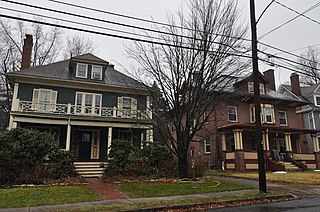
The West End South Historic District encompasses a neighborhood of mid 19th to early 20th century residential architecture in western Hartford, Connecticut and eastern West Hartford, Connecticut. Roughly bounded by Prospect and South Whitney Streets, West Boulevard, and Farmington Avenue, the area includes a large number of Colonial Revival and Queen Anne houses, as well as numerous buildings in other period styles, with only a small number of losses. It was listed on the National Register of Historic Places in 1985.

The Ann Street Historic District is a historic district encompassing part of Downtown Hartford in Hartford, Connecticut. A commercial and light industrial area, the district includes properties along Ann Uccello Street from Chapel Street south to Hicks Street. It also includes properties east of Ann Street fronting Pearl Street and Hicks Street to roughly Haynes Street, as well as properties west of Ann Uccello Street fronting Allyn and Asylum Streets to roughly a third of the block. The district's architecture typifies the city's development between about 1880 and 1930; it was listed on the National Register of Historic Places in 1983.

The Main Street Historic District No. 2 is a historic district in Hartford, Connecticut. It encompasses a city block in the city's downtown noted for its concentration of insurance-related highrise commercial buildings constructed in the early decades of the 20th century. It is visually dominated by the Travelers Tower, completed in 1919 and for many years Hartford's tallest building. The district was listed on the National Register of Historic Places in 1984, at which time it included seven contributing buildings over a nine-acre area.

The Prospect Street Historic District encompasses a residential area northeast located in New London, Connecticut. The district consists of two city blocks on either side of Prospect Street, and includes 24 buildings, most of which are Greek Revival or Italianate houses built between 1838 and 1859. The area was developed in response to local demand for increased middle-class housing, and the dense development and modest scale of the buildings is reflective of this objective. The district was listed on the National Register of Historic Places on July 31, 1986.

The Prospect Avenue Historic District encompasses a predominantly residential area in western Hartford and eastern West Hartford, Connecticut. The 300-acre (120 ha) historic district extends along Prospect Avenue from Albany Avenue to Fern Street, including most of the area between those streets and the Park River to the east, and Sycamore Street and Sycamore Lane to the west. The district includes 240 contributing buildings and 48 non-contributing buildings, most of them residences built between 1880 and 1930. The district was listed on the National Register of Historic Places in 1985.

Prospect Historic District is a residential historic district in Pasadena, California, consisting of homes along Prospect Boulevard and several surrounding streets. The district includes 108 residences and roughly encompasses the Prospect Park and Arroyo Park Tracts, a pair of early Pasadena subdivisions. Development on the Prospect Park Tract began in 1904, and the first house was built there in 1906. The Arroyo Park Tract was first surveyed in 1910, and its development soon followed; the two tracts were linked by the Prospect Boulevard Bridge, which was built in 1908. The houses in the district represent a wide variety of architectural styles and include works by several prominent architects, such as Frank Lloyd Wright's Millard House, Charles and Henry Greene's Bentz House, and a 1909 mansion designed by Alfred and Arthur Heineman. The varied architecture of the district's homes is united by its landscaping, particularly through the camphor trees which line its streets.

The Allen Place–Lincoln Street Historic District encompasses a small neighborhood of late 19th-century housing built for white-collar service workers in southern Hartford, Connecticut. It is roughly bounded by Madison, Washington, and Vernon Streets, and Zion Hill Cemetery, and has well-preserved examples of vernacular Queen Anne and Colonial Revival architecture. It was listed on the National Register of Historic Places in 2003.

Grandview Terrace Boulevard is a historic district encompassing a small well-preserved early 20th-century neighborhood in Hartford, Connecticut. It extends along Grandview Terrace in southwestern Hartford, between White and Linnmoore Streets, and includes a series of high-quality homes built mainly between 1910 and 1925. It was listed on the National Register of Historic Places in 2002.

The Garvan-Carroll Historic District encompasses a primarily residential area near the center of East Hartford, Connecticut. Located just southwest of its Main Street downtown on South Prospect and Garvan Streets, and Carroll and Tower Roads, this area retains a high concentration of residential architecture built mainly between 1890 and the 1920s. It was listed on the National Register of Historic Places in 1991.

The Naubuc Avenue-Broad Street Historic District encompasses a largely agrarian village area of southwestern East Hartford, Connecticut. Extending along Naubuc Avenue from the Glastonbury line to Broad Street, and along Broad to Main Street, its architecture encapsulates the area's history between the 18th and early 20th centuries. It was listed on the National Register of Historic Places in 1998.

The West End North Historic District encompasses a neighborhood of late 19th and early 20th century residential architecture in western Hartford, Connecticut and eastern West Hartford, Connecticut. Roughly bounded by Prospect, Elizabeth, and Lorraine Streets and Farmington Avenue, the area includes a large number of Colonial Revival and Queen Anne houses, as well as numerous buildings in other period styles, with only a small number of losses. It was listed on the National Register of Historic Places in 1985.

The Oxford-Whitney Streets District is a historic district encompassing an early-20th century residential area in the West End neighborhood of Hartford, Connecticut. It extends along the east side of Oxford Street between Elizabeth and Cone Streets, on the west side of Whitney between Fern and Elizabeth, and includes the north side of Fern Street between Whitney and Oxford. Most of the housing, a combination of single and multi-family residences, was built between 1906 and 1919, a period later than the surrounding areas, and is predominantly Colonial Revival in character. It was listed on the National Register of Historic Places in 2010.

The Sisson-South Whitney Historic District encompasses a neighborhood in the West End area of Hartford, Connecticut, that was built out between 1890 and 1930 as a streetcar suburb. It is roughly bounded by Farmington Avenue, South Whitney Street, West Boulevard, and Sisson Avenue, and includes a diversity of residential and commercial architecture, reflective of its initial development and subsequent growth. The district was listed on the National Register of Historic Places in 2013.

The State Arsenal and Armory, formally the Governor William A. O'Neill State Armory and informally the Connecticut State Armory, is a historic military facility at 360 Broad Street in Hartford, Connecticut. Built in 1906, it is a distinctive example of Classical Revival architecture, built using then-innovative construction techniques involving concrete and cast stone. It was listed on the National Register of Historic Places in 1996. It serves as the headquarters of the Connecticut State Militia.

The West End Historic District encompasses a predominantly residential area west of downtown New Britain, Connecticut. Forming a rough C shape around the west part of Walnut Hill Park, the area was developed in the late 19th century as one of its premier upper-class neighborhoods, home to business and civic leaders, with a fine array of late 19th and early 20th century architecture. It was listed on the National Register of Historic Places in 1998.


