West Burton, Nottinghamshire

Last updated

West Burton
Hamlet and civil parish
WestBurtonChurch.jpg
West Burton Church, c. 1885, shortly before its demolition
West Burton, Nottinghamshire
Parish map
Nottinghamshire UK location map.svg
Red pog.svg
West Burton
Location within Nottinghamshire
Area1.49 sq mi (3.9 km2)
Population14 (2021)
  Density 9/sq mi (3.5/km2)
OS grid reference SK 800851
  London 130 mi (210 km)  SSE
District
Shire county
Region
Country England
Sovereign state United Kingdom
Post town Retford
Postcode district DN22
Dialling code 01427
Police Nottinghamshire
Fire Nottinghamshire
Ambulance East Midlands
UK Parliament
Website www.sturtonlesteepleparishcouncil.gov.uk
(neighbouring council)
List of places
UK
England
Nottinghamshire
53°22′07″N0°48′56″W / 53.36859°N 0.81568°W / 53.36859; -0.81568

West Burton is a hamlet and civil parish in Nottinghamshire, England, located in the north-east of the county within the district of Bassetlaw. It lies between the villages of Bole and Sturton le Steeple. The Saxon name "burh-ton" states a fortified farmstead with the village lying to the west of Gate Burton in Lincolnshire. The recorded population at the 2021 census was 14 residents. [1]

Contents

Oxbow lakes

West Burton was originally based around a now-deserted village, which went into terminal decline when the course of the River Trent altered sometime around 1797. [2] For many years afterwards the total recorded population was less than 60, [3] and the residential part of the parish had effectively been reduced to just one or two scattered farms and their neighbouring cottages – notably Grange Farm and High House Farm. West Burton was originally on the side of the oxbow lake known as the Burton Round; a similar oxbow lake known as Bole Round or 'No Mans Friend' was situated just adjacent to Bole. [4] A flood in February 1792, cut through 'No Mans Friend' which was subsequently reported in the local press.

“A very singular event has lately taken place at Gainsborough, in Lincolnshire:- At Bole Ferry the Trent has formed itself a new channel, through which on Thursday se’nnight, two vessels passed abreast. Eighty or ninety acres of fine pasture land, the property of Sir E. Anderson, and Miss Hickman, are cut quite away from the Lincolnshire side of the river, and a complete island is formed between the late and present channel.” [5]

At Burton Round the Trent here took a circular sweep that a boatman might have thrown his hat on shore and after sailing two miles taken it up again. [6] The Burton Round is referred to in Shakespeare's [7] play Henry IV - Part 1

"Methinks my moiety, north from Burton here,
In quantity equals not one of yours:
See how this river comes me cranking in,
And cuts me from the best of all my land
A huge half-moon, a monstrous cantle out.
I'll have the current in this place damm'd up;
And here the smug and silver Trent shall run
In a new channel, fair and evenly;
It shall not wind with such a deep indent,
To rob me of so rich a bottom here.”

Church of St Helen

West Burton Church West Burton Church.jpg
West Burton Church

The ecclesiastical parish of West Burton was joined to the benefice of North Wheatley in 1884, even though these two adjacent places had no direct connection by road. The disused church of St Helen, founded in medieval times and previously served by a perpetual curate, was finally demolished around 1886, [8] although annual harvest thanksgiving services were later revived upon its site in the 20th century, and these continued for many years. [9]

The site is a Scheduled Ancient Monument [No.29915].

Bells

In 1764 two bells were recorded, however in 1832, Sir Stephen Glynne noted only a single bell. A drawing of the church in 1875 shows only one bell.

Stirling bomber crash

Short Stirling Short Sterling.jpg
Short Stirling

On the evening of 24 April 1944, Short Stirling Mk3 LK552 JF-C manufactured by the Austin Motor Company from No. 1654 Heavy Conversion Unit RAF Wigsley in Nottinghamshire took part in a night navigational exercise. The pilot was Pilot Officer Lee from No. 65 Course. At 11,000 feet and 0105 hours, nearing the end of the exercise, the port inner engine failed but the port outer engine was inadvertently shut down. With both port engines inoperative the pilot was unable to control the aircraft. All the crew bailed out near the Cheese House in West Burton. [10]

West Burton Power Station

Shah of Iran at West Burton, 1965 Shah Of Iran at West Burton.jpg
Shah of Iran at West Burton, 1965

The quiet and largely agricultural character of the area underwent a total transformation in the years following February 1961, when the Central Electricity Generating Board received consent for the building of the first West Burton Power Station, at that time intended for completion in 1967. [11] This was constructed on land surrounding the original deserted hamlet, and in subsequent years its cooling towers have totally dominated the surrounding countryside.

The power station was the first 2000MW station to be constructed in the UK and therefore attracted a large overseas interest at West Burton including Mohammad Reza Pahlavi the Shah of Iran in 1965.

Low Farm was demolished in 1992 by National Power, it was the last remaining building in the close proximity of the old deserted village.

A topographical survey of the deserted village of West Burton was carried out by a team from Nottinghamshire County Council's community archaeology service in 2008–09. [2]

Related Research Articles

<span class="mw-page-title-main">Gainsborough, Lincolnshire</span> Town and civil parish in Lincolnshire, England

Gainsborough is a market town, inland port and civil parish in the West Lindsey district of Lincolnshire, England. The town population was 20,842 at the 2011 census, and estimated at 23,243 in 2019. It lies on the east bank of the River Trent, 18 miles (29 km) north-west of Lincoln, 16 miles (26 km) south-west of Scunthorpe, 20 miles south-east of Doncaster and 39 miles (63 km) east of Sheffield. It is England's furthest inland port at over 55 miles (89 km) from the North Sea.

<span class="mw-page-title-main">West Lindsey</span> District in England

West Lindsey is a local government district in Lincolnshire, England. Its council is based in Gainsborough, the district's largest town. The district also includes the towns of Caistor and Market Rasen, along with numerous villages and surrounding rural areas. The east of the district includes part of the Lincolnshire Wolds, a designated Area of Outstanding Natural Beauty.

<span class="mw-page-title-main">Flixborough</span> Village and civil parish in North Lincolnshire, England

Flixborough is a village and civil parish in North Lincolnshire, England. The population of the civil parish at the 2011 census was 1,664. It is situated near the River Trent, approximately 3 miles (5 km) north-west from Scunthorpe. The village is noted for the 1974 Flixborough disaster.

Barrowby is a village and civil parish in the South Kesteven district of Lincolnshire, England. It is 2 miles (3.2 km) west of Grantham. It overlooks the Vale of Belvoir and has a Grade I listed parish church. The hamlet of Casthorpe is part of the parish. The 2001 Census listed 795 households and a population of 1,996, which fell to 840 households with 1,952 inhabitants at the 2011 census. It was estimated at 1,986 in 2019.

<span class="mw-page-title-main">Sheffield–Lincoln line</span> Railway line in England

The Sheffield–Lincoln line is a railway line in England. It runs from Sheffield to Lincoln via Worksop, Retford and Gainsborough Lea Road. The route comprises the main line of the former Manchester, Sheffield and Lincolnshire Railway (MS&LR), to Gainsborough Trent Junction, where it then follows the former Great Northern and Great Eastern Joint Railway (GNGEJR) to Lincoln Central. The former MS&LR main line continues from Trent Junction to Wrawby Junction, Barnetby, much of it now single line, where it then runs to Cleethorpes. In 2023, the Department for Transport announced that a new station will be opened on the line. Waverley station will be located between Darnall and Woodhouse.

<span class="mw-page-title-main">Bole, Nottinghamshire</span> Civil parish in England

Bole is a village and civil parish in the Bassetlaw district of Nottinghamshire, England. It is close by the River Trent, on the eastern side of which is Gainsborough in Lincolnshire. At one time the village stood – like the neighbouring parish of West Burton – very near to an oxbow lake, known as Bole Round. However flooding led to the original course of the River Trent being diverted after 1792. The parish now lies within a landscape largely dominated by the West Burton power stations. According to the 2001 census Bole had a population of 140,a count of 247 at the 2011 census, and singularly reported as 135 in 2021.

<span class="mw-page-title-main">West Stockwith</span> Village and civil parish in Nottinghamshire, England

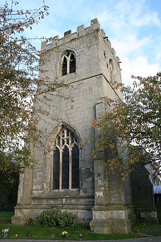
West Stockwith is a village within the Bassetlaw district of Nottinghamshire, England. The population at the 2011 census was 327, this increased to 335 at the 2021 census. It lies on the west bank of the River Trent, 3 miles (4.8 km) north-west of Gainsborough and 1.5 miles (2.4 km) east of Misterton. West Stockwith is an ecclesiastical parish in the Church of England Diocese of Southwell and Nottingham with the parish church of St Mary the Virgin's Church, West Stockwith being built in 1722.

<span class="mw-page-title-main">Misterton, Nottinghamshire</span> Village and civil parish in the Bassetlaw district of Nottinghamshire, England

Misterton is a village and civil parish in the Bassetlaw district of Nottinghamshire, England. The parish population at the 2011 census was 2,140, and has risen to 2,191 residents in the 2021 census.

<span class="mw-page-title-main">East Stockwith</span> Village in Lincolnshire, England

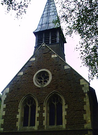
East Stockwith is a village within the civil parish of East Stockwith, in the West Lindsey district of Lincolnshire, England. It lies on the River Trent, 3 miles (4.8 km) north-west of Gainsborough. The River Trent Aegir, a tidal bore, reaches the village. In 2001 it had a total resident population of 209, increasing to 314 at the 2011 census.

<span class="mw-page-title-main">A631 road</span> Road in England

The A631 is a road running from Sheffield, South Yorkshire to Louth, Lincolnshire in England. It passes through the counties of South Yorkshire, Nottinghamshire and Lincolnshire. The road has many towns on its route including Rotherham, Maltby, Gainsborough and Market Rasen. It is mostly single road throughout its length but has some stretches of dual carriageway as well.

<span class="mw-page-title-main">Scotter</span> Village and civil parish in Lincolnshire, England

Scotter is a large village and civil parish in West Lindsey, Lincolnshire, England, situated between Scunthorpe and Gainsborough.

<span class="mw-page-title-main">South Leverton</span> Village and civil parish in Nottinghamshire, England

South Leverton is a village and civil parish in Bassetlaw, north Nottinghamshire, England, four miles from Retford. According to the 2001 census it has a population of 478, increasing marginally to 480 at the 2011 census, and more substantially to 514 at the 2021 census.

<span class="mw-page-title-main">North Wheatley</span> Human settlement in England

North Wheatley is a village and former civil parish, now in the parish of North and South Wheatley, in Bassetlaw district, in the county of Nottinghamshire, England. At the time of the 2001 census it had a population of 489, increasing to 509 at the 2011 census. It is located 6 miles north-east of Retford. The village has a number of 17th century brick houses. The Old Hall on Low Street/Church Hill is dated 1673, with the arms of the Cartwright family. The parish church of St Peter and St Paul was restored in 1896. Many farms in the area have dovecotes, either as free-standing buildings or above farm buildings. On 1 April 2015 the civil parish was merged with South Wheatley to form "North and South Wheatley".

<span class="mw-page-title-main">Beighton, South Yorkshire</span> Village in South Yorkshire, England

Beighton is a village 6 miles south-east of Sheffield's city centre, now classed as a historic township of the city. Due to much expansion, the village became a part of Sheffield city in 1967, and was transferred from Derbyshire to the newly created South Yorkshire, England. During much of the late 17th to 19th centuries the village was noted for its edge tool manufacturing, with Thomas Staniforth & Co Sickle works being based at nearby Hackenthorpe.

<span class="mw-page-title-main">Hodsock</span> Village and civil parish in Nottinghamshire, England

Hodsock is a village and civil parish about 4 miles from Worksop, in the Bassetlaw district, in the county of Nottinghamshire, England. The parish includes the village of Langold and the country house Hodsock Priory. In 2021 the parish had a population of 2,603. The parish is surrounded by the settlements of Babworth, Barnby Moor, Blyth, Carlton in Lindrick, Costhorpe, Firbeck, Letwell, Maltby, Styrrup with Oldcotes and Torworth.

<span class="mw-page-title-main">South Wheatley, Nottinghamshire</span> Settlement in Nottinghamshire, England

South Wheatley is a village and former civil parish, now within the North and South Wheatley civil parish, of Bassetlaw district, in the county of Nottinghamshire, England. In 2001 South Wheatley parish had a population of 102. It is 130 miles north of London, 30 miles north east of the county town of Nottingham, and 5 miles north east of the Nottinghamshire town of Retford. There are 4 listed buildings in South Wheatley.

<span class="mw-page-title-main">North and South Wheatley</span> Civil parish in Nottinghamshire, England

North and South Wheatley is a civil parish in the Bassetlaw district, in the county of Nottinghamshire, England. The parish includes the villages of North Wheatley and South Wheatley. In 2021 the parish had a population of 610 residents. It is 130 miles north of London, 30 miles north east of the county town of Nottingham, and 5 miles north east of the Nottinghamshire town of Retford. The parish touches Bole, Clarborough and Welham, Clayworth, Hayton, Saundby, Sturton Le Steeple and West Burton. There are 18 listed buildings in North and South Wheatley.

References

Modern gravestone in West Burton Churchyard Modern gravestone in West Burton Churchyard. - geograph.org.uk - 483347.jpg
Modern gravestone in West Burton Churchyard
  1. UK Census (2021). "2021 Census Area Profile – West Burton parish (E04007849)". Nomis. Office for National Statistics . Retrieved 24 January 2024.
  2. 1 2 West Burton Deserted Village: , report by Nottinghamshire Community Archaeology, retrieved 28 December 2011
  3. A Vision of Britain: West Burton , retrieved 28 December 2011
  4. Everard Leaver Guilford (1912). "Memorials of old Nottinghamshire" (Memorials of old Nottinghamshire. ed.). London: G. Allen. Retrieved 11 May 2013.
  5. Leicester Journal’ for the Friday 3rd 1792
  6. The Rev J. Gurnhill in his "Monograph on the Gainsborough Parish Registers" 1890
  7. William Shakespeare, Henry IV, Pt.I., Act III, Sc. I
  8. K S S Train, Lists of the Clergy of North Nottinghamshire, Thoroton Society, 1959–60, page 28: "The Church of West Burton was given to Worksop priory by Geoffrey de Malquinci at the end of the 12th century and was appropriated 5 June 1234, but no vicarage was endowed. After the dissolution of Worksop priory William Nevill became the impropriator, 3 March 1544/5 and he and his successors nominated the curate. West Burton was united with North and South Wheatley by Order in Council 29 November 1884. At a Vestry meeting, held 14 December 1885, it was decided to apply for a faculty to pull the church down in view of its disused and dilapidated state; this was granted 7 January 1886."
  9. The Country Parish, Retford Rural Deanery magazine, September 1962 (West Burton): The forty-ninth Open Air Harvest Thanksgiving Service will be held on the site of the old Church on Sunday 16 Sep, at 3 p.m. ... The Archdeacon of Newark will preach.
  10. "1654 Conversion Unit. Formed at Swinderby (UK) in May 1942. Moved to Wigsley (UK) in..." nationalarchives.gov.uk.
  11. The Times newspaper, Tuesday, 21 February 1961; pg. 5