West Point, Wisconsin

Last updated

West Point, Wisconsin
WIMap-doton-West Point.png
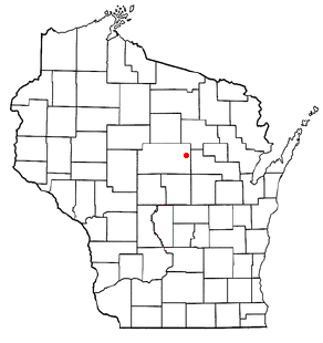
Location of West Point, Wisconsin
Coordinates: 43°19′11″N89°38′15″W / 43.31972°N 89.63750°W / 43.31972; -89.63750
Country Flag of the United States.svg  United States
State Flag of Wisconsin.svg  Wisconsin
County Columbia
Area
  Total32.5 sq mi (84.1 km2)
  Land28.9 sq mi (74.9 km2)
  Water3.6 sq mi (9.2 km2)
Elevation
[1]
853 ft (260 m)
Population
 (2000)
  Total1,634
  Density56.5/sq mi (21.8/km2)
Time zone UTC-6 (Central (CST))
  Summer (DST) UTC-5 (CDT)
FIPS code 55-86100 [2]
GNIS feature ID1584414 [1]
Website http://townofwestpoint.us

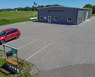
West Point is a town in Columbia County, Wisconsin, United States. The population was 1,634 at the 2000 census.

Contents

Geography

According to the United States Census Bureau, the town has a total area of 32.5 square miles (84.1 km2), of which, 28.9 square miles (74.9 km2) of it is land and 3.5 square miles (9.2 km2) of it (10.94%) is water.

Demographics

As of the census [2] of 2000, there were 1,634 people, 660 households, and 485 families residing in the town. The population density was 56.5 people per square mile (21.8/km2). There were 907 housing units at an average density of 31.4 per square mile (12.1/km2). The racial makeup of the town was 98.35% White, 0.49% African American, 0.43% Asian, 0.24% from other races, and 0.49% from two or more races. Hispanic or Latino of any race were 0.86% of the population.

There were 660 households, out of which 29.8% had children under the age of 18 living with them, 68.5% were married couples living together, 2.6% had a female householder with no husband present, and 26.4% were non-families. 22.0% of all households were made up of individuals, and 8.8% had someone living alone who was 65 years of age or older. The average household size was 2.48 and the average family size was 2.92.

In the town, the population was spread out, with 24.0% under the age of 18, 3.6% from 18 to 24, 26.4% from 25 to 44, 30.9% from 45 to 64, and 15.1% who were 65 years of age or older. The median age was 42 years. For every 100 females, there were 105.0 males. For every 100 females age 18 and over, there were 105.6 males.

The median income for a household in the town was $55,781, and the median income for a family was $62,132. Males had a median income of $39,063 versus $28,403 for females. The per capita income for the town was $30,750. About 2.5% of families and 3.8% of the population were below the poverty line, including 3.1% of those under age 18 and 5.9% of those age 65 or over.

Protected areas

Notable people

Related Research Articles

<span class="mw-page-title-main">Volney, New York</span> Town in New York, United States

Volney is a town in Oswego County, New York, United States. The population was 5,926 at the 2010 census. The town was named after a French author, Constantin François de Chassebœuf, comte de Volney, who toured the area in 1808.

<span class="mw-page-title-main">Beloit, Ohio</span> Village in Ohio, United States

Beloit is a village in southwestern Mahoning County, Ohio, United States. The population was 903 at the 2020 census. It is part of the Youngstown–Warren metropolitan area.

<span class="mw-page-title-main">Berkshire, Vermont</span> Town in Vermont, United States

Berkshire is a town in Franklin County, Vermont, United States. The population was 1,547 at the 2020 census. It contains the unincorporated village of East Berkshire.

<span class="mw-page-title-main">Dunkirk, Wisconsin</span> Town in Wisconsin, United States

The Town of Dunkirk is located in Dane County, Wisconsin, United States. The population was 2,053 at the 2000 census. The unincorporated community of Hanerville, which was named for James Haner, who had moved from Easton, New York in 1844, is located in the town.

<span class="mw-page-title-main">Washington Island, Door County, Wisconsin</span> Town in Wisconsin, United States

Washington Island is a town in northern Door County, Wisconsin, United States, with a population of 708 at the 2010 census. The unincorporated communities of Detroit Harbor and Washington are located in the town.

<span class="mw-page-title-main">Bridge Creek, Wisconsin</span> Town in Wisconsin, United States

Bridge Creek is a town in Eau Claire County, Wisconsin, United States. The population was 1,900 at the 2010 census. The city of Augusta is located entirely within the town of Bridge Creek. The unincorporated community of Hay Creek is located in the town.

<span class="mw-page-title-main">Marion, Grant County, Wisconsin</span> Town in Wisconsin, United States

Marion is a town in Grant County, Wisconsin, United States. The population was 517 at the 2000 census.

<span class="mw-page-title-main">Deer Creek, Outagamie County, Wisconsin</span> Town in Wisconsin, United States

Deer Creek is a town in Outagamie County, Wisconsin, United States. The population was 682 at the 2000 census. Area of the village is 35.5 sq mi (92.0 km2)

<span class="mw-page-title-main">Liberty, Outagamie County, Wisconsin</span> Town in Wisconsin, United States

There are three other towns called 'Liberty' in Wisconsin. See Liberty, Wisconsin

<span class="mw-page-title-main">Rusk, Rusk County, Wisconsin</span> Town in Wisconsin, United States

Rusk is a town in Rusk County, Wisconsin, United States. The population was 475 at the 2000 census. The unincorporated community of Bear Lake is located in the town.

<span class="mw-page-title-main">Dellona, Wisconsin</span> Town in Wisconsin, United States

Dellona is a town in Sauk County, Wisconsin, United States. The population was 1,199 at the 2000 census. The unincorporated community of Dellwood is located in the town.

<span class="mw-page-title-main">Sugar Creek, Wisconsin</span> Town in Wisconsin, United States

Sugar Creek is a town in Walworth County, Wisconsin, United States. The population was 3,902 at the 2020 census. The unincorporated communities of Millard and Tibbets are located in the town. The unincorporated community of Abells Corners is also located partially in the town.

<span class="mw-page-title-main">Troy, Walworth County, Wisconsin</span> Town in Wisconsin, United States

Troy is a town in Walworth County, Wisconsin, United States. The population was 2,355 at the 2020 census. The unincorporated communities of Adams, Little Prairie, and Troy Center are located in the town. The ghost town of Mayhews was also located in the town.

<span class="mw-page-title-main">Saxeville, Wisconsin</span> Town in Wisconsin, United States

Saxeville is a town in Waushara County, Wisconsin, United States. The population was 974 at the 2000 census. The unincorporated community of Saxeville is located in the town.

<span class="mw-page-title-main">Warren, Waushara County, Wisconsin</span> Town in Wisconsin, United States

Warren is a town in Waushara County, Wisconsin, United States. The population was 675 at the 2000 census. The ghost town of Rodney was located partially in the town.

Andover is a town in Allegany County, New York, United States. The population was 1,634 at the 2020 census. The town is on the eastern edge of Allegany County and contains the village of Andover.

<span class="mw-page-title-main">Oregon (town), Wisconsin</span>

The Town of Oregon is a town in Dane County, Wisconsin, United States. The population was 3,148 at the 2000 census. The village of Oregon is located adjacent to the town and most of its area previously belonged to the town.

<span class="mw-page-title-main">Melrose (town), Wisconsin</span>

Melrose is a town in Jackson County, Wisconsin, United States. The population was 402 at the 2000 census. The Village of Melrose is located within the town.
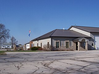
<span class="mw-page-title-main">Osceola, Wisconsin</span> Village in Wisconsin, United States

Osceola is a village in Polk County, Wisconsin, United States. The population was 2,765 at the 2020 census. Located mostly within the Town of Osceola, the village sits on the border with Minnesota, separated by the St. Croix River. It is along Wisconsin Highway 35.

The Town of Spring Green is located in Sauk County, Wisconsin, United States. The January 1, 2021, final population estimate for the town is 1,728. Approximately 1,374 of the estimated population for the Town of Spring Green in Sauk County are of voting age.

References

  1. 1 2 "US Board on Geographic Names". United States Geological Survey. October 25, 2007. Retrieved January 31, 2008.
  2. 1 2 "U.S. Census website". United States Census Bureau . Retrieved January 31, 2008.
  3. "Wisconsin Department of Transportation, Columbia County, Wisconsin map" (PDF). Archived from the original (PDF) on October 6, 2014. Retrieved October 29, 2012.
  4. 'Wisconsin Blue Book 1899, Biographical Sketch of Horace N. Polley, pg. 770