Related Research Articles

Derwent Valley Mills is a World Heritage Site along the River Derwent in Derbyshire, England, designated in December 2001. It is administered by the Derwent Valley Mills Partnership. The modern factory, or 'mill', system was born here in the 18th century to accommodate the new technology for spinning cotton developed by Richard Arkwright. With advancements in technology, it became possible to produce cotton continuously. The system was adopted throughout the valley, and later spread so that by 1788 there were over 200 Arkwright-type mills in Britain. Arkwright's inventions and system of organising labour was exported to Europe and the United States.
The Upper Derwent Valley is an area of the Peak District National Park in England. It largely lies in Derbyshire, but its north eastern area lies in Sheffield, South Yorkshire. Its most significant features are the Derwent Dams, Ladybower, Derwent and Howden, which form Ladybower Reservoir, Derwent Reservoir and Howden Reservoir respectively.

The Derwent is a river in Derbyshire, England. It is 50 miles (80 km) long and is a tributary of the River Trent, which it joins south of Derby. Throughout its course, the river mostly flows through the Peak District and its foothills.

Matlock is the county town of Derbyshire, England. It is situated in the south-eastern part of the Peak District, with the National Park directly to the west. The town is twinned with the French town of Eaubonne. The former spa resort of Matlock Bath lies immediately south of the town on the A6. The civil parish of Matlock Town had a population in the 2011 UK census of 9,543. The population of the wider Matlock urban area is approximately 20,000.

Matlock Bath is a village and civil parish in Derbyshire, England. It lies in the Peak District, south of Matlock on the main A6 road, and approximately halfway between Buxton and Derby. The population of the civil parish as of the 2011 census was 753. Originally built at the head of a dead-end dirt road running alongside the valley of the River Derwent from Matlock itself, the locality developed in the 19th century as residential and a spa town which remains a tourist destination. The steep hillside restricts any development with the majority of buildings on one side of the valley with only footbridges across the river. The road was upgraded, becoming a through-way, now designated A6, avoiding the previous old coaching road approach to Matlock from Cromford over very steep hills near to the Riber plateau area.
Derwent Valley Council is a local government body situated in southern-central Tasmania, west of Hobart. Derwent Valley is classified as a rural local government area and has a population of 10,290, it includes the localities of Bushy Park, Maydena and Strathgordon, with New Norfolk the major, principal town.

The Hope Valley is a rural area centred on the village of Hope, Derbyshire, in the Peak District in the northern Midlands of England.

New Norfolk is a town on the River Derwent, in the south-east of Tasmania, Australia. At the 2011 census, New Norfolk had a population of 5,543.

Cromford is a village and civil parish in Derbyshire, England, in the valley of the River Derwent between Wirksworth and Matlock. It is first mentioned in the 11th-century Domesday Book as Crumforde, a berewick of Wirksworth and this remained the case throughout the Middle Ages. The population at the 2011 Census was 1,433. It is principally known for its historical connection with Richard Arkwright, and the nearby Cromford Mill which he built outside the village in 1771. Cromford is in the Derwent Valley Mills World Heritage Site.
Rowlands Gill is a town situated along the A694, between Winlaton Mill and Hamsterley Mill, on the north bank of the River Derwent, in the Metropolitan Borough of Gateshead, Tyne and Wear, England. Within Gateshead's greenbelt, the town has a picturesque setting with much open space and views across the valley to Gibside Estate, now owned by the National Trust.

The Derwent Valley line is a railway line from Derby to Matlock in Derbyshire.

Whatstandwell railway station is a railway station owned by Network Rail and managed by East Midlands Railway. It serves the villages of Whatstandwell and Crich Carr in Derbyshire, England. The station is located on the Derwent Valley Line from Derby to Matlock.
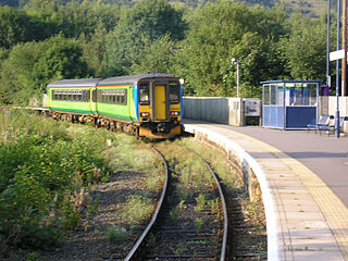
Ambergate railway station is a railway station owned by Network Rail and managed by East Midlands Railway. It serves the village of Ambergate in Derbyshire, England. The station is located on the Derwent Valley Line from Derby to Matlock, which diverges from the Midland Main Line just south of the station at Ambergate Junction.

The Derwent Valley Light Railway (DVLR) was a privately owned standard-gauge railway in North Yorkshire, England, and was unusual in that it was never nationalised, remaining as a private operation all its life. It ran between Layerthorpe on the outskirts of York to Cliffe Common near Selby. It opened in two stages, in 1912 and 1913, and closed in sections between 1965 and 1981. Between 1977 and 1979, passenger steam trains operated between Layerthorpe and Dunnington — the entire length of track at that time. In 1993 a small section was re-opened as part of the Yorkshire Museum of Farming at Murton.

The electoral division of Derwent is one of the 15 electoral divisions in the Tasmanian Legislative Council. It is situated in the central south of the state.

The Derwent Valley Railway is an inoperational heritage railway in Tasmania, Australia. Its base is in New Norfolk. It is 3' 6" narrow gauge.
Westerway is a rural locality in the local government areas (LGA) of Central Highlands and Derwent Valley in the Central and South-east LGA regions of Tasmania. The locality is about 29 kilometres (18 mi) north-west of the town of New Norfolk. The 2016 census has a population of 225 for the state suburb of Westerway.
The Derwent Valley Railway was a branch railway in County Durham, England. Built by the North Eastern Railway, it ran from Swalwell to Blackhill via five intermediate stations, and onwards to Consett.
Crook railway station served the town of Crook, County Durham, England. It was located on the Bishop Auckland and Weardale Railway line from Bishop Auckland to Blackhill between Wear Valley Junction and Tow Law, 17 miles (27 km) north west of Darlington.
Florentine Junction, also known as Pillinger’s Creek, Risby’s Junction, Florentine Rail Yard and Florentine Depot, is the terminus of the Derwent Valley Railway, a 3’ 6” narrow gauge railway that operates from New Norfolk in Tasmania, Australia. The station opened in 1936 but closed in the mid twentieth century when the railway beyond Kallista was closed.
References
Southern region of Tasmania, Australia | |||||
|---|---|---|---|---|---|
| City Other settlements | |||||
| Governance | |||||
| Mountains | |||||
| Protected areas, parks and reserves | |||||
| Rivers | |||||
| Harbours, bays, inlets and estuaries | |||||
| Coastal features | |||||
| Transport | |||||
| Landmarks |
| ||||
| Islands | |||||
| Books and newspapers | |||||
| Flora, fauna, and fishlife | |||||
| Bioregions | |||||
| Indigenous heritage | |||||
| Other | |||||