
The River Derwent is a river located in Tasmania, Australia. It is also known by the palawa kani name timtumili minanya. The river rises in the state's Central Highlands at Lake St Clair, and descends more than 700 metres (2,300 ft) over a distance of more than 200 kilometres (120 mi), flowing through Hobart, the state's capital city, before emptying into Storm Bay and flowing into the Tasman Sea. The banks of the Derwent were once covered by forests and occupied by Aboriginal Tasmanians. European settlers farmed the area and during the 20th century many dams were built on its tributaries for the generation of hydro-electricity.
The Great Lake, officially yingina / Great Lake, is a natural lake and man-made reservoir that is located in the central northern region of Tasmania, Australia.
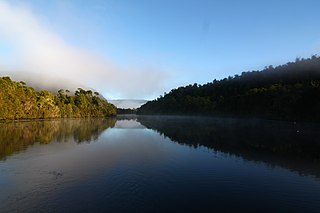
The Pieman River is a major perennial river located in the west coast region of Tasmania, Australia.

The Huon River is a perennial river located in the south-west and south-east regions of Tasmania, Australia. At 174 kilometres (108 mi) in length, the Huon River is the fifth-longest in the state, with its course flowing east through the fertile Huon Valley and emptying into the D'Entrecasteaux Channel, before flowing into the Tasman Sea.

The Tarraleah Power Station is a hydroelectric power station located in the Central Highlands region of Tasmania, Australia. The power station is part of the Upper Derwent hydro scheme and is operated by Hydro Tasmania.
The Catagunya Power Station is a run-of-the-river hydroelectric power station located in the Central Highlands region of Tasmania, Australia. The power station is situated on the Lower River Derwent catchment and is owned and operated by Hydro Tasmania.
The Murchison River, part of the Pieman River catchment, is a major perennial river located in the West Coast region of Tasmania, Australia.
The Mackintosh River, part of the Pieman River catchment, is a major perennial river located in the West Coast region of Tasmania, Australia. The river was named in November 1828 by Henry Hellyer, a surveyor of the Van Diemans Land Company, in honour of Sir James Mackintosh, son of John Mackintosh of Kyllachy, Inverness-shire

The Gordon Dam, also known as the Gordon River Dam, is a major gated double curvature concrete arch dam with a controlled spillway across the Gordon River, located in South West Tasmania, Australia. The impounded reservoir is called Lake Gordon.
The Serpentine River is a major perennial river located in the south-west and western regions of Tasmania, Australia.
The Edgar Dam is an earthfill embankment saddle dam without a spillway, located offstream in the South West region of Tasmania, Australia.
The Weld Valley is a valley located in southern Tasmania. It is an area of aboriginal cultural heritage and natural history within the Tasmanian Wilderness World Heritage Area. The valley stretches north-west of Huonville and is approximately 50 kilometres (31 mi) west of Hobart.
The Spero River is a perennial river located in the West Coast or South West region of Tasmania, Australia.
The Blythe River is a perennial river located in north-western region of Tasmania, Australia.
The Anthony River, part of the Pieman River catchment, is a perennial river in the West Coast region of Tasmania, Australia.
The John Butters Power Station is a conventional hydroelectric power station located in Western Tasmania, Australia. The power station forms part of the King – Yolande River Power Scheme and is owned and operated by Hydro Tasmania.
The Ringarooma River is a perennial river located in the north-east region of Tasmania, Australia.
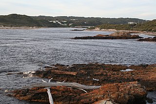
The Arthur River is a major perennial river located in the north-west region of Tasmania, Australia.
The Lune River is a perennial river located in south-eastern Tasmania, Australia.

