Frankland River (North West Tasmania)

Last updated

Frankland
Relief Map of Tasmania.png
Red pog.svg
Location of the Frankland River mouth in Tasmania
Etymology George Frankland
Location
Country Australia
State Tasmania
Region North-west
Physical characteristics
Source confluence Horton and Lindsay rivers
  locationSumac Forest Reserve
  coordinates 41°15′4″S144°57′25″E / 41.25111°S 144.95694°E / -41.25111; 144.95694
  elevation164 m (538 ft)
Mouth Arthur River
  location
east of the town of Arthur River
  coordinates
41°04′29″S144°46′19″E / 41.07472°S 144.77194°E / -41.07472; 144.77194 Coordinates: 41°04′29″S144°46′19″E / 41.07472°S 144.77194°E / -41.07472; 144.77194
  elevation
22 m (72 ft)
Length41 km (25 mi)
Basin features
River system Arthur River catchment
[1]

The Frankland River is a major perennial river located in the north-west region of Tasmania, Australia.

North West Tasmania is one of the regions of Tasmania in Australia. The region comprises the whole of the north west, including the North West Coast and the northern reaches of the West Coast. It is usually accepted as extending as far south as the Pieman River and including the Savage River National Park within the Tarkine region.

Tasmania island state of Australia

Tasmania is an island state of Australia. It is located 240 km (150 mi) to the south of the Australian mainland, separated by Bass Strait. The state encompasses the main island of Tasmania, the 26th-largest island in the world, and the surrounding 334 islands. The state has a population of around 533,308 as of March 2019. Just over forty percent of the population resides in the Greater Hobart precinct, which forms the metropolitan area of the state capital and largest city, Hobart.

Contents

Location and features

Formed by the confluence of the Horton and Lindsay rivers, the Frankland River rises in the Sumac Forest Reserve and flows generally west by north. The Frankland River reaches its mouth in remote country east of the settlement of Arthur River where it empties into the Arthur River. The river descends 142 metres (466 ft) over its 41-kilometre (25 mi) course. [1]

Confluence Meeting of two or more bodies of flowing water

In geography, a confluence occurs where two or more flowing bodies of water join together to form a single channel. A confluence can occur in several configurations: at the point where a tributary joins a larger river ; or where two streams meet to become the source of a river of a new name ; or where two separated channels of a river rejoin at the downstream end.

River mouth end of a river

A river mouth is the part of a river where the river debouches into another river, a lake, a reservoir, a sea, or an ocean.

Arthur River, Tasmania Town in Tasmania, Australia

Arthur River is the name of a small township on the northern part of the West Coast of Tasmania, Australia. At the 2006 census, Arthur River and the surrounding area had a population of 121.

The river draws its name from George Frankland, an English surveyor and Surveyor-General of Van Diemen's Land between 1827 and 1838.

George Frankland was an English surveyor and Surveyor-General of Van Diemen's Land .

Surveying The technique, profession, and science of determining the positions of points and the distances and angles between them

Surveying or land surveying is the technique, profession, art and science of determining the terrestrial or three-dimensional positions of points and the distances and angles between them. A land surveying professional is called a land surveyor. These points are usually on the surface of the Earth, and they are often used to establish maps and boundaries for ownership, locations, such as building corners or the surface location of subsurface features, or other purposes required by government or civil law, such as property sales.

Surveyor General of Tasmania is a position originally created for the colony of Van Diemens Land.

See also

Related Research Articles

Mount Ossa (Tasmania) mountain in Tasmania

Mount Ossa is the highest mountain in Tasmania with a summit elevation of 1,617 metres (5,305 ft) above sea level. It makes up part of the Pelion Range within Cradle Mountain-Lake St Clair National Park in the Central Highlands region of Tasmania, Australia.

Huon River river in Tasmania, Australia

The Huon River is a perennial river located in the south-west and south-east regions of Tasmania, Australia. At 174 kilometres (108 mi) in length, the Huon River is the fifth-longest in the state, with its course flowing east through the fertile Huon Valley and emptying into the D'Entrecasteaux Channel, before flowing into the Tasman Sea.

John Helder Wedge English surveyor, explorer and politician

John Helder Wedge was a surveyor, explorer and politician in Van Diemen's Land.

Frankland may refer to:

Frankland, Western Australia Town in Western Australia

Frankland is a small town in the Great Southern Region of Western Australia. The town is in the shire of Cranbrook and is situated approximately 360 km from the State's capital, Perth, approximately 120 km north west of Albany, 83 km southwest of Kojonup, 19 km north of Rocky Gully and 90 km east of Manjimup. Frankland derives its name from its location 6 km east of the Frankland River. At the 2006 census, Frankland had a population of 380.

Frankland River (Western Australia) river in Western Australia, Australia

The Frankland River is a river in the Great Southern region of Western Australia. The Frankland River is the largest river by volume in the region and the eighth largest in the state. The traditional owners of the area are the Noongar people who know the river as Kwakoorillup.

Davey River river in Australia

The Davey River is a perennial river located in the south-west region of Tasmania, Australia.

Mount Anne mountain

Mount Anne is a mountain located in the Southwest National Park in south-west region of Tasmania, Australia. The mountain lies within the UNESCO World Heritage-listed Tasmanian Wilderness.

Serpentine River (Tasmania) river in Tasmania, Australia

The Serpentine River is a major perennial river located in the south-west and western regions of Tasmania, Australia.

Scotts Peak Dam Road road in Tasmania

The Scotts Peak Dam Road is the most southerly point of road access into the south western region of Tasmania, Australia.

Serpentine Dam (Tasmania) dam in South West Tasmania

The Serpentine Dam is a rockfill embankment dam with a concrete face and a controlled spillway across the Serpentine River, located in the South West region of Tasmania, Australia.

Frankland Range mountain range

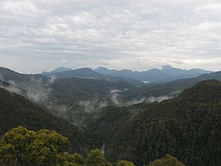
The Frankland Range is a mountain range that is located in the south-west region of Tasmania, Australia. The range forms part of a natural south-western border to the impounded Lake Pedder, formed by the damming of the Serpentine and Huon rivers.

Gordon River (Western Australia) river in Western Australia, Australia

The Gordon River is a river in the Great Southern region of Western Australia.

Arthur-Pieman Conservation Area Protected area in Tasmania, Australia

The Arthur – Pieman Conservation Area (APCA) stretches along the north-west coast of Tasmania, Australia and covers over 1,030 square kilometres (400 sq mi). Much of the reserve is between the Arthur River in the north, the Pieman River in the south and the Frankland and Donaldson Rivers to the east. It is a dynamic landscape which is being continually reshaped by wind, fire and water.

James Goodwin was a convict escapee and explorer in Van Diemen's Land. In March 1828, he escaped from the notorious Sarah Island prison with fellow convict, Thomas Connolly and the two were the first white men to pass through the Lake St Clair region. Assuming Goodwin was then taken on to Hobart, he is the first white man to have traversed Tasmania from west to east.

Arthur River (Tasmania) river in Tasmania, Australia

The Arthur River is a major perennial river located in the north-west region of Tasmania, Australia.

Frankland River may refer to:

Calder River (Tasmania) river

The Calder River is a river in North West Tasmania, Australia, it extends approximately 15 kilometres (9.3 mi) from the Campbell Ranges near Henrietta before reaching its confluence with the Inglis River near Calder. The river is transversed by the Murchison Highway in its upper reaches. Part of the course of the river is located adjacent to the 65.21-hectare (161.1-acre) Calder River Conservation Area.

References

  1. 1 2 "Map of Frankland River, TAS". Bonzle Digital Atlas of Australia. 2015. Retrieved 27 June 2016.